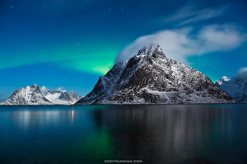
Kungsleden Trail Sweden – Part 2 – Kebnekaise Fjallstation to Salka
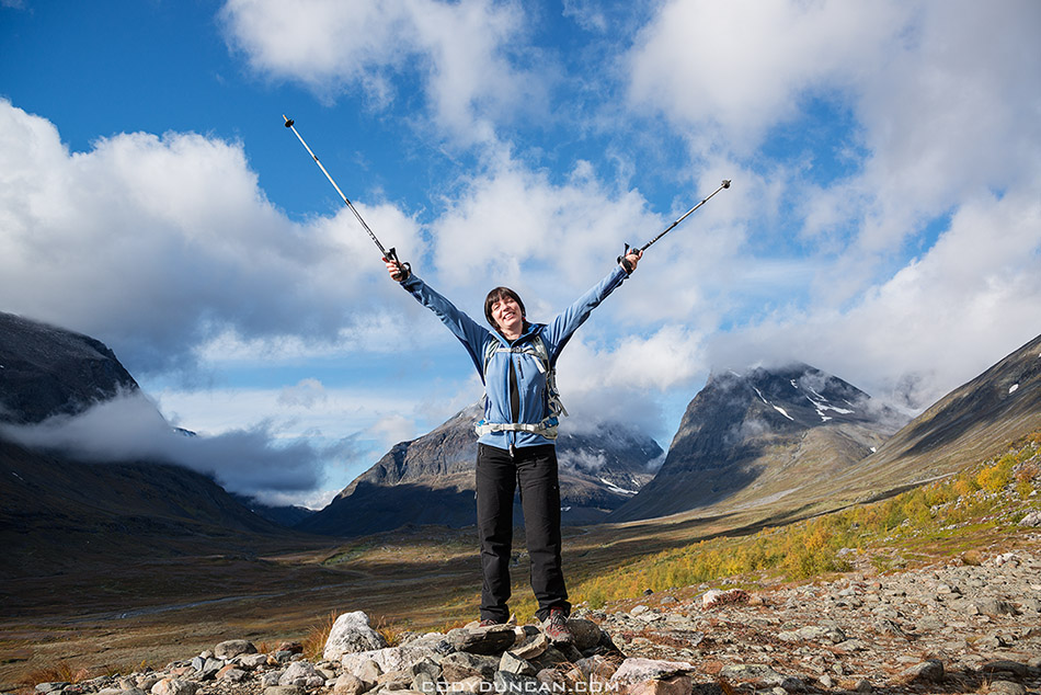
Photo: Leaving Kebnekaise Fjällstation under sunny skies, Kungsleden trail, Sweden. Sept 2012
Kebnekaise Fjällstation to Singi: 14km – Singi to Sälka: 12km
[This is part 2 of my hike along the northern section of the Kungsleden trail, Sweden from Sept 11 – 20, 2012. For part 1 CLICK HERE. For a general overview of hiking the trail in autumn, CLICK HERE ]
As morning came to ebnekaise Fjällstation and we prepared for our third day on the trail I had already seen more sun than my entire 10 day journey in 2009. With an easy 14km to Singi hut, we lazed around for a bit, not taking to the trail until mid morning. This goes slightly against my normal advice to take advantage of good weather when you have it. It is never a question of if it will rain, but rather, when. And so in tempting fate, we hiked west into the Ladtjovagge while surrounded by some of Sweden’s highest peaks which already carried a dusting of the season’s first snows.
About an hour into the day we came across a group heading our way. “You have three options – wet, wet, or wet.” The warning from a Swedish woman who had just passed through the particularly flooded and boggy section along the trail, which we now faced. Another couple from their group sat on the side of the trail putting their boots back on, having given up any attempt at keeping their feet dry and preferring a barefoot crossing of the river.
So there I stood in my light trail runners, still fairly dry at that point, looking for any sort of weakness in the in 100+ meters of Swedish super bog interlaced with series of small rivers that needed fording. The following few minutes weren’t particularly elegant: a quick hop onto a slightly submerged rock, almost slipping into knee deep and ice cold water. Another long step saw me onto a broken bush, the bog creeping up around my shoes with every second my foot remained. Moving fast I found another, more secure bush with which I could use scout out my next few moves. More steps and more cursing as the mud crept up around my feet, the first hints of moisture beginning to penetrate though. Another small stream to hop across and then I came to the final section with no way around. I put my trekking poles as far forward as possible and did a sort of flying leap into another clump of small bushes. My poles flexed and sank as I used them like crutches in a desperate attempt to keep from sinking past my ankles. Finally across I surveyed the damage: left foot somewhat wet from taking the worst of the bog, right foot muddy, but overall pretty dry. Success. Or at least success for my preferred use of trail runners in a country where people often hike in wells.
The next hours passed uneventfully as the valley narrowed and we hiked in the shadows of mountains and along crystal clear rivers and waterfalls, everywhere. We passed another large group of school age kids taking a break on the side of the trail. My thoughts immediately diverted from the scenic terrain to one of dread; that we might encounter another such a group at Singi, where they would literally take over the whole place. While I don’t go to the Kungsleden expecting some isolated wilderness experience, I also don’t expect to share a small mountain hut with 19 (yes, I counted) teenagers. It’s good to give kids an outdoor experience, but I feel such large groups have too much impact on their surrounds in an isolated mountain area and the small huts that shelter us. So it came to my relief as we arrived at Singi just prior to the rain that we would have the place almost totally to ourselves, just an elderly Swedish couple across the hall in a separate room.
Morning arrived to clear skies once more, but a fresh, to put it nicely, wind was coming from the south and I knew it wouldn’t be long before some not-so-nice hiking weather would arrive. So before 8:00 we were back on the trail, this time heading almost perfectly north, towards the Sälka hut, 12km away. This part of the journey was now familiar with me, as Singi had been my southernmost point while on the Kungleden in 2009 when I hiked from Abisko to Singi and back to Abisko again after I learned there were no more busses running from Nikkaluokta for the season.
With the wind at our backs, I wasn’t paying much attention to the weather behind us until I stopped for some quick photos and saw a wall of snow quickly heading our way. Having taken chances in the morning and not wearing rain gear, we we both in for a rather chilling change of clothes on the side of the trail. Minutes after our backpacks were back on a terrible mix of snow, sleet, and icy rain hit us with a fury.
A couple more hours of hiking saw us arriving to a warm fire at Sälka. It is here that I learned some wisdom from the hut warden: wood warms you twice. Once while preparing it for the fire, and once while in the fire. It was also at Sälka that I learned that I was somewhat known in this part of the world, as a nice young Australian couple at the hut had read my blog about my 2009 journey. Cool!
I knew Sälka to be a nice place. I knew there to be some good potential for photos in the area, but once again, like 2009, the weather chose otherwise. This is a frustration that I, and we, as landscape photographers often face I think; that I’ve hiked several days to get to an isolated place, only to be shut down by the weather. I made the most of the light and conditions that I could, but already put a note in my mind that I’ll have to come back once again, not that I would complain!
And so our 4th night on the Kungsleden arrived as we sat warm and dry from the heat of a glowing birch wood fire.
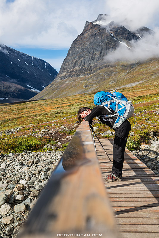
Photo: Enjoying the day, Kunglseden trail, Sweden. Sept 2012
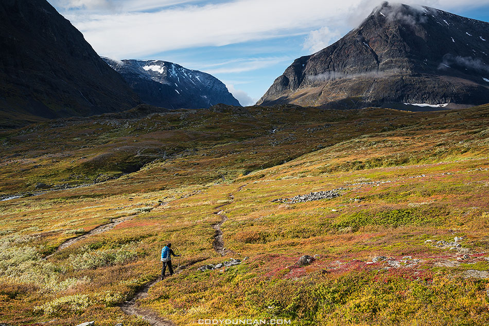
Photo: Autumn colors fill the landscape in Ladtjovagge, Kungsleden trail, Sweden. Sept 2012
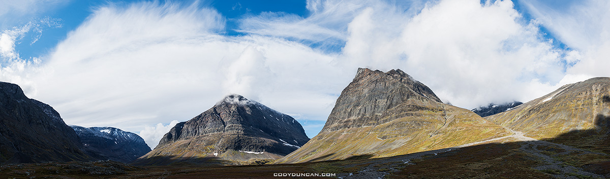
Photo: Mountain peaks surround Ladtjovagge, Kungsleden Trail, Sweden. Sept 2012
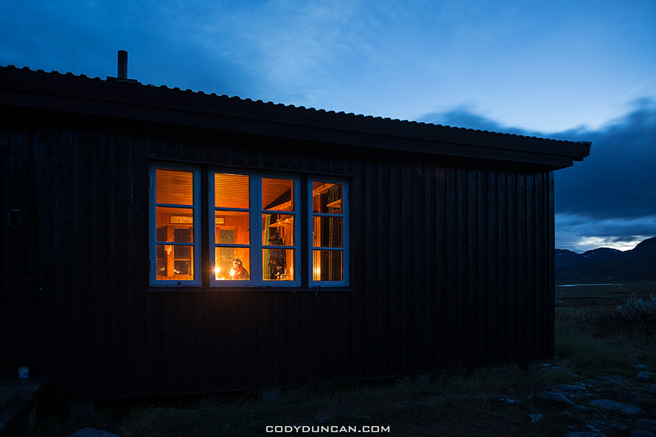
Photo: Night arrives at Singi hut, Kungsleden trail, Sweden. Sept 2012
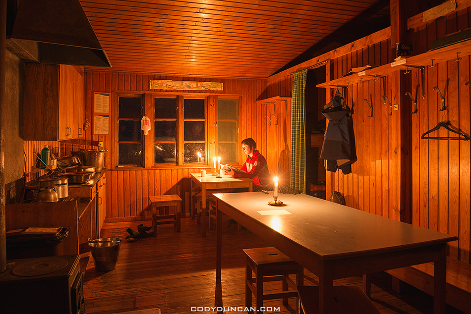
Photo: Candlelight at Singi hut, Kungsleden trail, Sweden. Sept 2012
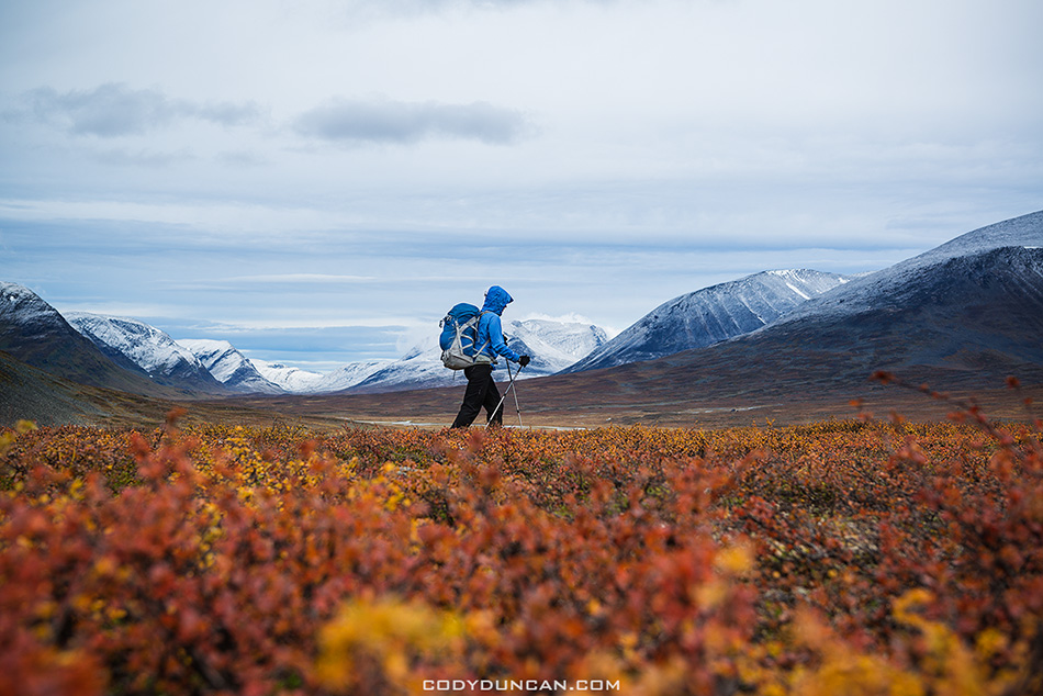
Photo: Autumn colors and snowy mountains; late season hiking on the Kungsleden trail, Sweden. Sept 2012
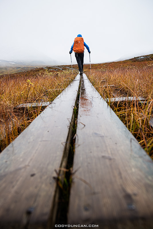
Photo: ‘Mountain sidewalk,’ Kungsleden trail, Sweden. Sept 2012
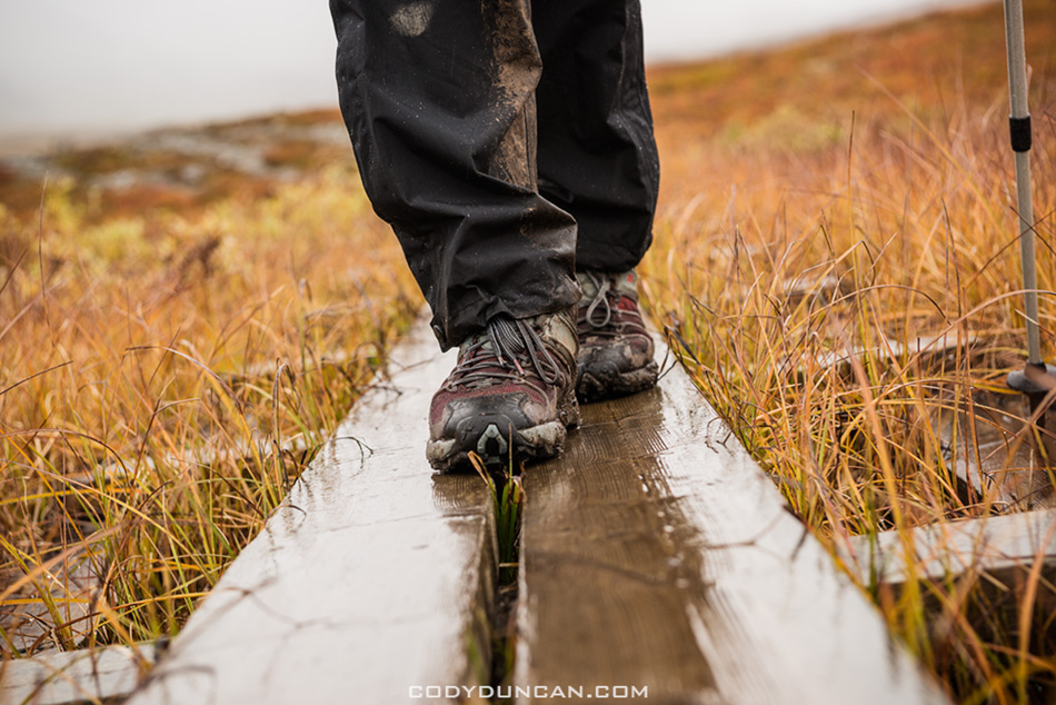
Photo: Are your feet wet? Kungsleden trail, Sweden. Sept 2012
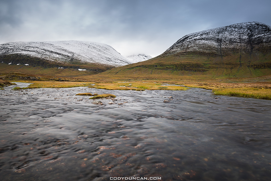
Photo: A river flows near Sälka Hut, Kungsleden trail, Sweden. Sept 2012
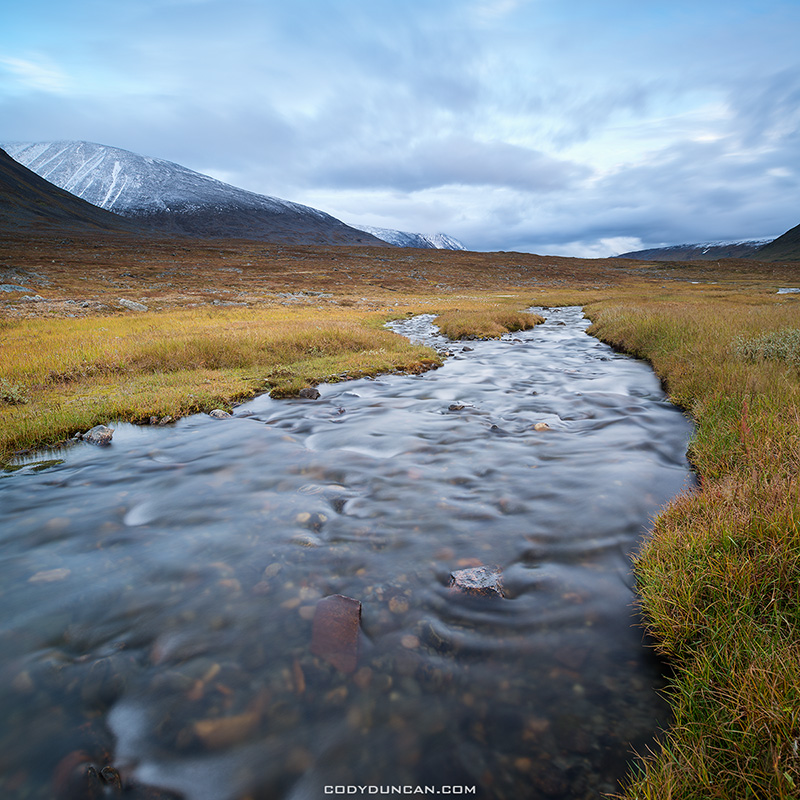
Photo: A river flows near Sälka Hut, Kungsleden trail, Sweden. Sept 2012