Hiking the Besseggen Ridge – Jotunheimen National Park, Norway
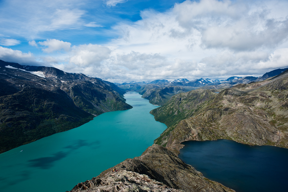
Photo: The Besseggen Ridge: lake Bessvatnet on the right, lake Gjende on the left
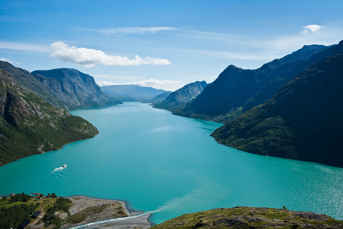
The Besseggen ridge hike is one of the most popular routes in Norway, with some 30,000 people making the trek between Gjendesheim and Memurubu each year. Located in the stunning mountain scenery of Norway’s Jotunheimen national park, the trail roughly follows a ridge on the north side of lake Gjende and provides amazing views of the whole length of the long and colorful lake as it sits surrounded by glaciated mountain peaks.
With a distance of about 8 miles (13 km) and climbing 2,500 feet (759 m) above lake Gjende the hike requires a moderate level of physical fitness. Expect to take 5-7 hours to complete the hike between Gjendesheim and Memurubu. The trail is well marked and easy to follow, and due to its popularity, it’s doubtful you’ll be alone – even in bad and rainy weather.
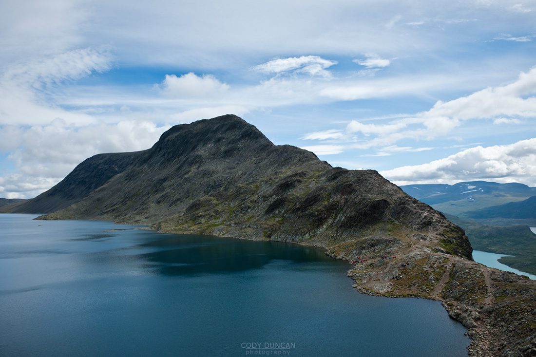
From Gjendesheim, the trail climbs at a moderate gain for several kilometers until finally reaching a high and rocky alpine plateau. Even if the wind is calm at lake level, it can be cold and windy once up high, be prepared. The steepest and narrowest section occurs shortly after passing the high point of 5,718 feet (1743 M) – marked with a large cairn. After this point, the trail then proceeds to quickly drop down to the southern shore of lake Bessvatnet at 4,504 feet (1373m). Here is were you have one of the best views of Lake Gjende. Lake Bessvatnet represents the approximate half way point and is a good place to sit in the sun (if your lucky) and have a nice lunch.
Continuing from lake Bessvatnet the trail is relatively flat with only moderate climbs/descents until the final short and steep descent to Memurubu and the shores of lake Gjende.
HERE is a good online topo map for all of Norway. Take a quick look so you can get a bit more comfortable with my descriptions and not mix up Gjende for Gjendebu for Gjendesheim. Enter either ‘Besseggen’ or ‘Gjende’ in the search box and hit the ‘Kartsøk’ button. This will get you where you need to look…
HIKING ROUTES
Day hiking the Besseggen ridge gives one several options on how to go about things and how long of a day is desired.
• Ferry Gjendesheim – Memurubu : Hike Memurubu – Gjendesheim:
A popular way to make the hike is to take the morning ferry from Gjendesheim to Memurubu and make the hike back. This way has the benefit of not having to meet the ferry schedule for a return trip, thus meaning that one can go as slow or fast as wanted. One drawback is you will likely be hiking in a crowd of people all arriving with the boat, unless one sits around Memurubu while the crowd continues up the trail.
• Hike Gjendesheim – Memurubu : Ferry Memurubu – Gjendesheim:
This way one can get an early start and have the trail relatively empty. Though if looking for mountain solitude, I suggest going elsewhere in the park. The main drawback of this way is that one has to keep schedule to catch the ferry back to Gjendesheim. Personally, I think the view is more scenic in this direction, and the sun will be at your back during the morning hours.
• Hike Gjendesheim – Memurubu : Hike Memurubu – Gjendesheim:
For a longer day, it’s possible to hike the ridge to Memurubu and back. Or, to save some tired knees, there is a flat trail that follows the lake, connecting Gjendesheim and Memurubu.
• Ferry Gjendesheim – Gjendebu : Hike Gjendebu – Gjendesheim:
For a long day, take the morning ferry to the end of lake Gjende and Gjendebu and hike back to Gjendesheim. The section between Gjendebu and Memurubu is relatively uncrowded and provides stunning views of lake Gjende and one approaches Memurubu and also some amazing views of Memurudalen – Memuru valley.
CLICK HERE for ferry schedule
CLICK HERE for ferry prices
CLICK HERE for DNT mountain hut info
CLICK HERE for a topo map of Norway. Search ‘Besseggen’ or ‘Gjende’
OVERNIGHT
Huts
The lake ferry boat not only carries people, it will also carry luggage. So, say one is looking to stay overnight at Memurubu or Gjendebu hut, put your luggage on the ferry and hike from Gjendesheim. When you arrive in Memurubu, your bags will be waiting. This can also work in reverse, staying your first night in the hut and then hike back to Gjendesheim while your luggage takes the ferry.
Camping
Wild camping is possible basically everywhere, the only restrictions being the immediate area around the huts. Water is plentiful and tasty. On the other hand, finding a flat and dry spot to pitch a tent can sometimes take a bit of searching, but is well worth the effort to sleep with some amazing views out the tent door.
Camping near Gjendesheim. Walk past the end of the parking area and continue along the lakeside trail for 100m. Beginning here you you see plenty of places to pitch a tent. Can get a bit crowded on a nice summer weekend.
Further into Jotunheimen
Jotunheimen national park is an amazing place. I highly recommend making a longer hike through the park, either as a multi-day loop or through hike. While I enjoy camping in the wild, it’s also possible to carry a light pack and overnight in the well connected network of huts, many of which also serve food.
WHEN TO GO
The main summer season in the Norwegian mountains in July and August. These months will be your best bet for sunny, warm days.
GETTING THERE
The start or finish of the Besseggen ridge is located at Gjendesheim, on the eastern end of lake Gjende and Jotunheimen national park itself. Here you’ll find a full service DNT hut, a small (expensive!) shop/cafe, toilets, the ferry boat, and parking area.
Bus
Several buses travel to Gjendesheim daily. The two options are to travel via Fagernes (to/from Oslo) in the south. To the north the bus travels to Vagamo where one can transfer east to Otta and the train, or continue west through the fjords.
By Train
There is no direct train link to Jotunheimen national park. If traveling by train, from Trondheim in the north or Oslo in the south, exit at Otta. Here you will have to take the bus to Vagamo, then on to Gjendesheim. The bus/train does not always meet at a convenient time, so be sure to check schedules. The bus stop is directly outside the train station in Otta. There is a tourist info center in the train station where you can buy maps during business hours.
Transportation links
NSB – Norwegian train company
Nor-Way – Long distance bus routes incl. Olso – Gjendesheim
Ruteinfo – Local and regional bus information
Gjende – Lake Gjende ferry. Prices and timetable
Other Useful links
DNT – The Norwegian Trekking Assocaition
Interactive topo map including trails and huts for all of Norway
Norwegian weather
CLICK HERE for more photos of Jotunheimen national park from summer 2010

Photo: Ferry leaves Memurubu hut headed towards Gjendesheim

Photo: The steepest and narrowest section of the hike, as the Besseggen ridge rises from the shore of lake Bessvatnet

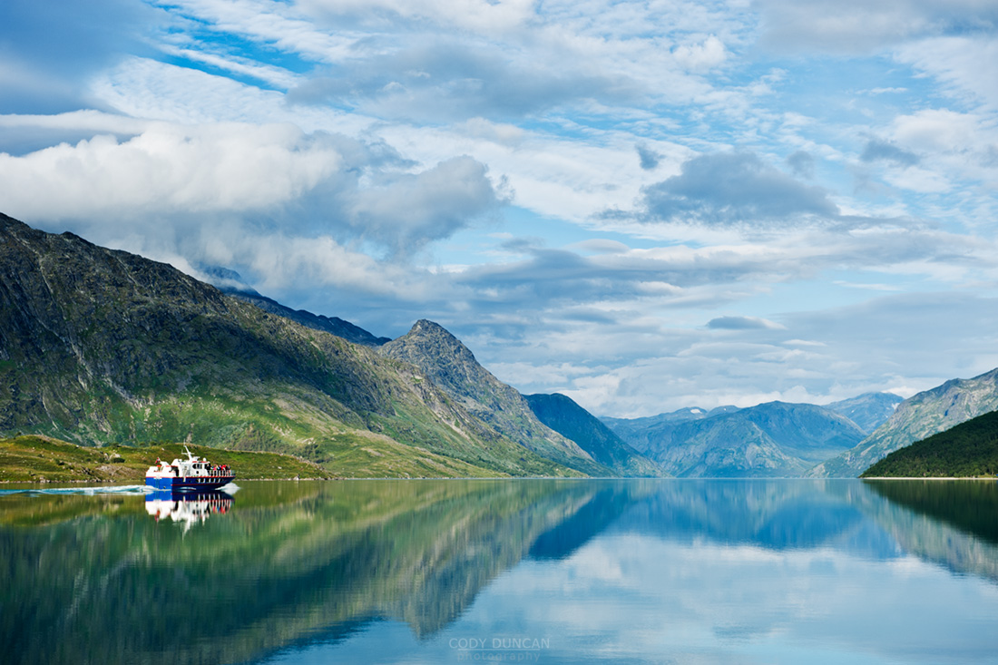
Photo: The morning ferry leaves Gjendesheim on the still waters of lake Gjende


Leave a Reply
Want to join the discussion?Feel free to contribute!