Back to Lofoten

Northern Lights - Aurora Borealis in night sky behind Olstind mountain peak, Reine, Lofoten Islands, Norway

Photo: Northern Lights over Olstinden, Reine, Lofoten Islands, Norway.  Feb 2012  

I’m getting my bags packed for another winter trip to Lofoten.  I fly from the UK on Tuesday morning and arrive north of the Arctic Circle in Bodø, Norway in the evening.  Then I catch the 01:30am ferry to Moskenes, arriving on Lofoten around 07:00am Wednesday morning.  The weather has been good for the last week of so, but it is looking to become somewhat unsettled once I arrive, that’s just how it goes in the north.

Change of travel plans. I’ll spend 2 weeks on Lofoten and then fly down to Stockholm, Sweden for a few days before returning home to California in early March.  I was originally planning on returning to the UK, but I’ve had to make some adjustments to my travels.  On the bright side, I’ll only be in California for about 2 months before heading back to Lofoten at the end of April.  Not too bad considering I wasn’t even sure if I would get to Lofoten at all in 2013.

Reflection of Olstind mountain peak in harbour at Reine, Lofoten Islands, Norway

Photo: Olstinden rises above Reine in winter, Lofoten Islands, Norway.  Feb 2012

gear

Photo: Packing the winter climbing gear for Lofoten.

backpack

Photo: About time for me to get a new backpack, I hope it lasts the next 3 weeks…

Outer Hebrides Scotland Photo Gallery Update

Berneray beach, Outer Hebrides, Scotland

Photo: Chasing rainbows on Berneray’s west beach, Outer Hebrides, Scotland.  Jan 2013

I’ve added about 50 images from my New Year’s trip to the islands of Scotland’s Outer Hebrides – Western Isles.

-CLICK HERE- to view the gallery.

To read a more extensive writeup about the trip: part 1 HERE, part 2 HERE, part 3 HERE.

North Uist beach, Outer Hebrides, Scotland

Photo: Afternoon light on New Year’s day, North Uist, Outer Hebrides, Scotland.  Jan 2013

Brecon Beacons – Pen Y Fan Winter Sunrise

Brecon Beacons Pen Y Fan winter hiking

Photo: Winter sunrise from summit of Pen Y Fan, Brecon Beacons national park, Wales.  Feb 2013

With clear skies forecasted for Saturday morning, and in need of a bit more exercise before heading off to the Lofoten Islands next week, I decided that catching one last sunrise on Pen Y Fan would be a good idea.  So I set the alarm for 5:00 am and promised myself not to be lazy.

We left the car park just after 6:00 am for the short hike up the trail, and found ourselves to be the 2nd people on the mountain on Saturday morning.  It had been fairly warm all week with lots of rain so I was surprised to find the summits still covered in snow.  Wasn’t the most brilliant sunrise, but was still good to get in a short hike before breakfast…

Pen Y Fan Brecon Beacons winter sunrise

Photo: Winter sunrise from summit of Pen Y Fan, Brecon Beacons national park, Wales.  Feb 2013

Brecon Beacons Corn Du winter hiking

Photo: Cold morning on the summit of Corn Du, Brecon Beacons national park, Wales.  Feb 2013

Pen Y Fan Brecon Beacons winter sunrise

Photo: Dawn approaches on Pen Y Fan, Brecon Beacons national park, Wales.  Feb 2013

Winter Walking Brecon Beacons

Photo: Hiking across Corn Du in the morning light, Brecon Beacons national park, Wales.  Feb 2013

Kungsleden Trail Sweden – Part 4 – Alesjaure to Abisko

Hiking kungsleden trail Sweden

Photo: Long shadows in late afternoon at lake Radujavri, Kungsleden trail, Sweden.  Sept 2012

Alesjaure to Abiskojaure: 20km – Abiskojaure to Abisko 15km

[This is part 3 of my hike along the northern section of the Kungsleden trail, Sweden from Sept 11 – 20, 2012.  Part 1 HERE, part 2 HERE, part 3 HERE. You can find a complete photo gallery of the hike HERE. For a general overview of hiking the trail in autumn, CLICK HERE ]

Even after a full day of rest at Alesjaure, our colds were still taking a toll on energy an motivation levels.  The original plan had been to leave the Kungsleden trail proper and head west to Unna Allakas at the Norwegian border, but this would also add another 24km to our journey, something my stuffed up head and runny nose weren’t very excited for at the moment.  Even the thought of staying another night at Alesjaure was discussed, but quickly dismissed.  Best to get a move on, even if not all the way to Abiskojaure.  After a bland breakfast, we were once again on the trail, heading north towards our final destination, which now sat only 35km away.

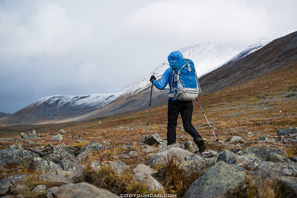
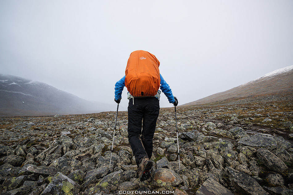
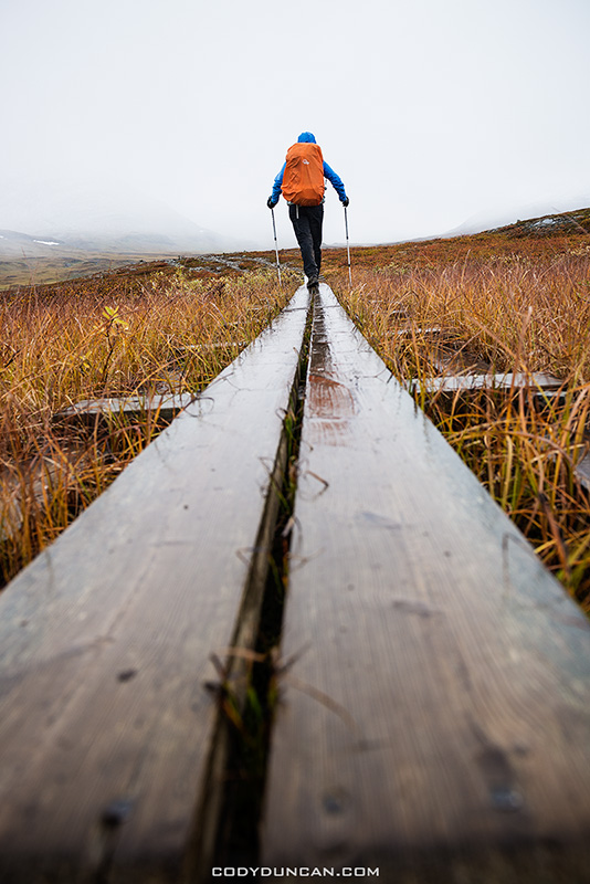
Overnight rains turned the trail into a boggy, slippery mess, and it was slow going around the lakes.  We had heard that the forecast promised clear skies, but as noon neared, heavy clouds still guarded us against any possibility of getting a sunburn.  The winds were calm however, giving the day a much more relaxed feeling than what most of the previous week had been.

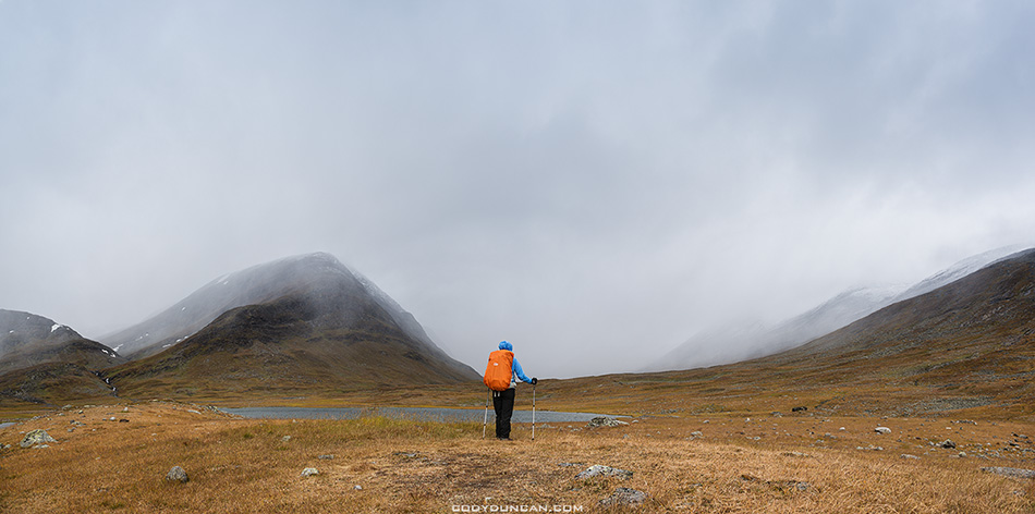
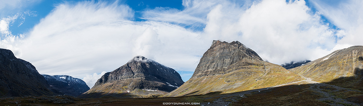
Sometime around noon, we ended up at the small shelter near lake Radujavri.  Taking a slow lunch, I began to notice the the clouds seemed to be quickly clearing.  I then mulled the decision, to stay or not to stay.  We had not even reached the halfway point to Abiskojaure, but on the other hand, we still had some extra days, and I didn’t mind laziness.  Not to mention, I was hiking to trail to enjoy myself and hopefully get some nice photos; I was carrying too much camera gear to miss the possibility of a good photo opportunity just because I was in a hurry.  The reason I purposely scheduled a few extra days than necessary for the trail.

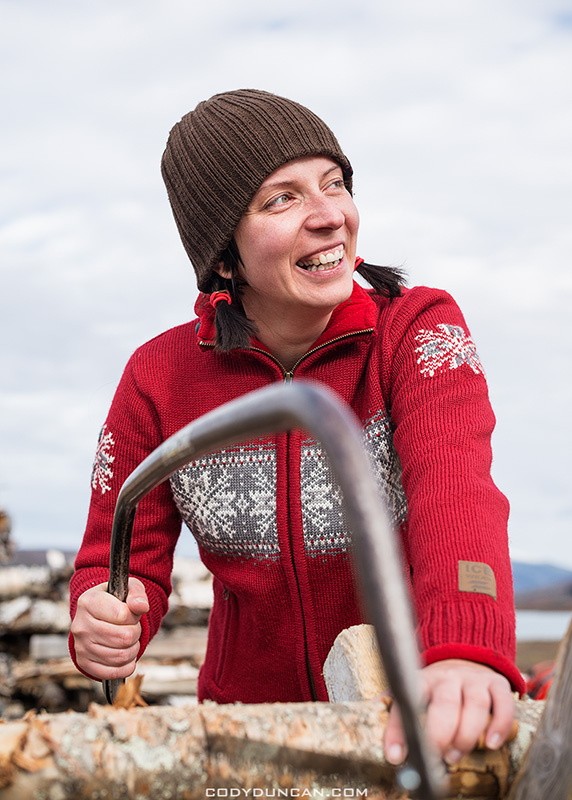
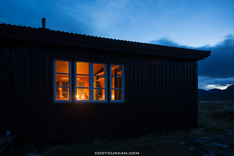
I also knew that if the weather did clear, it would be better to remain up in the high country rather then head down into the forests which surround Abiskojaure.  I’d also heard some mentions of a moth infestation which had stripped many of the birches barren.  And so at that, the decision was made. We would stay at the small hut.  And luckily enough, there was even one last log of firewood that had thus far survived the season.  Though the saws and axes were in a bit of over-used state and it required a little creativity to get the log into a burnable state – no need to mention that it was also pretty wet.

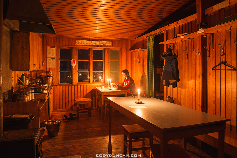
As as the afternoon hours passed the sun finally emerged from the clouds.  As dusk arrived the sky was now almost completely clear and my excitement grew at the possibilities of something that had thus far eluded us, Northern Lights.  The night grew clear and crisp and dark.  I don’t think I’ve ever seen so many stars!  It was a struggle to choose between remaining outside in the cold, or the warmth of the hut.

I soon settled into a restless sleep.  No doubt because I set my alarm to go off over 30 minutes so I could check for Auroras.  The hours passed and passed but the sky remained quite.  Sometime around 03:00 am I gave up hope, knowing that if anything were to happen, it likely would’ve by then.  I didn’t wake again until the light of dawn was creeping through the tiny window.

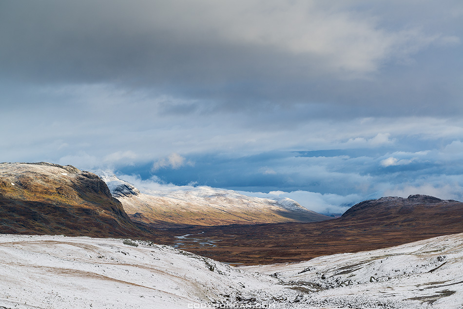
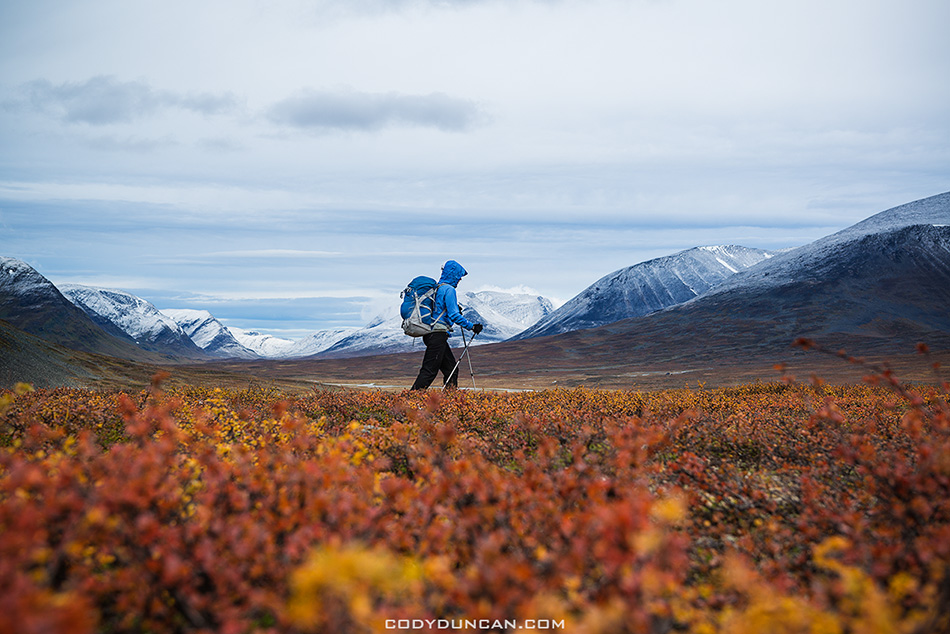
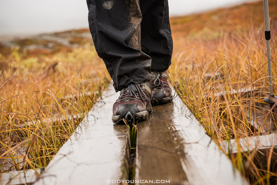
The morning arrived with a chill and not a single cloud in the sky.  A good decision had been made to stay up in the high country.  An added benefit was that the previous day’s boggy trail was now frozen solid, making for much easier going.  Or at least most parts of the trail.  The wooden plank sections were covered in a layer of ice and slippery as hell, needing much extra caution at times.

We made quick progress towards Abiskojaure and arrived by late morning.  The stories of the moth infestation was true and we near suffocated as we had to hike though clouds of them that hung over the trail at times.  And indeed, much of the forest was nothing more than brown twigs, the leaves not failed, but eaten.

Abiskojaure turned out to be a pretty crowded place as it seems many people make just a single overnight trip there from Abisko.  A lazy afternoon followed and thoughts of our last night in the wilderness.  The morning would see us back to civilisation, at least as much as Abisko can be called as such.  We turned in for an early night.

the final 15km to Abisko went by quickly and we arrived before noon.  We checked into the hostel for a couple nights and then quickly headed to town for something that had been on our minds a lot in the last days, food!  I generally know better than to go shopping while hungry.  I should have definitely known better than to go shopping in a Swedish supermarket after 10 days in the mountains.  To say we overbought for the next two days would be a fairly large understatement.

The hostel in Abisko was a much more popular place than I was expecting and we had the unfortunate benefit of a school group of teenagers from Kiruna who pretty much ran uncontrolled about the place.  It took some harsh words by a middle aged German dude before that at least quitted down somewhat.  I guess the Swedes are a little more relaxed in their supervision of youngsters, though I don’t think the teacher were much pleased when they heard the Sauna had been left littered with empty beer cans.  Kids will be kids…

Abisko markets itself as a ‘Northern Lights watching destination,’ and it appeared many of the guests at the hostel where there for this.  Our first night passed uneventful, mostly thanks to the clouds.  But finally, on the second night some Aurora’s finally decided to make an appearance, though still mostly hidden by clouds.  The photographer in me wished I could have been back at the hut on the shores of lake Radujavri as I don’t actually find Abisko to be that scenic of a place.  I don’t quite know why it is such a popular destination, other than perhaps ease of access and the fact that the weather is often better than over in Norway, where there seems to sit a perpetual wall of cloud quite literally at the border to Sweden.  Quite funny actually.

In the morning came the train back to Kiruna where our journey had begun 10 days and 130km earlier.  All in all, it was a brilliant week in the Sweden’s mountains with some excellent days and a much greater variety of weather than my first trip.  No doubt I’ll be back again.  [As I type these words I’m working out the possibility of a winter tour on skis for the coming months, but will more likely have to wait until Spring 2014]

Kungsleden trail hiker autumn

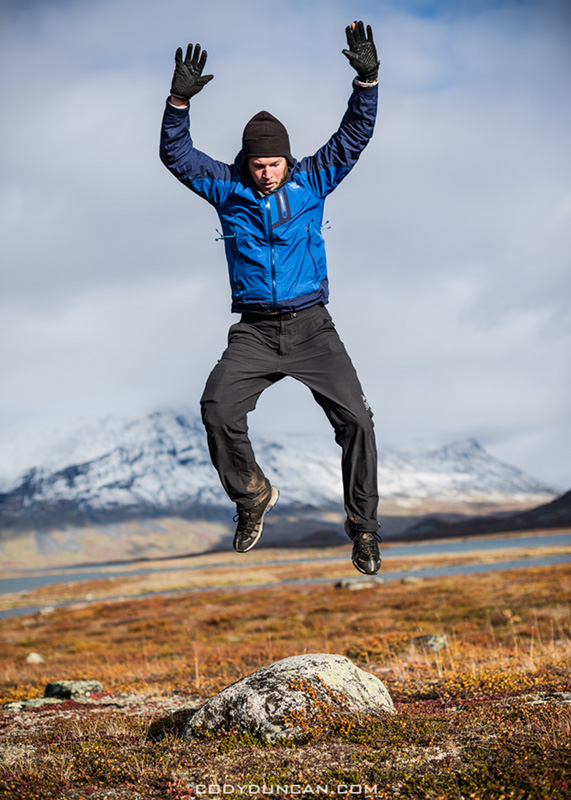
Photo: A rare photo of me.  Practicing my rock jumping skills, Kungsleden trail, Sweden.  Sept 2012

Hiking Kungsleden trail Sweden

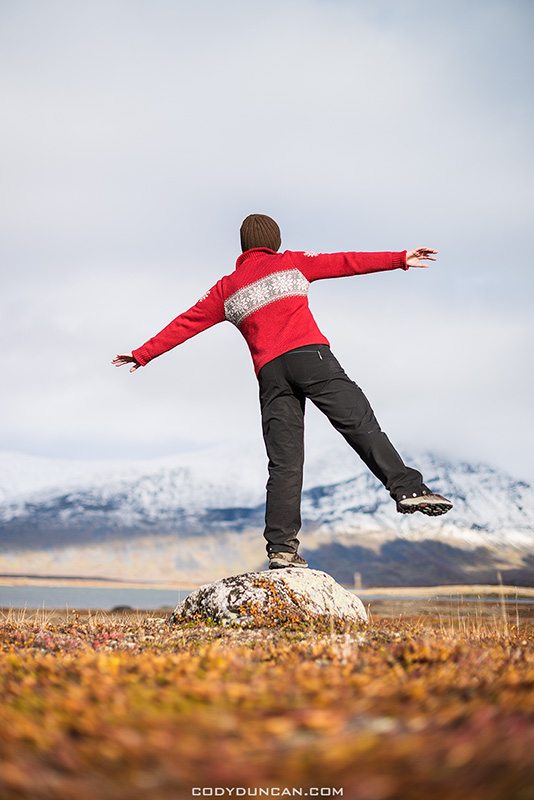
Photo: A more balanced approach to standing on a rock, Kungsleden trail, Sweden.  Sept 2012

Kungsleden trail Autumn Landscape, Sweden

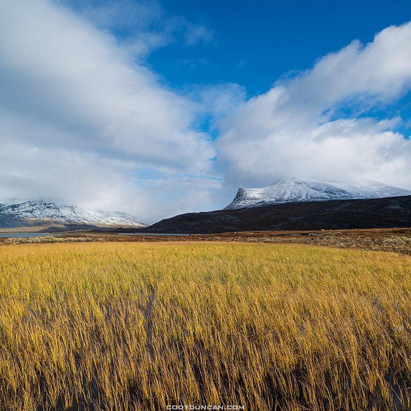
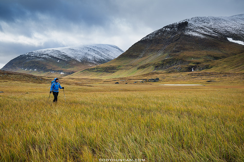
Photo: Yellow grasses of Autumn, Kungsleden trail, Sweden.  Sept 2012

Snow covered mountain peaks in Autumn, Kunglseden trail, Lappland, Sweden

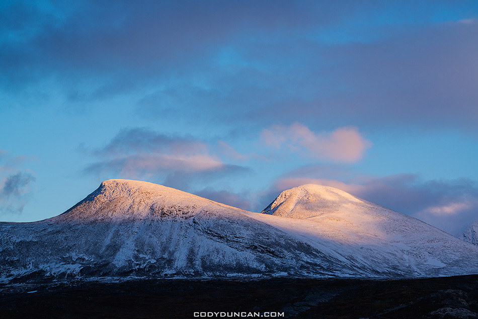
Photo: Mountain sunset, Kungsleden trail, Sweden.  Sept 2012

Mountain landscape, near lake Radujavri, Kungsleden trail, Lappland, Sweden

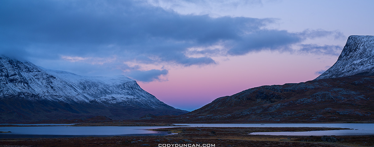
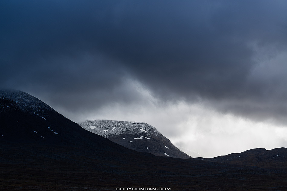
Photo: Twilight comes to the mountains, Kungsleden trail, Sweden.  Sept 2012

Snow covered mountain rise above lake Radujavri along Kungsleden trail, Lappland, Sweden

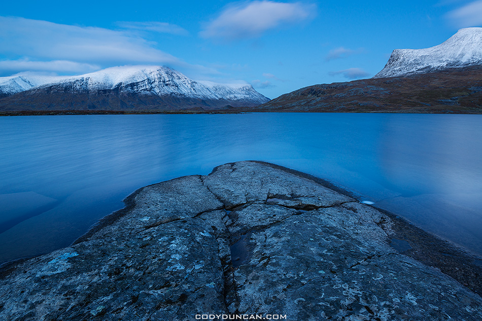
Photo: Blue hour on the shores of lake Radujavri, Kungsleden trail, Sweden.  Sept 2012

Hiking Kungsleden trail in Autumn

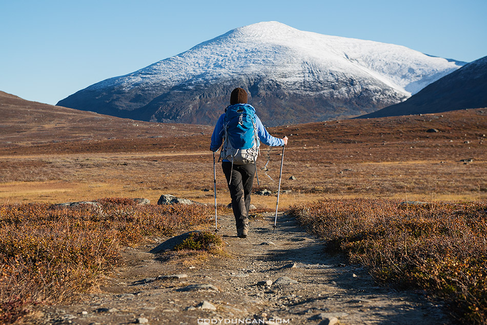
Photo: Keron rises in the north, Kungsleden trail, Sweden.  Sept 2012

Hiking Kungsleden trail in Autumn

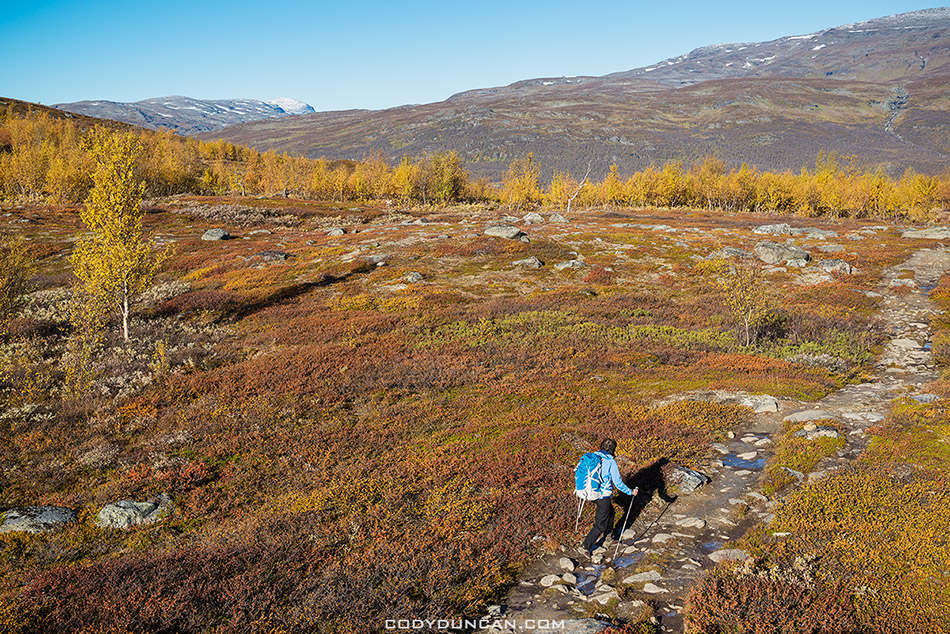
Photo: Descending back into the trees near Abiskojaure, Kungsleden trail, Sweden.  Sept 2012

Hiking Kungsleden trail in Autumn

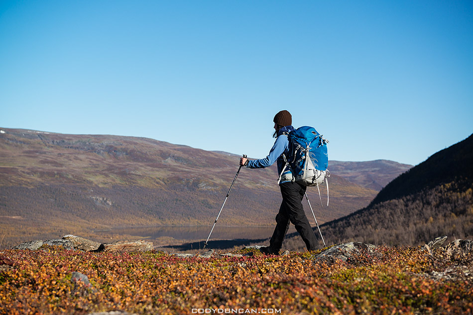
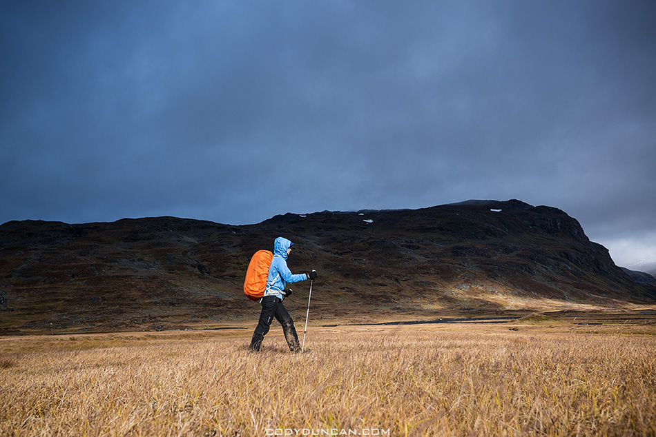
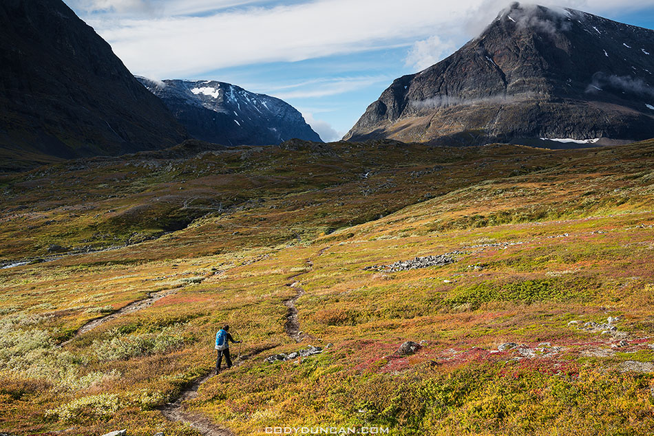
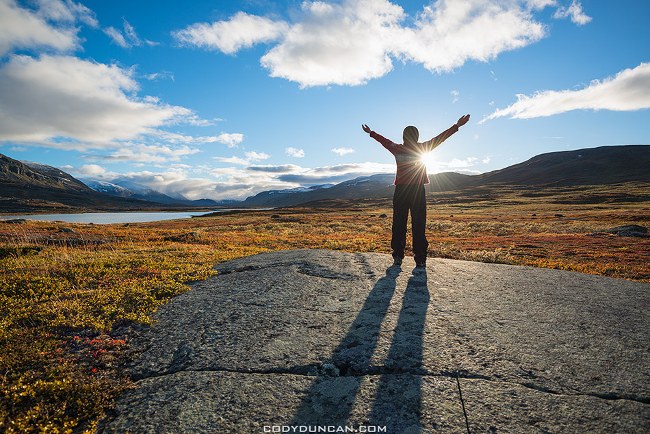
Photo: Autumn hiking under bluebird skies, Kungsleden trail, Sweden.  Sept 2012

Abiskojaure hut Kungsleden trail Sweden

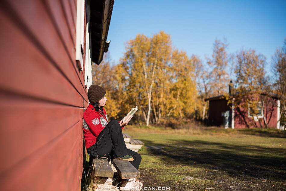
Photo: Enjoying some afternoon sun outside Abiskojaure hut, Kungsleden trail, Sweden.  Sept 2012

Lake Abiskojaure - Abeskojavri with overcast sky, Kungsleden trail, Lappland, Sweden

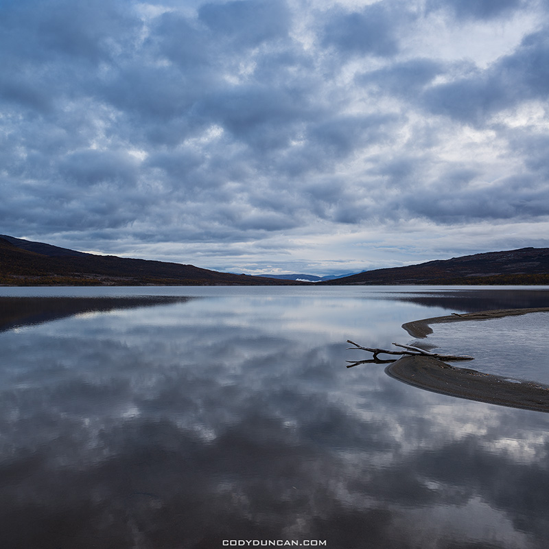
Photo: Final morning on the trail, Abiskojaure, Kungsleden trail, Sweden.  Sept 2012

Hiking through autumn birch forest near Abisko at northern end of Kungsleden trail, Lappland, Sweden

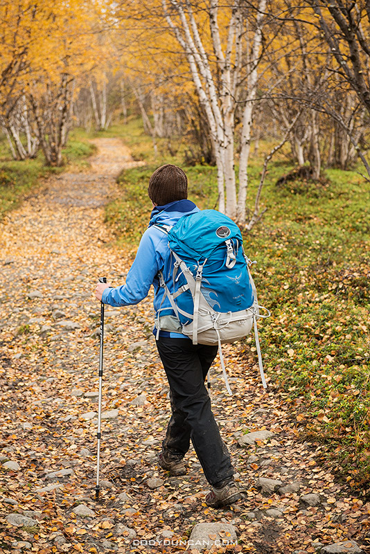
Photo: Hiking under a golden birch canopy in the final kilometers to Abisko, Kungsleden trail, Sweden.  Sept 2012

Abisko Sweden

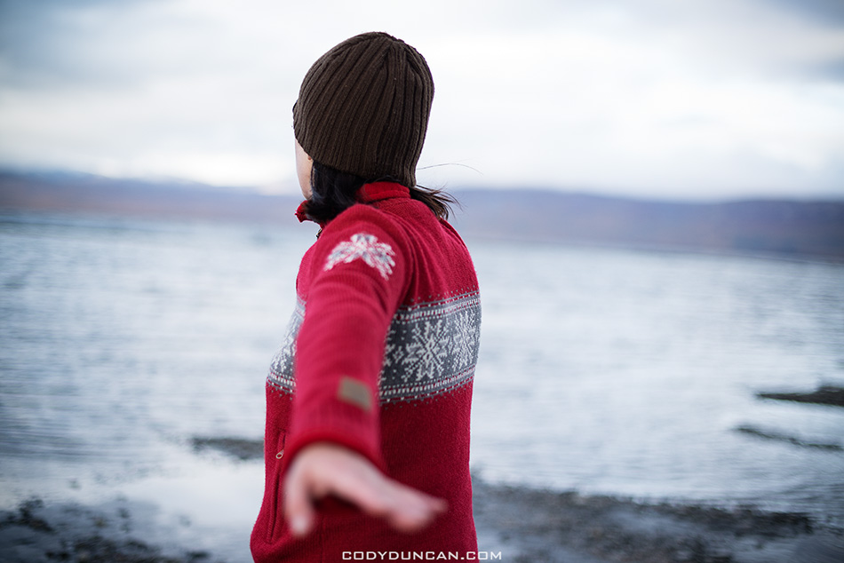
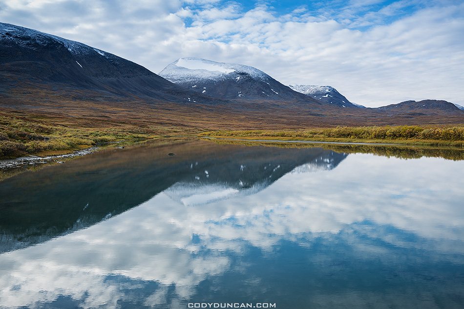
Photo: Wandering the shores of lake Torneträsk, Abisko, Sweden.  Sept 2012

Northern Lights Abisko Sweden

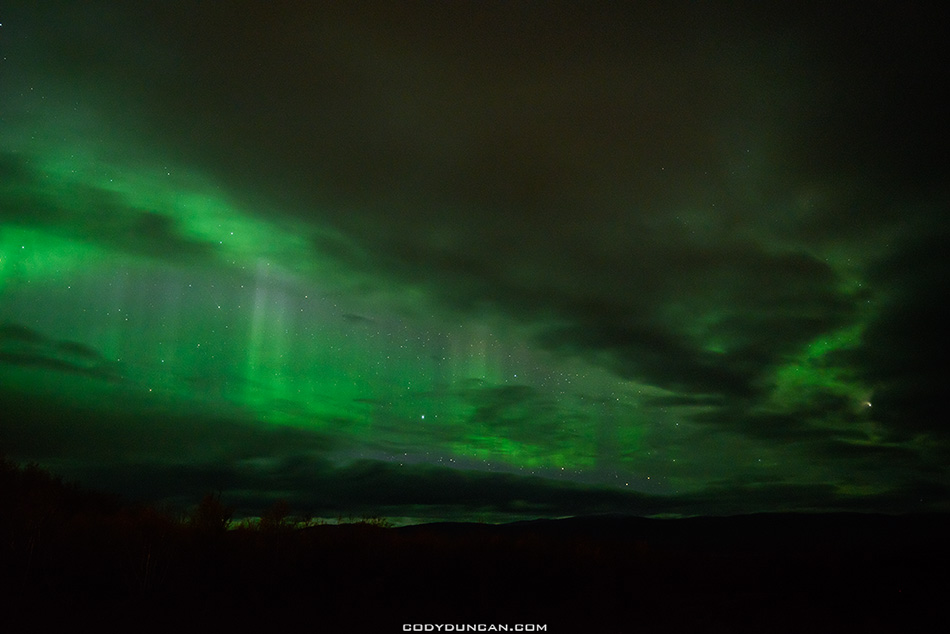
Photo: Northern Lights shine from behind clouds, Abisko, Sweden.  Sept 2012

Kungsleden Trail Sweden – Part 3 – Salka to Alesjaure

Hiking Kungsleden trail Sweden

Photo: Hiking north through the scenic Tjäktjavagge, Kungsleden trail, Sweden.  Sept 2012

Sälka to Tjäktja: 12km – Tjäktja to Alesjaure: 13km

[This is part 3 of my hike along the northern section of the Kungsleden trail, Sweden from Sept 11 – 20, 2012.  Part 1 HERE, part 2 HERE.  For a general overview of hiking the trail in autumn, CLICK HERE ]

I woke in the morning with a sore throat and a bit of a headache, which for me typically means one thing.  I’m about to get a cold.  I probably picked something up in Germany, most likely from my coughing neighbour at the festival, who also happened to sit behind us on the train, constantly coughing until we had to change trains.

It was another blustery day as we left Sälka, heading north towards Tjäktja pass, the highest point on the Kungsleden’s northern section.  And unfortunately this day, the wind was heading directly into our faces.  It was also on this section in 2009 that the wind was so strong, it blew my rain cover right off my pack, which unfortunately I didn’t notice for a few minutes then had to turn around and go chase it down.

At 1,140 meters in elevation Tjäktja pass is not especially high.  But as it sits at the northern end of the long Tjäktjavagge, the views south are some of the most spectacular along the trail.  Unfortunately for my camera, I didn’t choose the most scenic day to head over the pass.  I gave some thought about spending the night in the shelter at the top, but eventually decided to continue to to Tjäktja hut.  Arriving at Tjäktja hut, we were now a little more than half way though the 110km distance of the trail.

After a cold windy day hiking, my cold had worsened, and infect we were both now sick.  I loaded up on Ibuprofen and tried to make the best of it.  If there is one hut that seems to be most often skipped along the trail, it is Tjäktja.  And as it ended up, it was just the two of us there for the night.  I actually feel a little bad about staying in an empty hut, as it takes a lot of wood to head the place up for just two people.  The hut warden, an old lady that didn’t speak much English, but was always smiling, must of thought me to be a bit crazy as I was running around and setting up my cameras to shoot time-lapse sequences.  I tried to explain what I was doing, but I’m not sure I got the point across, but she did seem amazed at the amount of crap I was carrying!

As the morning light increased, a fresh layer of snow was covering the ground around the hut.  And so once again, we headed out into the wind and snow and rain for a relatively easy hike to Alesjaure hut.  Luckily the wind was back to our backs again, it what turned into a pretty grim day for the most part.

Partly because of our colds and partly because we were a few days ahead of schedule, we would spend two nights at Alesjaure hut.  I knew the area around the hut to be fairly scenic, so this would also give me a change to see if the weather might decide to clear up.  And as luck would have it, I would have the pleasure of meeting another one of my blog readers here, this time from Austria.  I’m always amazed at how small the world can be sometimes.

So some lazy days passed.  A few photos here and there, but the light largely remained elusive.  We even spoiled ourselves and bought a can of beans, perhaps the most expensive beans I’ll ever eat in my life, and instant mash potatoes to bring some variety to our bland diets of couscous thus far.  I think even one of the worlds most expensive apples was bought, though I don’t think I received any.  Oh, and a nice warm sauna in the evenings was nothing to complain about!

Hiking Kungsleden trail Sweden

Photo: Mountain sidewalk, Kungsleden trail, Sweden.  Sept 2012

Hiking Kungsleden trail Sweden

Photo: Hiking north towards Tjäktja pass, Kungsleden trail, Sweden.  Sept 2012

Hiking Kungsleden trail Sweden

Photo: Awaiting the arrival of a snow flurry, Kungsleden trail, Sweden.  Sept 2012

Hiking Kungsleden trail Sweden

Photo: Hiking over rocky terrain, Kungsleden trail, Sweden.  Sept 2012

Autumn snow from Tjaktja hut, Kungsleden trail, Sweden

Photo: Overnight dusting of snow at Tjäktja hut, Kungsleden trail, Sweden.  Sept 2012

Hiking Kungsleden trail Sweden

Photo: A brief moment of light on the way to Alesjaure, Kungsleden trail, Sweden.  Sept 2012

Alesjaure mountain landscape kunglseden trail Sweden

Photo: Dark skies to the south from Alesjaure, Kungsleden trail, Sweden.  Sept 2012

Autumn mountain reflection in river, Alisvagge from near Alesjaure mountain hut, Kungsleden trail, Lappland, Sweden

Photo: Mountain reflection near Alesjuare, Kungsleden trail, Sweden.  Sept 2012

 holding axe to cut firewood at mountain hut, Kungsleden trail, Lappland, Sweden

Photo: Perhaps I should sleep with one eye open? Alesjaure hut, Kungsleden trail, Sweden.  Sept 2012

cutting firewood at mountain hut, Kungsleden trail, Lappland, Sweden

Photo: Preparing the evenings firewood at Alesjaure hut, Kungsleden trail, Sweden.  Sept 2012

Kungsleden Trail Sweden – Part 2 – Kebnekaise Fjallstation to Salka

Female hiker with mountains in distance, Ladtjovagge, near Kebnekaise Fjällstation, Lappland, Sweden

Photo: Leaving Kebnekaise Fjällstation under sunny skies, Kungsleden trail, Sweden.  Sept 2012

Kebnekaise Fjällstation to Singi: 14km – Singi to Sälka: 12km

[This is part 2 of my hike along the northern section of the Kungsleden trail, Sweden from Sept 11 – 20, 2012.  For part 1 CLICK HERE.  For a general overview of hiking the trail in autumn, CLICK HERE ]

As morning came to ebnekaise Fjällstation and we prepared for our third day on the trail I had already seen more sun than my entire 10 day journey in 2009.  With an easy 14km to Singi hut, we lazed around for a bit, not taking to the trail until mid morning.  This goes slightly against my normal advice to take advantage of good weather when you have it.  It is never a question of if it will rain, but rather, when.  And so in tempting fate, we hiked west into the Ladtjovagge while surrounded by some of Sweden’s highest peaks which already carried a dusting of the season’s first snows.

About an hour into the day we came across a group heading our way.  “You have three options – wet, wet, or wet.”  The warning from a Swedish woman who had just passed through the particularly flooded and boggy section along the trail, which we now faced.  Another couple from their group sat on the side of the trail putting their boots back on, having given up any attempt at keeping their feet dry and preferring a barefoot crossing of the river.

So there I stood in my light trail runners, still fairly dry at that point, looking for any sort of weakness in the in 100+ meters of Swedish super bog interlaced with series of small rivers that needed fording.  The following few minutes weren’t particularly elegant:  a quick hop onto a slightly submerged rock, almost slipping into knee deep and ice cold water.  Another long step saw me onto a broken bush, the bog creeping up around my shoes with every second my foot remained.  Moving fast I found another, more secure bush with which I could use scout out my next few moves.  More steps and more cursing as the mud crept up around my feet, the first hints of moisture beginning to penetrate though.  Another small stream to hop across and then I came to the final section with no way around.  I put my trekking poles as far forward as possible and did a sort of flying leap into another clump of small bushes.  My poles flexed and sank as I used them like crutches in a desperate attempt to keep from sinking past my ankles.  Finally across I surveyed the damage: left foot somewhat wet from taking the worst of the bog, right foot muddy, but overall pretty dry.  Success.  Or at least success for my preferred use of trail runners in a country where people often hike in wells.

The next hours passed uneventfully as the valley narrowed and we hiked in the shadows of mountains and along crystal clear rivers and waterfalls, everywhere.  We passed another large group of school age kids taking a break on the side of the trail.  My thoughts immediately diverted from the scenic terrain to one of dread; that we might encounter another such a group at Singi, where they would literally take over the whole place.  While I don’t go to the Kungsleden expecting some isolated wilderness experience, I also don’t expect to share a small mountain hut with 19 (yes, I counted) teenagers.  It’s good to give kids an outdoor experience, but I feel such large groups have too much impact on their surrounds in an isolated mountain area and the small huts that shelter us.  So it came to my relief as we arrived at Singi just prior to the rain that we would have the place almost totally to ourselves, just an elderly Swedish couple across the hall in a separate room.

Morning arrived to clear skies once more, but a fresh, to put it nicely, wind was coming from the south and I knew it wouldn’t be long before some not-so-nice hiking weather would arrive.  So before 8:00 we were back on the trail, this time heading almost perfectly north, towards the Sälka hut, 12km away.  This part of the journey was now familiar with me, as Singi had been my southernmost point while on the Kungleden in 2009 when I hiked from Abisko to Singi and back to Abisko again after I learned there were no more busses running from Nikkaluokta for the season.

With the wind at our backs, I wasn’t paying much attention to the weather behind us until I stopped for some quick photos and saw a wall of snow quickly heading our way.  Having taken chances in the morning and not wearing rain gear, we we both in for a rather chilling change of clothes on the side of the trail.  Minutes after our backpacks were back on a terrible mix of snow, sleet, and icy rain hit us with a fury.

A couple more hours of hiking saw us arriving to a warm fire at Sälka.  It is here that I learned some wisdom from the hut warden: wood warms you twice.  Once while preparing it for the fire, and once while in the fire.  It was also at Sälka that I learned that I was somewhat known in this part of the world, as a nice young Australian couple at the hut had read my blog about my 2009 journey.  Cool!

I knew Sälka to be a nice place.  I knew there to be some good potential for photos in the area, but once again, like 2009, the weather chose otherwise.  This is a frustration that I, and we, as landscape photographers often face I think; that I’ve hiked several days to get to an isolated place, only to be shut down by the weather.  I made the most of the light and conditions that I could, but already put a note in my mind that I’ll have to come back once again, not that I would complain!

And so our 4th night on the Kungsleden arrived as we sat warm and dry from the heat of a glowing birch wood fire.

Female hiker leans on bridge in Ladtjovagge Lappland, Sweden

Photo: Enjoying the day, Kunglseden trail, Sweden.  Sept 2012

Hiking trail in Ladtjovagge with Tolpagorni - Duolbagorni mountain in distance, Lappland, Sweden

Photo: Autumn colors fill the landscape in Ladtjovagge, Kungsleden trail, Sweden.  Sept 2012

Panoramic view of Ladtjovagge viewed from near Kebnekaise Fjällstation, Lappland, Sweden

Photo: Mountain peaks surround Ladtjovagge, Kungsleden Trail, Sweden.  Sept 2012

Singi hut Kungsleden trail Sweden

Photo: Night arrives at Singi hut, Kungsleden trail, Sweden.  Sept 2012

Singi hut Kungsleden trail Sweden

Photo: Candlelight at Singi hut, Kungsleden trail, Sweden.  Sept 2012

Hiking Kungsleden trail Sweden in Autumn

Photo: Autumn colors and snowy mountains; late season hiking on the Kungsleden trail, Sweden.  Sept 2012

Hiking Kungsleden trail Sweden in Autumn

Photo: ‘Mountain sidewalk,’ Kungsleden trail, Sweden.  Sept 2012

Hiking boots rain kungsleden trail sweden

Photo: Are your feet wet? Kungsleden trail, Sweden.  Sept 2012

River at Sälka mountain hut along Kungsleden trail, Lappland, Sweden

Photo: A river flows near Sälka Hut, Kungsleden trail, Sweden.  Sept 2012

Small river flows south into Tjäktjavagge, near Sälka mountain hut, Kungsleden trail, Sweden

Photo: A river flows near Sälka Hut, Kungsleden trail, Sweden.  Sept 2012

Kungsleden Trail Sweden – Part 1 – Berlin to Kebnekaise Fjällstation

Autumn view over STF Kebnekaise Fjallstation mountain hut, Lappland, Sweden

Photo: Kebnekaise Fjällstation mountain huts in Autumn, Lapland, Sweden.  Sept. 2012

Days 1-2 Berlin – Kiruna – Nikkaluokta – Kebnekaise Fjällstation

[This is part 1 of my hike along the northern section of the Kungsleden trail, Sweden from Sept 11 – 20, 2012.  For a general overview of hiking the trail in Autumn, CLICK HERE ]

Beep, Beep, BEEEEEEPPPP! WAKE UP!!!  My imaginary mental alarm wakes to the 4:00 am darkness of Berlin.  My real alarm wasn’t too far behind; my head likes to give me a bit of a warning so I have a moment of brief calm before the day begins.  Showered (would be the last one for a week) and packed, we head out the hostel door into the mild morning air barely 12 hours after we’d arrived in Berlin the previous afternoon.  Hopping on the U-bahn, we ride with the early morning commuters, most looking like they wouldn’t have minded a few more hours in bed.  But despite our tired faces our backpacks give us away.  Just passing through…

At 7:00 am we were in the air heading north to Stockholm.  A few hours later, we were landing north of the Arctic Circle, under the grey, misty skies of Kiruna, Sweden.  Though it doesn’t really ever appear on any schedule, or at least not the two times I’ve flown to Kiruna, there seems to be a bus that appears from somewhere mysterious and takes you to the city center.  The last guy to get on the bus asked if there would be another one later that night, as his girlfriend would be arriving on another flight.  ‘Nope,’ the driver replies.  ‘Only one bus today.’  That seems to be how things work in the north, and I’m always wondering if the info I read, especially if found online, is accurate.  Does the bus actually come when the schedule says it will?  Or do they just go by their own rule.  Luckily, the bus taking us to Nikkaluokta did show up at the bus station in Kiruna and by late afternoon were were deposited at the trail head. The next 120km would be by foot.

The clouds hung low in the valley, concealing the peaks around us.  A light drizzle fell from the grey sky.  One of those rains that temps you not to put on rain gear, but then ends up getting you unexpectedly wet somehow.  After taking shelter to change into full waterproofs, we took to the trail for several hours of uneventful hiking into the fading afternoon light.  At the estimated halfway point, I found a nice flat spot amongst the autumn birches and setup camp.  I did put a little effort into trying to find someplace slightly scenic, trying to remain optimistic that I could put my camera to work at sunrise. As morning came heavy drops pelted the tent, a bit more sleep seemed the best idea.

The only thing worse than setting up a tent in the rain is taking down a tent in the rain.  And the rain was falling, and falling as the morning hours passes.  Finally tired of waiting to see if the storm would relent, we packed up camp and continued along the trail.  In my best swag (scientific wild ass guess) of an estimate, we’d reach Kebnekaise Fjällstation is about 3 hours, around noon or so.

The rain was relentless a we continued down the sloppy trail and through forests of golden birch trees.  We passed the ghostly silhouettes of hikers, hoods up and heads down, more closely resembling waterfalls than men.  My (supposedly) waterproof shoes soon began to show their submission to the weather, and my thin fleece gloves left my hands wet and cold.  We continued in silence towards the dream of warmth and of fire, of a place to dry off and relax, of an expensive bunk at Kebnekaise Fjällstation.

And then, out of nowhere, the clouds parted and a brilliant blue filled the sky!  My first thoughts where that we should have waited in the tent longer.  My next thought was that it probably would have rained for a week straight had we waited.  I think the North sometimes likes me to suffer a bit before she offers me any rewards.  As we neared the surrounds of hut, my thoughts drifted to finding a nice place to camp and maybe a few nice camping photos.  And then reality reminded me that the tent was completely soaked, sleeping bags were damp, clothes were wet, and most importantly, if I set up my tent, it would rain again.  And so I forked out the 500 SEK for a bunk bed and went even more extreme and bought myself a beer or two.  And since I was carrying a laptop for no other reason than I had no place to leave it, I even made use of some internets.  Luxury in the mountains.

Kebnekaise Fjällstation turned out to be a busy place, or at least much more so than I imagined, it being so late in the season.  And entering the guest kitchen I was presented with the dilemma I always seem to find myself in: Yummy free food to eat or the beginnings of a lighter backpack.  A mix of both would do on this night.  And so my head hit the pillow that night, full, dry and warm.  Luxury in the mountains…

1662 meter Tolpagorni - Duolbagorni rises above Ladtjovagge viewed from near Kebnekaise Fjallstation, Lappland, Sweden

Photo: 1662 meter Tolpagorni – Duolbagorni rises above Ladtjovagge viewed from near Kebnekaise Fjällstation, Lapland, Sweden.  Sept. 2012


Autumn tree with summit of Tolpagorni - Duolbagorni in distance, viewed from near Kebnekaise Fjallstation, Ladtjovagge, Lappland, Sweden

Photo: Autumn tree with summit of Tolpagorni – Duolbagorni in distance, viewed from near Kebnekaise Fjällstation, Ladtjovagge, Lappland, Sweden.  Sept 2012

Hebridean New Year – Part 3 – Misty Days on Harris and Lewis

Luskentyre beach, Isle of Harris, Scotland

Photo: Misty January sky over Luskentyre beach, Isle of Harris, Scotland.  Jan 2013

[For part I – Howmore – CLICK HERE.  For part II – Berneray – CLICK HERE.]

The mist was heavy as the ferry sailed slowly towards Leverburgh on south Harris.  One of those mornings when you cannot actually tell when when the day begins, and somehow perfectly fitting to the rocky, moon like landscape of the Isle of Harris.  One of those landscape where a person could disappear into the mist, never to be seen again.

On trips to the islands, I like to try and spend a majority of my time on Harris, as It’s the most scenic and diverse of the islands, not to mention the beaches.  But the way the New Year fell, combined with ferry schedules, meant we only had 3 nights to explore both Harris and Lewis.  So, knowing that I wouldn’t get any decent photos on the south, we headed all the way north to the furthest tip of Lewis, the Butt of Lewis.  Last year I got some cool photos of monstrous waves crashing into the cliffs, so I was hoping for a bit of a repeat.  Unfortunately, the sea was too calm and the wind from the wrong direction for much of a show this time.  And so it was back to the road to look for a place to camp for the night, finally ending up by some beach near Uig.

Another day of mist came and went.

For our final night on the islands we stayed at the oldest of the Gatliff hostels in Rhenigidale, a small, isolated village on the rugged east side of Harris that wasn’t even connected by road to the outside world until 1990. Warmed by the fire, our final, rainy night on the islands passed.

We were on the road in the early morning hours, me hoping for one last chance for a sunrise.  But again, nothing, leaving me at 0 for 8 sunrises so far this trip.  Not too good!  Another stormy ferry ride put us back on Skye with a heavy rain falling.

The plan had been to stay the night on Skye, but this was nixed and we headed back south to Glencoe, and it was lucky I did so.  For the following morning on Rannoch Moor, I saw one of the best sunrises I’ve yet to see in Scotland.  We spent the afternoon climbing at the Ice Factor, then our usual tradition of dinner at the Clachaig.  Monday was a rainy 8 hours back to Wales and the end of another Hebridean New Year.

Luskentyre beach, Isle of Harris, Scotland

Photo: Luskentyre beach, Isle of Harris, Scotland.  Jan 2013


Dalmore beach, Isle of Lewis, Scotland

Photo: Dalmore beach, Isle of Lewis, Scotland.  Jan 2013


peat cutting, isle of harris, Scotland

Photo: Peat cuttings, Isle of Harris, Scotland.  Jan 2013


Rhenigidale hostel

Photo: Rhenigidale hostel, Isle of Harris, Scotland.  Jan 2013

Hebridean New Year – Part 2 – New Year on Berneray

Berneray hostel scotland

Photo: Night comes to Berneray youth hostel, Berneray, Scotland.  Jan 2013

[For part 1 of the story – Howmore – CLICK HERE. For part 3 – Harris and Lewis – CLICK HERE]

Monday morning, New Year’s Eve, we said our goodbyes to Howmore and headed north to Berneray.  The hostel at Berneray, also part of the Gatliff trust, is perhaps my favourite hostel in all of Scotland.  And for the third year in a row, despite the weather, I’ve journeyed here to welcome in the new year.  Only feet from the crashing waves of the sea, and surrounded by the ruins of days gone by, the hostel at Berneray sits alone on the edge of the small island who’s population comes in at an uncrowded 136 people.  As the clock struck midnight, there were 7 of us sitting around the table in the dimly lit room, rain battering the windows and wind creaking the roof.

New Year’s day brought a slight improvement to the weather and so we headed out to walk along Berneray’s West beach, perhaps one of the nicest beaches in Scotland – if you don’t mind the temperature!  Covering nearly the whole western side of the islend, the beach is some 3 miles of white sand backed by grassy dunes and machair.

As afternoon arrived, it was off to another beach on North Uist to see if the sunset might bring some nice light. It didn’t.  And little did I know, this would be the last time I would see the sun on this trip.  In the morning, an early ferry would bring us to my favourite Hebridean island, the Isle of Harris.

west beach berneray scotland

Photo: Chasing rainbows on west beach, Berneray, Scotland.  Jan 2013

west beach berneray scotland

Photo: Walking along the grassy dunes above west beach, Berneray, Scotland.  Jan 2013

west beach berneray scotland

Photo: west beach, Berneray, Scotland.  Jan 2013

west beach berneray scotland

Photo: Can you find the sheep? west beach, Berneray, Scotland.  Jan 2013

Berneray hostel scotland

Photo: Catching a brief moment of sun outside the hostel, Berneray, Scotland.  Dec 2012

Abandoned building, Berneray, Scotland

Photo: Old wall, Berneray, Scotland.  Dec 2012

Abandoned building, Berneray, Scotland

Photo: Alone and empty, Berneray, Scotland.  Dec 2012

Hebridean New Year – Part 1 – Stormy ride to Howmore

Stormy sea scotland minch

Photo: Gale force winds and rough seas while crossing to the Outer Hebrides, Scotland.  Dec 2012

[For part 2 – Berneray – CLICK HERE.  For part 3 – Harris and Lewis – CLICK HERE]

A deer jumped into the headlights 20 meters ahead of me in the 2am darkness of Rannoch Moor.  I locked up the front tires, missing it be mere feet as it sprung across the road.  After 8 hours of driving from Wales, it was finally time to find a place to camp for the night.  In the morning, the journey would continue onwards to the Isle of Skye, and finally the ferry to North Uist to once again celebrate the coming year on Scotland’s Outer Hebrides.

Arriving in Uig, I learned of the chaos the gale and storm force winds had been causing.  Friday’s sailing to the islands had been canceled, resulting in a huge backup on the Saturday afternoon ferry that we were hoping to get on.  We ended up in the standby line, and sat around to wait.  There was word that there would also be an extra sailing later that night ahead of Sunday’s expected weather cancelations, but as luck would have it, we made it on the boat as the 2nd to last car.  I later learned there was no second sailing that night, and the weather held off the ferry until late Sunday afternoon.

The Little Minch, the 20 mile stretch of water separating Skye from the Outer Hebrides, was full of fury as the boat traveled west into the afternoon darkness of winter in the north.  Dishes crashed and barf bags were filled.  Huge waves crashed over the ferry as the boat continued westwards, and people needed to go out to get some ‘fresh air’ at a more regular interval.  But soon enough, it was over, and I was back in the drivers seat heading south on the single lane roads to Howmore.

At Howmore, South Uist, is one of 3 hostels run by the Gatliff Trust.  The hostels are simple places in restored, thatched roof black houses; as the traditional, single room stone houses northern Scotland are called.  Full of atmosphere and history, each one is unique and with its own character.  They are some of my favourite places in Scotland to stay, and fit well to the landscape of the islands.  Here would be our home for the next two nights as the gales continued to sweep across the islands.

Sunday brought little worth wandering outside for, so it was mostly spent driving around the south of South Uist.  And with darkness arriving around 3:30 in the afternoon, the day doesn’t even leave much time for that.  In the morning, we headed north, to Berneray.

outer hebrides ferry scotland

Photo: Just made it, 2nd to last car on the ferry.  Isle of Skye in distance.  Dec 2012

Howmore youth hostel

Photo: Howmore Hostel, South Uist, Scotland.  Dec 2012

Howmore

Photo: Warm fire and a splash of whisky, Howmore, South Uist, Scotland.  Dec 2012

Howmore church cemetery ruin

Photo: Cemetery and church ruins, Howmore, South Uist, Scotland.  Dec 2012

Howmore church cemetery ruin

Photo: Cemetery and church ruins, Howmore, South Uist, Scotland.  Dec 2012

Howmore church cemetery ruin

Photo: Cemetery and church ruins, Howmore, South Uist, Scotland.  Dec 2012