Rialto Beach – Olympic National Park

Rialto Beach Olympic national park

Photo: Sunset at Rialto Beach, Olympic National Park, Washington

For the last couple weeks I’ve been on a road trip up north.  Most my time was spent visiting friends in Portland, as well as a few days a bit further north in Washington.  I had been to Rialto beach a few years back and I remembered it being a pretty cool place.  The entire beach is covered in the most massive driftwood I have ever seen, ancient trees up to 6 feet in diameter and a hundred feet long.  I can hardly imagine the power of the storms that deposited the trees there, but it must have been a sight.  In summer things are a bit calmer, but I think it is still one of those places where the wind always blows and the waves always crash with a bit more fury than down here in California.    I got a bit lucky with a somewhat decent sunset on my first evening.  My second day was mostly thick fog, that while not especially photogenic, seems quite fitting and appropriate for a place like Rialto.

Rialto Beach Olympic national park

Photo: Sunset at Rialto Beach, Olympic National Park, Washington


Rialto Beach Olympic national park

Photo: Sea stacks and incoming tide at Rialto Beach, Olympic National Park, Washington

Rialto Beach Olympic national park

Photo: Sunset at Rialto Beach, Olympic National Park, Washington

Rialto Beach Olympic national park

Photo: Sunset at Rialto Beach, Olympic National Park, Washington


Rialto Beach Olympic national park


Rialto Beach Olympic national park


Rialto Beach Olympic national park

Making Plans for Europe

Autumn storm clouds over Vestfjord, Lofoten islands, Norway

Photo: Autumn storm over Vestfjord, Lofoten islands, Norway

For whatever reason, it’s been a pretty stagnant and boring summer (and year for that matter) for me so far.  I’ve hardly been able to get out of Santa Barbara and other than a few commercial assignments, I haven’t even touched my camera in months.  I’ve been trying to put something together for several months now, but I always seem to run into some sort of setback..  Finally now it seems I have somewhat of a haphazard travel plan materializing.

With Luck I should be back on the Lofoten islands around the last week of September.  It’s not exactly under the conditions I had hoped, to move there with a work visa.  But if I can manage to find a flat to rent, at least I’ll be able to continue with the application process.  If not, it might just forever remain an unfulfilled dream.  I know its a bit late in the year and I’m hoping autumn waits for me, but other engagements keep me here until then.  I had also hoped to hike another section on the Kungsleden or perhaps wander around Sarek national park in Sweden, but that will have to wait another year unfortunately.  So I’m looking at some other hiking options that I might be able to manage in October.  Been thinking about maybe crossing the High Tatra mountains from Slovakia to Poland, or perhaps something in Austria or Switzerland.  I Mainly just have to see how early the snow arrives and decide from there.  Otherwise I think I’ll pay another visit to Stockholm on the way down from Lofoten and maybe Copenhagen.  Then visit some friends in Germany and perhaps some old places in Czech Republic that I really like.  Hopefully I’ll catch some Christmas markets before going to Wales in early December or so, where I’ll stay a few more months.   As much as I seem to travel, it’s really been over 4 years since I did any proper ‘backpacking’ in the Euro sense of the word: hostels, trains, buses, hitchhiking, cities, etc.  I almost feel a bit nervous about it.


Empty stockfish drying rack, Lofoten islands, Norway

Photo: Empty stockfish drying rack, Lofoten islands, Norway

Scenic beach at Ramberg, Flakstadoy, Lofoten islands, Norway

Photo: Scenic beach at Ramberg, Flakstadoy, Lofoten islands, Norway

Snow covered rocky coastline at Stamsund, Vestvagoy, Lofoten islands, Norway

Photo: Snow covered rocky coastline at Stamsund, Vestvagoy, Lofoten islands, Norway

Berneray – Western Isles

Sound of Harris, Berneray, Outer Hebrides, Scotland

Photo: White sand beach and view across Sound of Harris, Berneray, Outer Hebrides, Scotland

Berneray is the newest edition to my very short list of favorite places, places that I can just get lost in.  I spent a few days there of blasting gales in October last year and returned again to bring in the new year.  The wonderful small little hostel only feet away from the waters edge on the north of the island is my chosen abode.  Run by the Gatliff Trust, the hostel is an old croft house.  Rustic and homely, white washed stone walls and a thatch roof; the way a place must be on a lonely island out on the edge of the world.  The heat comes from a coal stove and one end of the room as the sound of rain patters against the small windows and the howling of wind creeps under the old wooden door.  Lights and candles burn late into the winter nights as strangers sit around sharing meals and stories, perhaps also a splash of two of Scotch.

As with most places in the part of the world, photography is more a game of patience than anything.  It’s a good time to slow down from the fast pace of life, maybe not check those emails for a week or two, it’s not gonna kill you.  All these photos are taken no more than 3-4 minutes walk from the front door.


Sunset over Sound of Berneray and North Uist, Western Isles, Scotland

Photo: North Harris silhouetted against the days last light

Berneray, Western Isles, Scotland

Photo: Calm waters and blue skies, just before the rain

Berneray Dunes, Outer Hebrides, Scotland

Photo: Dunes blow in the wind as rain approaches over the Sound of Harris

Dune grass, Berneray, Outer Hebrides, Scotland

Photo: An elusive sun lights up the dunes, mountains of South Harris rise in the distance

Ruins of derelict croft house, Berneray, Western Isles, Scotland

Photo: Abandoned croft at twilight

Lofoten Islands Hiking

Reinebringen view Lofoten islands

Photo: View from Reinebringen, Lofoten islands, Norway

I’ve written several post about mountain hikes and camping on the Lofoten islands, but they’re a bit scattered across my blog at the moment so I putting links to them all here in one place.

Reinebringen hiking and info: CLICK HERE.  Reinebringen trailhead is located near Reine, on Moskenesoy.

Justadtinden hiking and info: CLICK HERE.  Justadtinden trailhead is located at Hagskaret, between Leknes and Stamsund on Vestvagoy.

Steinetinden hiking and info: CLICK HERE.  Steinetinden trailhead is located in Stamsund, on Vestvagoy.

Bunes Beach camping and info: CLICK HERE.  The ferry to Bunes Beach is located in Reine, on Moskenesoy.


Justadtinden Lofoten islands

Photo: Summer afternoon on Justadtinden, Lofoten islands, Norway


Lofoten islands hiking Justadtinden

Photo: Saviors of my knees, Justadtinden, Lofoten Islands, Norway

Unstad Beach Lofoten Islands

Unstad Beach Lofoten Islands

Photo: Snow covered Unstad beach, Lofoten Islands, Norway

A hunch, as well as some minor understanding of Lofoten weather patterns (if such a thing can exist) led me out a of a never ending snow storm to the relative calm at Unstad.  The light was nearly gone from an already short January day, but there was enough.

Unstad Beach Lofoten Islands

Photo: Storm clouds over Unstad beach, Lofoten Islands, Norway

Ågvatnet – Å I Lofoten Norway

Ågvatnet lofoten islands norway

Photo: Ågvatnet cloaked in winter snow.  Jan 2010

In my last post I wrote about returning to Ågvatnet to try and make a ‘better’ version of a photo that I like very much, and was good for a 20 year having only ever taken a high school photo class, but by today’s standards is a bit lacking.  Ågvatnet is the small lake behind the village of Å I Lofoten, which is the westernmost village, and end of the road, in the Lofoten islands.  It can be a gnarly tourist trap in summer  – the road ends in a parking lot after a 1.5 lane tunnel and it can be stuffed to the brim with motorhomes on a nice July afternoon.  So I usually avoid the area at this time of year.   Though that being said, I’m not usually on the islands in the summer anyways.

Anyhow, here’s a few images of the lake during other parts of the year: winter, spring, and autumn.  The autumn image is the closest I’ve come to my first photo, yet as you can see the boat is not exactly in top form.  The Rainbow towards the left of the image is from the rain that would soak me in another minute.

Ågvatnet lofoten islands norway

Ågvatnet lofoten islands norway

Ågvatnet lofoten islands norway

10 years

Lofoten islands, Norway

Photo: Boats at rest in Ågvatnet, Å I Lofoten, Norway.  2001

I know the above photo kind of sucks.  I shot it 10 years ago within a couple hours of stepping foot on Lofoten for the first time.  It’s taken with an old Nikon FE and a crappy 35-105mm lens on Fuji Provia 100, hand held sometime shortly before midnight.  I made a print of it, where it hung on my wall for 5 years before I was able to return again.  Over the years I’ve tried to take a ‘better’ version of this photo, but I’ve never encountered proper conditions.  Despite all its faults, it’s still one of my favorites.  I can remember those moments with stunning clarity; it was the point where I knew I had ended up someplace special.  With luck and hard work, Lofoten will be my home by the end of the year.  Something I’ve dreamed about all those years, yet never managed to make much progress towards.  Maybe I just needed to get a little older.

stamsund

schmitsch Smicz, Prudnik, Poland

Schmitsch – Smicz

schmitsch Smicz, Prudnik, Poland

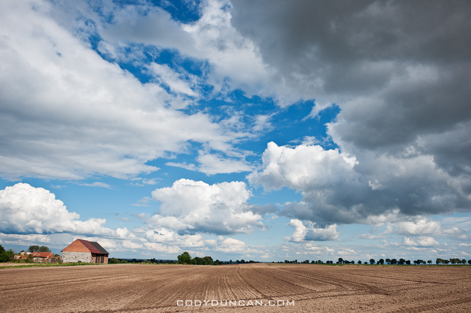
Photo: Freshly plowed fields in autumn, Schmitsch/Smicz, Poland

[UPDATE: April 2014 – I have written an updated post about with further information into the Hindera (and other) families – CLICK HERE ]

Rarely do I visit a place that I have a personal connection with.  The tiny village of Schmitsch/smicz is an exception.  It’s the place where my great-great grandfather, Albert Hindera, was born.  In those days it was part of Prussian Silesia.  Today it now lies in Prudnik county, in the south of Poland.

This history of Schmitch, now named Smicz in Polish, is a complex one.  At the center of Europe, the Silesian region (Schlessien) has fallen under the rule of numerous duchies, kingdoms, and empires throughout the centuries.  By the mid 18th century the Prussians gained control over the region from the Austrian Habsburgs.  In 1871 Silesia then became part of the newly formed German empire (Deutsches Reich) where it remained a part of Germany up until the end of WWII, when a majority of the region was transferred to Poland.

In 1879, at the age of 17, Albert, along with several brothers and sisters, left the German port of Bremen for America.  Landing in Baltimore he took the train to Nebraska, eventually ending up with land in western part of the state.  He built himself a house out of sod and started a farm.  After 5 years, he was awarded the deed to his land, upon which he sold it and bought another farm in the southeast of Nebraska near the town of Steinauer, where the soil was better.  There he married another Silesian immigrant, Anna Lempka and in 1889 my great-grandfather George Hindera was born.  Looking at family records it seems like half of Schmitsch must have traveled to America during that period.  The names of the Nebraska census closely match those from the war memorials, cemetery, and church records in Smicz.

I was granted the privilege to look in the hand written church birth/baptism registry where I saw the names of long forgotten family and the records of their births from centuries past.  Even finding a few new names of my family line further back in time.  It was somewhat difficult to read the old German handwriting.  Especially once I got used to one persons writing style in the book, and then a new person took over with even worse handwriting!

I unfortunately was not allowed to take any photos of the books, not sure why not.  It’s a bit frustrating to realize how much information is locked away in those old books with their deteriorating paper and fading ink.  And there is no real access to it outside of going there, and hopefully having someone who speaks the language of the local priest.  I guess I should also be thankful that my family records have survived two wars and dramatic political changes.  Hopefully I can return in another few years and keep looking back further in time and maybe try and get permission to take some photos.  The records go back to the 1500’s.

Looking at the war memorial in the city center, I guess it is a good thing my family left.  The names Brinsa, Hindera, Mellar, and Peschel are all of direct ancestry to me, and probably nephews/cousins of Albert.  It seems a large toll was taken from this small town of 500 souls.   The cost of the second world war was even greater.

Schmitsch smicz poland bilingual sign

Photo: Bilingual Polish/German city sign.  The region where Schmitsch/Smicz lies is one of the few areas in Poland where German has recently become an official recognized language once again.

Rural road in poor condition, Smicz, Opole, Southern Poland

Photo: Main road into town.  Could use some paving.

Schmitsch smicz poland

Photo: Downtown Smicz.  Other than the asphalt and power lines, it probably hasn’t changed much since Albert left.  When I return I’ll see if the family home still exists.

German war memorial schmitsch smicz poland

Photo: WWI memorial.  A lot of names, both German and Polish, for a village of 500.

Lofoten Islands Hiking – Steinetinden

steinetinden, stamsund lofoten islands norway

Photo: Winter view from Stamsundheia towards Steinetinden in distance.  Mar 2009

Steinetinden (sometimes called Steinstind, Steinstinden) is a relatively small 509 meter high peak located between Stamsund and Steine on Vestvågøy in the Lofoten islands.  By Lofoten standards its not anything spectacular.  The main attraction of the peak is its close location to the Stamsund youth hostel, about a 5 minute walk across the street for the beginning of the trail.  If you have access to a car, I would recommend setting you’re sights on more aesthetic peaks.  If you just got off the Hurtigruten in Stamsund, are lucky enough to have some fair weather, then Steinetinden is the perfect introduction to what the Lofoten Islands have to offer.  The views aren’t bad, just not as good as elsewhere on the islands.

Location:
Steinetinden is the highest peak along the circular mountain ridge towards the east of Stamsund.  The most direct and straight forward way is walk up ‘Ringveien’ street which is located across from the Joker market.  From Ringveien one has several options.  One way is to turn on Halsbakken street and continue walking east towards the mountain.  When you see a yellow house with what looks like a parking area  for 2-3 cars in the street before it, head into the bushes at the back of the parking area.  You should detect a faint and probably overgrown trail.  This way will take you up and over Mannfallet first.

Otherwise, from Ringveien take the pathway into the forest at the back of the road that heads towards the lakes (this is also the cross-country ski route in winter).  After several hundred meters on the trail, there should be a sign and a small trail coming from the left.  Once on this trail, there are also two options when one comes to the fork.  Towards the left takes one up the middle peak of Mannfallet (308 meters), towards the right the trail continues through the forest and up a steep, often muddy trail towards Steinetinden.  Personally I think hiking up Mannfallet first is the more scenic route, and even slightly easier.  I generally save the steeper, more direct route for the way down, to make a bit of a loop out of things.

Whether going over Mannfallet first or heading direct towards Steinetinden you will eventually find yourself in a flat grassy area between the two peaks.  From here the trail steeply climbs about another 150 meters up to the summit of Steinetinden.

A word of caution:
while for the most part the trail is not anything technical, there are several locations where it passes quite close to high, steep cliffs and one is exposed to a possible fall of 400-500 meters.  In wet conditions the trail can also be quite slippery/muddy.  There are also several short rock steps that need to be negotiated, again with some exposure to a possible long fall. Go with a group of people if possible, and especially if you’re new to mountains.  Be sure to have proper footwear and don’t be afraid to turn around if necessary.

steinetinden, stamsund lofoten islands norway

Photo: Final climb towards summit.  July 2006

steinetinden, stamsund lofoten islands norway

Photo: Summer view from Manfallet towards Steinetinden.  July 2006


steinetinden, stamsund lofoten islands norway

Photo: Spring view from Mannfallet towards Steinetinden.  April 2007

steinetinden, stamsund lofoten islands norway

Photo: A bit of exposure near the summit.  July 2006

steinetinden stamsund lofoten islands

Photo: View of Stamsund from summit. Aug 2010

map

Hadselfjorden – Norway

Hadselfjorden vesteralen norway

Photo: Autumn storms over mountains of Vesterålen while traveling on Hurtigruten ferry through Hadselfjorden, Norway. Sept 2009

I think Hadselfjorden is not really a fjord but a straight, separating some of the Vesterålen islands and a bit of Lofoten as well.  But in Norwegian, if its made of salt water, and you can see land from it, they call it a fjord. Forget about firths, bays, straights, bights, coves, channels, etc.  Fjord it is in Norway. (Yes, I know this is not totally true.  I’m attempting to be slightly humorous.  No need to correct me.)

I usually have pretty good luck with dramatic light and stormy weather while traveling along the Norwegian coast, making it one of my favorite ways to get up and down the country.  Maybe its just always stormy.  These images are from one autumn afternoon while traveling on the Hurtigruten from Sortland to Stamsund. 


Stormy seas of Hadselfjord, Vesteralen, Norway

Dramatic skies over rising mountain peaks of Vesteralen viewed from Hadselfjord, Norway

Steep mountains rise from sea, Lofoten islands, Norway

Dramatic light over mountains of vesteralen as viewed from Hurtigruten