Corn Du – Brecon Beacons

Panoramic landscape photography: Corn Du hidden in clouds, Brecon Beacons, Wales

View from Pen Y Fan of Corn Du partially hidden in Clouds, Brecon Beacons, Wales.  December 21, 2009

Super cold and lots of snow, but the winds were calm. The clouds were slowly blowing over the summits creating total whiteouts with occasional moments of visibility. Would have been easy to get lost if I wasn’t familiar with the area.

Lofoten Islands – Flakstad

Panoramic landscape photography: Flakstad beach, Lofoten islands, Norway

Flakstad, Lofoten Islands, Norway.

In summer under blue skies, this is a wonderful beach that is often crowded with people.  In early January it is a cold and windswept place – which is perfect for me because there are no footprints.

Nikon D700, 24mm tilt-shift lens.

Brecon Beacons Winter

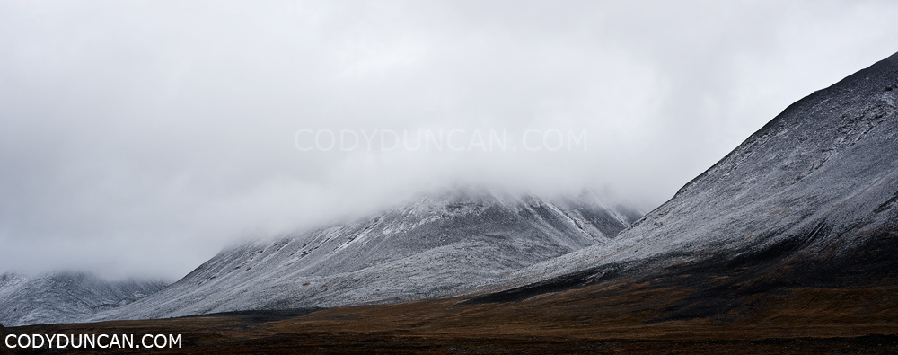
We’ve had a fair bit of snow here in the south of Wales (and the UK as a whole, causing quite a bit of chaos) over the last week (snowing right now as well).  My current location is right on the edge of the Brecon Beacons national park, so it’s been nice to get up into the hills over the last days.  On Sunday and Monday I was up on Pen Y Fan and Corn Du.  Tuesday was a wonderful day up on Fan Fawr and this morning (Wednesday) was a dawn patrol run up Pen Y Fan and Corn Du again in hopes of a nice sunrise, which never materialized.

Brecon beacons national park winter snow december 2009 Panoramic landscape photo

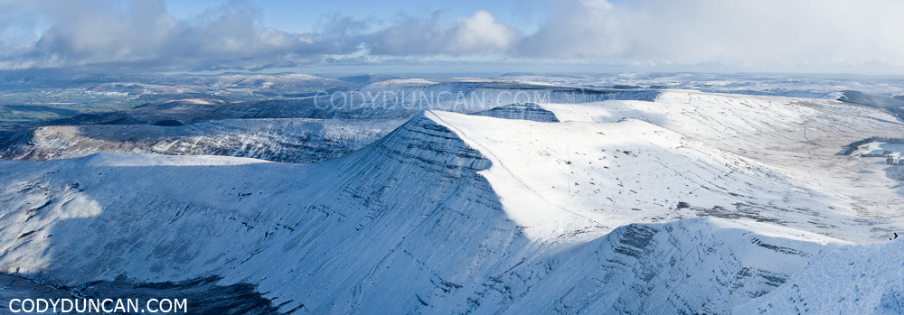
Panoramic image of view from Pen Y Fan looking towards Cribyn.  Sunday was a day of 50-60  mph winds blasting across the summits and ridges throwing snow everywhere.  A layer of clouds sat about 200 meters above the mountains forming a constantly changing show of light and shadow.  A constant struggle to keep the lens free from spindrift – actually better to keep the lens hood off, as it would create some weird wind vortex that would bring more snow.

Brecon beacons national park winter snow december 2009.  Pen Y Fan in clouds

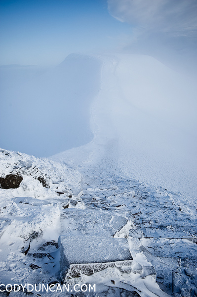
Pen Y Fan concealed behind clouds as seen from Corn Du.  Monday was a much calmer day with slow moving clouds forming over the summits and then clearing again.

Black Cuillins – Isle of Skye

Panoramic landscape photography - Black Cuillin Hills, Glenbrittle, Isle of Skye, Scotland

Black Cuillin Hills as viewed from Glenbrittle, Isle of Skye, Scotland.

Ring of Brodgar – Orkney

Ring of Brodgar standing stones, Orkney, Scotland - Cody Duncan photogapher

Ring of Brodgar standing stones, Orkney.

Sunset panoramic photo Ring of Brodgar standing stones, Orkney, Scotland

Winter sunset behind Ring of Brodgar stone circle, Orkney

Kungsleden – Sweden

Kungsleden, Sweden: Panoramic landscape photo of autumn snow

September snow falls on mountains along the Kungsleden trail, Sweden.

Lofoten Autumn Snow

Lofoten islands panoramic landscape photography: Autumn snow covers rocky coastline

Autumn snow on rocky coast at Stamsund, Lofoten Islands, Norway.

Kungsleden

Kungsleden trail, Sweden: Panoramic landscape photo from Tjaektja

Typical weather during my 10 days on the Kungsleden trail.  View from near Tjaektja hut, looking north up the Alisvaggi towards Alesjaure.

The landscape is totally amazing and beautiful, despite the weather.  Barren rugged mountains with rivers and waterfalls everywhere.  Most of the northern section of the trail is above the tree line.

(working on some small netbook, so not too sure about the color.  Hope its not too bad.)

Long Beach, Vancouver Island, British Columbia

Travel landscape stock photography: dramatic clouds over Long Beach, Tofino, Vancouver Island, British Columbia

Travel landscape stock photography: dramatic clouds over Long Beach, Tofino, Vancouver Island, British Columbia

Long Beach, Vancouver Island, British Columbia.

Probably the only interesting clouds of the whole trip.  Last day on Vancouver Islands while heading back to catch a ferry to the mainland.  Just happed to stop by the beach to check things out and it looked pretty cool.  Brutal contrast though, with the sun in and out of the clouds.  And windy.

Night Comes to Lofoten

Lofoten islands panoramic landscape stock photo: view of Austvågøya and Vestfjorden in winter

View from the top of Stamsundheia above Stamsund, Vestvågøya towards the village of Henningsvær and mountains of Austvågøya.  The mountain peak in the center of the photo is about 16km away.  The second set of mountains behind that are about 35km away.  The Furthest distant peaks are the Norwegain mainland (Hamarøy I think) about 65km away, sperated by the mighty Vestfjord.

The night arrives slowly this far north due to the low angle of the sun.  In the weeks prior the the nearly 2 month long “day” of the summer months, night never really properly arrives, just a few hours of twilight.  Though here in March the night eventually comes, delayed enough that one has enough time to walk off a mountain after sunset with relative good visibility.