• Link to X
  • Link to Facebook
  • Link to Instagram
  • Home
  • About
+47 95 44 46 62
Cody Duncan Photography
  • Portfolio
  • Ebooks
  • Motion
  • Travel
    • STORIES
      • Lofoten’s Mountains of Summer
      • Lofoten Autumn Nights
      • Lofoten Winter Journeys
      • Kungsleden Trail Sweden
      • Baltic Gold
    • GUIDES
      • Norway – Besseggen Ridge
      • Sweden – Kungsleden Trail
    • FESTIVALS
      • Germany – Pottenstein – Ewige Anbetung Fire Festival
    • GEAR
      • Backpacking Gear – 2015
  • Blog
  • Contact
  • Click to open the search input field Click to open the search input field Search
  • Menu Menu

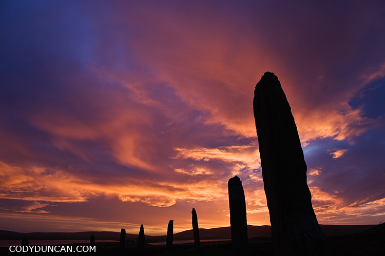
Ring of Brodgar – Orkney
April 19, 2010/2 Comments/in Historic Places, Landscape, Mostly Photos, Panoramics, Scotland/by Cody

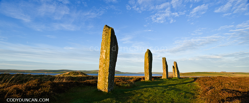
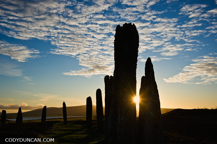
Ring of Brodgar, Orkney, Scotland, stock image

Winter dawn at Ring of Brodgar, Orkney, Scotland.

In December, the sun has little strength to rise very far above the horizon this far in the north.  The winter days are short and the nights long, only to be reversed in a few months during the endless days of summer.  Such a contrast of light at dark that I never knew growing up at a more mild latitude.  No wonder that the sun played such an important role in the lives of the ancient peoples of this barren land.

It is always a strange feeling for me to walk amongst something so old.  To think that these stones have seen some 5,000 winters, and will probably see another 5,000 more;  it helps to put things in perspective about the importance of our ‘achievements.’
Share:

  • Click to share on X (Opens in new window) X
  • Click to share on Facebook (Opens in new window) Facebook
  • Click to share on Reddit (Opens in new window) Reddit
  • Click to email a link to a friend (Opens in new window) Email
https://www.codyduncan.com/blogimages/2013/07/codyduncan-logo.png 0 0 Cody https://www.codyduncan.com/blogimages/2013/07/codyduncan-logo.png Cody2010-04-19 18:59:112010-04-22 11:45:19Ring of Brodgar – Orkney

Elgol – Isle of Skye

April 17, 2010/1 Comment/in Landscape, Mostly Photos, Mountains, Scotland/by Cody

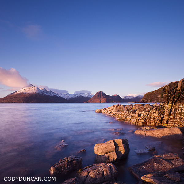
Travel stock image: Rocky coast at Elgol with Cuillins in background, Isle of Skye, Scotland

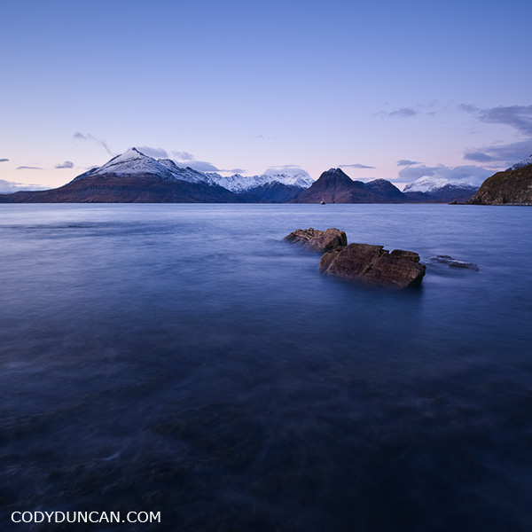
The rugged and rocky coastline at at Elgol with it’s view back towards the mighty Black Cuillins as they rise from Lock Scavaig is one of the more iconic photo locations on the Isle of Skye.  As long as one is willing to gamble on good weather, it is well worth the long drive down the winding single lane road.

Snow covered peak on the left is Gars-Bheinn at the start of the famous Cuillin ridge.  Sgurr na Stri is the lower, snowless peak towards the center.  To the left of that sits Loch Coruisk, another marvelously scenic, and isolated, place and Skye.  There is a nice hiking route that starts in the north at Sligachan and passes by loch Coruisk and then around the coast under Sgurr na Stri to Camasunary and eventually finishing here at Elgol.

One of my stupider moments in life happened along the coast under Sgurr na Stri.  It had just finished raining ( = slippery rocks), I was trying to eat a piece of chocolate while at the same time messing with my camera to take a picture of Bla Bheinn rising above the Camasunary bothy.  Well, I slipped and ended up upside down; nothing bad, just a little ‘oops’ moment.  Not wanting to drop my camera on the muddy ground, I couldn’t use my hands to get myself up.  And not wanting to drop the piece of chocolate in my mouth that I had been munching on, I couldn’t talk clearly enough to ask my friend to pull on my backpack to help me up.  So was upside down with my backpack on top of me and unable to move.  Totally stuck, but only because I didn’t want to drop my camera or chocolate.  Finally my friend came to the rescue after a moment of wondering if I was practicing some new form of mountain yoga.  Luckily there was only two of us to witness this event.

Landscape stock photography - Elgol and Black Cuillin, Isle of Skye, Scotland

Share:

  • Click to share on X (Opens in new window) X
  • Click to share on Facebook (Opens in new window) Facebook
  • Click to share on Reddit (Opens in new window) Reddit
  • Click to email a link to a friend (Opens in new window) Email
https://www.codyduncan.com/blogimages/2013/07/codyduncan-logo.png 0 0 Cody https://www.codyduncan.com/blogimages/2013/07/codyduncan-logo.png Cody2010-04-17 12:43:232010-04-17 17:16:24Elgol – Isle of Skye

Salton Sea

March 22, 2010/0 Comments/in California, Landscape, Mostly Photos, Travel/by Cody

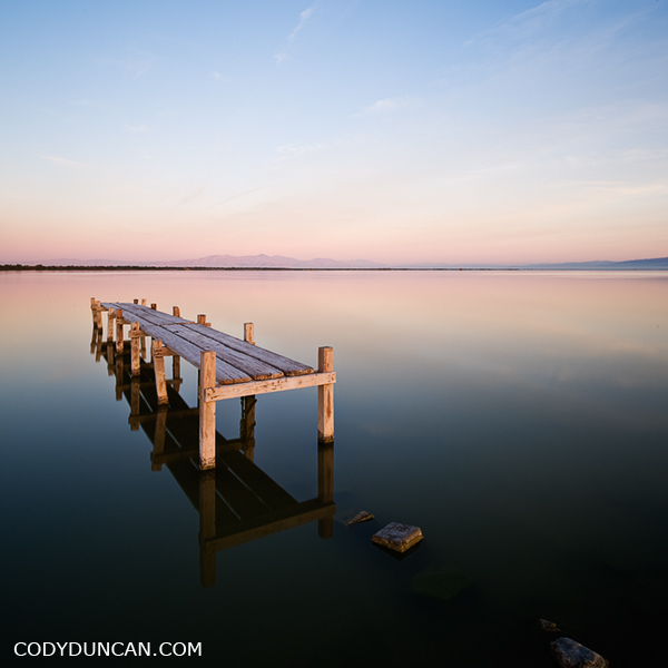
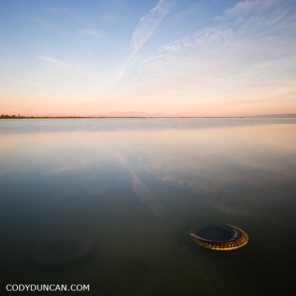
photo of old dock in water, Salton Sea, California

I was amazed out how far the water has dropped in the 5 years since I was last at the Salton Sea.  I drove to this location in the darkness of morning, remembering it to be a cool place that I last visited when I was shooting B&W film on a Hasselblad and spending hours and hour in a darkroom instead of hours and hours on a computer as I do now.  How things have changed.  There used to be cool set of the old docks that were on the edge of the water.  Now they are landlocked hundreds of feet from the current shore of the sea.  I also remember this little dock in the picture above could only be accessed by wading through knee deep water.  Now one can drive to only a few feet away.  Change is constant.

Salton Sea sunrise, California

Share:

  • Click to share on X (Opens in new window) X
  • Click to share on Facebook (Opens in new window) Facebook
  • Click to share on Reddit (Opens in new window) Reddit
  • Click to email a link to a friend (Opens in new window) Email
https://www.codyduncan.com/blogimages/2013/07/codyduncan-logo.png 0 0 Cody https://www.codyduncan.com/blogimages/2013/07/codyduncan-logo.png Cody2010-03-22 09:38:352010-03-22 09:38:35Salton Sea

Badwater Dawn – Death Valley

March 15, 2010/2 Comments/in California, Landscape, Mostly Photos, Travel/by Cody

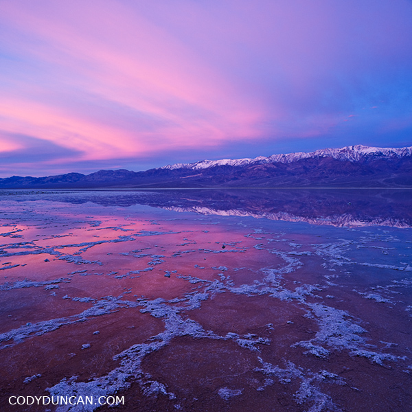
Badwater basin, Death Valley national park, Californai

Winter sunrise over Badwater basin and Panamint mountains, Death Valley national park, California.

This light lasted 3 minutes before the color faded into a washed out and overcast day.  At 6am I counted 19 other photographers within sight.  Quite the popular place to be on that morning.  The next morning however, I only saw 3 other photographers.  Though it was raining so maybe that scared all the others away…

Share:

  • Click to share on X (Opens in new window) X
  • Click to share on Facebook (Opens in new window) Facebook
  • Click to share on Reddit (Opens in new window) Reddit
  • Click to email a link to a friend (Opens in new window) Email
https://www.codyduncan.com/blogimages/2013/07/codyduncan-logo.png 0 0 Cody https://www.codyduncan.com/blogimages/2013/07/codyduncan-logo.png Cody2010-03-15 09:00:522010-03-15 09:17:51Badwater Dawn – Death Valley

Alabama Hills – California

March 14, 2010/0 Comments/in California, Landscape, Mostly Photos, Mountains, Panoramics/by Cody

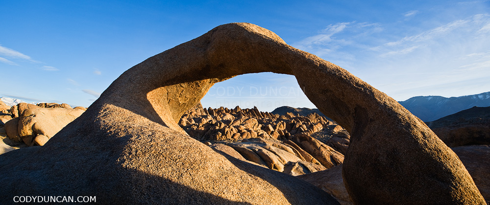
Mobius arch at Alabama Hills, near Lone Pine, California

Mobius arch, Alabama Hills, Owen’s Valley, California

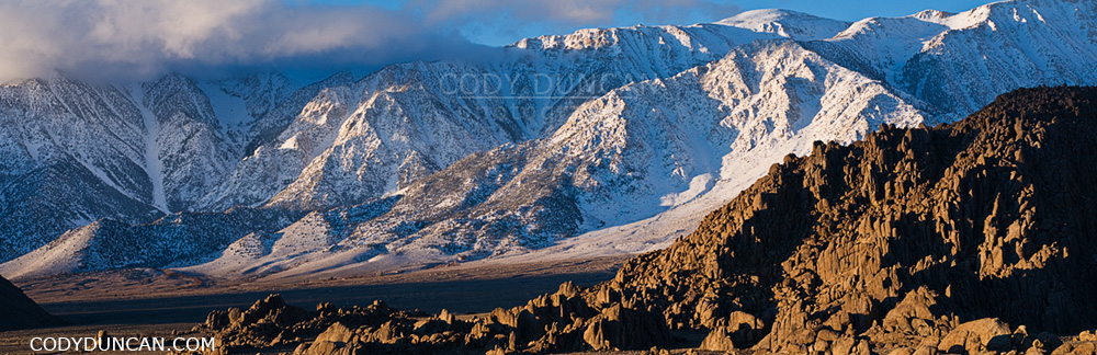
I think one of the coolest things about the Alabama Hills is that no matter how many times one has been there, there is always something new to photograph.  Be it exploring some new area, different weather, or different time of year. The hills and mountains are always changing.  One of the reasons it is one of my favorite places to go.

Granite rock formations of Alabama Hills with Lone Pine peak and Sierra Nevada mountains in background, California

Granite rock formations of Alabama Hills Sierra Nevada mountains in background, California

Share:

  • Click to share on X (Opens in new window) X
  • Click to share on Facebook (Opens in new window) Facebook
  • Click to share on Reddit (Opens in new window) Reddit
  • Click to email a link to a friend (Opens in new window) Email
https://www.codyduncan.com/blogimages/2013/07/codyduncan-logo.png 0 0 Cody https://www.codyduncan.com/blogimages/2013/07/codyduncan-logo.png Cody2010-03-14 20:39:592010-03-14 20:39:59Alabama Hills – California

Lone Pine Peak

March 11, 2010/0 Comments/in California, Landscape, Mostly Photos, Mountains, Panoramics/by Cody

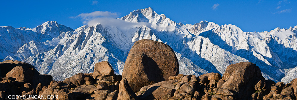
Lone Pine peak and Sierra Nevada mountains panoramic image

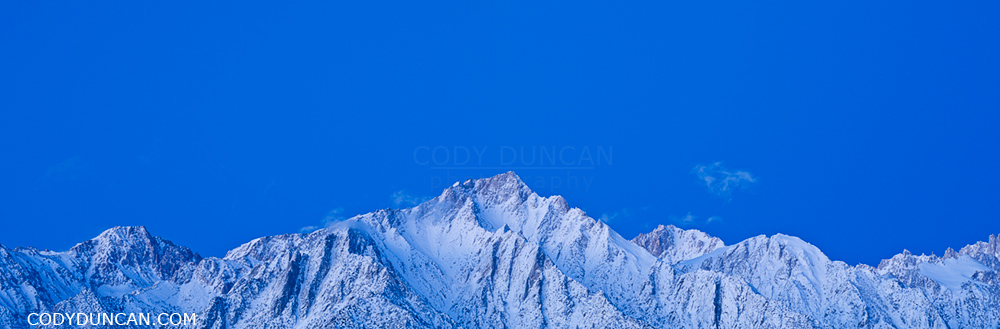
Lone Pine peak in dawn light, Sierra Nevada Mountains, California.

Share:

  • Click to share on X (Opens in new window) X
  • Click to share on Facebook (Opens in new window) Facebook
  • Click to share on Reddit (Opens in new window) Reddit
  • Click to email a link to a friend (Opens in new window) Email
https://www.codyduncan.com/blogimages/2013/07/codyduncan-logo.png 0 0 Cody https://www.codyduncan.com/blogimages/2013/07/codyduncan-logo.png Cody2010-03-11 11:33:312010-03-11 11:33:31Lone Pine Peak

Mount Whitney Sunrise

March 9, 2010/0 Comments/in California, Landscape, Mostly Photos, Mountains, Panoramics/by Cody

Mt. Whitney and Sierra Nevada mountains, California panoramic landscape photo

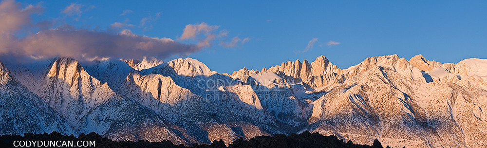
Winter sunrise over mount Whitney and the Sierra Nevada mountains as seen from the Alabama Hills, California.

This is a location that is better photographed in winter/early spring.  Besides it not being 110˚ F as it can be in summer.  The main reason is that the winter sun rises further towards the south, which creates better patterns of shadow and light on the mountain ridges than occur in summer.  And then there’s always something nice about the day’s first light on freshly fallen snow.  I find in summer this scene can also appear slightly ‘tired’ and dry, for lack of a better description.

Share:

  • Click to share on X (Opens in new window) X
  • Click to share on Facebook (Opens in new window) Facebook
  • Click to share on Reddit (Opens in new window) Reddit
  • Click to email a link to a friend (Opens in new window) Email
https://www.codyduncan.com/blogimages/2013/07/codyduncan-logo.png 0 0 Cody https://www.codyduncan.com/blogimages/2013/07/codyduncan-logo.png Cody2010-03-09 13:41:072010-03-09 13:41:07Mount Whitney Sunrise

Racetrack Playa – Death Valley

March 8, 2010/0 Comments/in California, Landscape, Mostly Photos, Panoramics, Travel/by Cody

rare winter water fill dry lakebed of devils racetrack playa - death valley, california

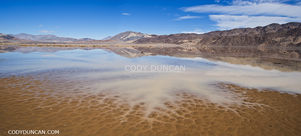
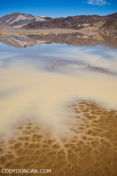
Winter rains flood the playa at the southern end of the Devil’s Racetrack, Death Valley, California.  February 25-25, 2010

Prior to this recent trip I’d only twice been to Death Valley national park.  And on those two previous trips I was only in the ‘valley’ itself and not any of the more wild areas only accessible by dirt roads.  Based upon my prior trips, I had a total lack of understanding of the true size of the park, which in fact the largest US national park outside of Alaska.  Somehow looking at distance numbers on a map, 17 miles here, 27 miles there, doesn’t always properly translate to the true length of the journey.  Especially when it is on some of the most bone jarring, bolt loosening, tire shredding, knocking-cooler-over-and-spilling-water-all-over-my-bed, wash-boarded dirt roads I have ever driven.  You know the roads, the ones that are so full of stutter bumps that you have two choices:  Drive 5mph and arrive sometime in the next millennium or drive 50mph to ‘skim’ over the bumps while totally destroying your tires.   I really don’t know what is worse those though.  Being subjected to endless bumps for hours on end, but knowing that it’s not as bad as it feels and you should eventually arrive.  As opposed to just going for it to get it over with in a shorter amount of time with the constant clatter of rocks flying loose inside the wheel wells and then just holding your breath as you see some large washout appear that there is no way to slowdown for.   So driving nearly 70 miles of this in one day from the Eureka dunes in the far north of the park down to the Racetrack playa was a long day that I don’t look forward to repeating anytime soon, or at least not with my truck.  If someone else wants to drive, I’d be happy go along.

rare winter water fill dry lakebed of devils racetrack playa - death valley, california. February 2010

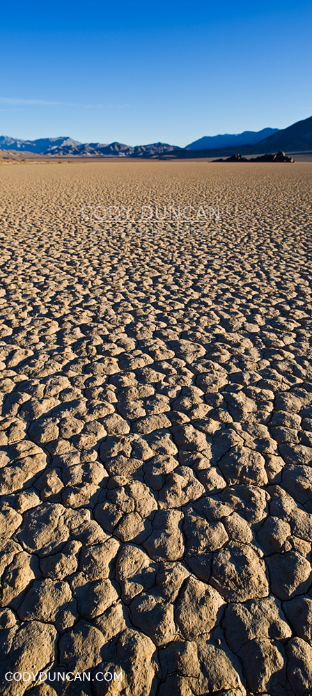
Normally the lake bed playa is totally bone dry, but some years in winter, a small lake will appear towards the southern end.  This is also the location of the moving rocks for which the Racetrack is most famous for.  Unfortunately the water and mud meant I couldn’t get near them, so I guess I do have to go back again.  Though I think it was interesting to see this somewhat rare event.

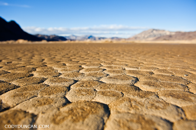
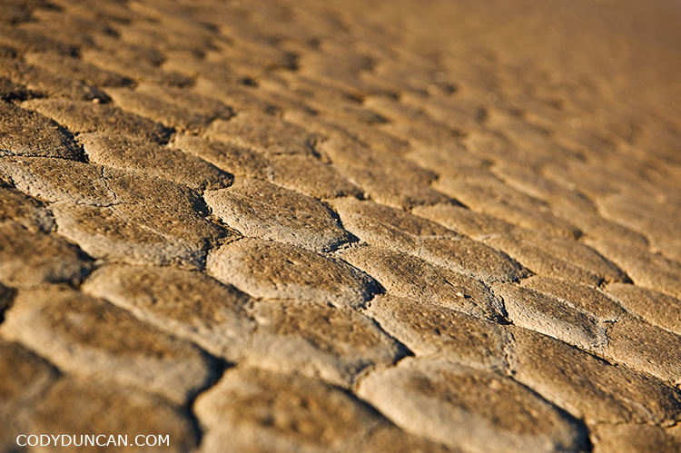
Dry mud patterns in devils racetrack playa dry lakebed, death valley, California

landscape photography, devils racetrack playa, death valley, california

Dry mud patterns in devils racetrack playa dry lakebed, death valley, California

travel and landscape photographer Cody Duncan stands on dry lake bed at Racetrack playa, Death Valley, California

Share:

  • Click to share on X (Opens in new window) X
  • Click to share on Facebook (Opens in new window) Facebook
  • Click to share on Reddit (Opens in new window) Reddit
  • Click to email a link to a friend (Opens in new window) Email
https://www.codyduncan.com/blogimages/2013/07/codyduncan-logo.png 0 0 Cody https://www.codyduncan.com/blogimages/2013/07/codyduncan-logo.png Cody2010-03-08 15:26:262010-03-08 15:30:41Racetrack Playa – Death Valley

Lofoten Islands Winter Photo Gallery

March 7, 2010/0 Comments/in Landscape, Lofoten Islands, Mostly Photos, Mountains, Norway, Stock Photography, Travel/by Cody

Lofoten islands winter photo gallery: click here.

In early January I traveled north into the Norwegian arctic in search of the polar night.  At 68 degrees north, I was unfortunately too low and too late for a true polar night, finding only the ‘polar twilight.’  Twilight would begin around 9:30 AM and last until around 3:00, all other hours of the day I would consider to be night and stars were visible.  It was actually far brighter than I was expecting when the sky was clear, the day being essentially a 4 hour long sunrise/sunset all merged into one before the night’s darkness arrived again.  Needless to say, I got a lot of reading done.

Since there are no tourists to the islands at this time of year and no hostels are open I was left to sleep in my (tiny) rental car as best as I could.  Which wasn’t very good.  Only having a 0˚ C sleeping bag and temps down to -7-8˚ C ensured for some cold nights.  I felt like some contortionist trying to fit inside the car to sleep.  I could fold the back seats down, but there was no possible way for me to get even somewhat comfortable.  Better than an airplane seat, yes, but the cold and my lack of a proper sleeping bag would mean that if I didn’t maintain good blood flow to my feet, they would become super cold.  On one of the nights it snowed so much that I could hardly get out of my parking area in the morning.  Only twice did I get the car stuck in the snow.  Once having to track down some dude in a tractor and ask him for a tow.  His comment, “You’re not the first one today.”  Second time a car full of the young guys came along after about an hour and helped push the car out.  I tried to be more cautious after that but still managed a few close calls.

I was fortunate enough for one day of good weather.  The remaining days I would classify a somewhere between bad and ‘I wish I had a warm house to sit in and some decent food to eat and not be stuck in this freezing car being rocked about by the wind and buried under snow.’

Å I lofoten, Lofoten islands, Norway. Winter travel photography

Share:

  • Click to share on X (Opens in new window) X
  • Click to share on Facebook (Opens in new window) Facebook
  • Click to share on Reddit (Opens in new window) Reddit
  • Click to email a link to a friend (Opens in new window) Email
https://www.codyduncan.com/blogimages/2013/07/codyduncan-logo.png 0 0 Cody https://www.codyduncan.com/blogimages/2013/07/codyduncan-logo.png Cody2010-03-07 12:55:072010-08-27 12:34:28Lofoten Islands Winter Photo Gallery

Footprints Everywhere! Wanderings Among the Mesquite Flat Sand Dunes – Death Valley

March 3, 2010/0 Comments/in California, Landscape, Mostly Photos, Panoramics, Travel/by Cody

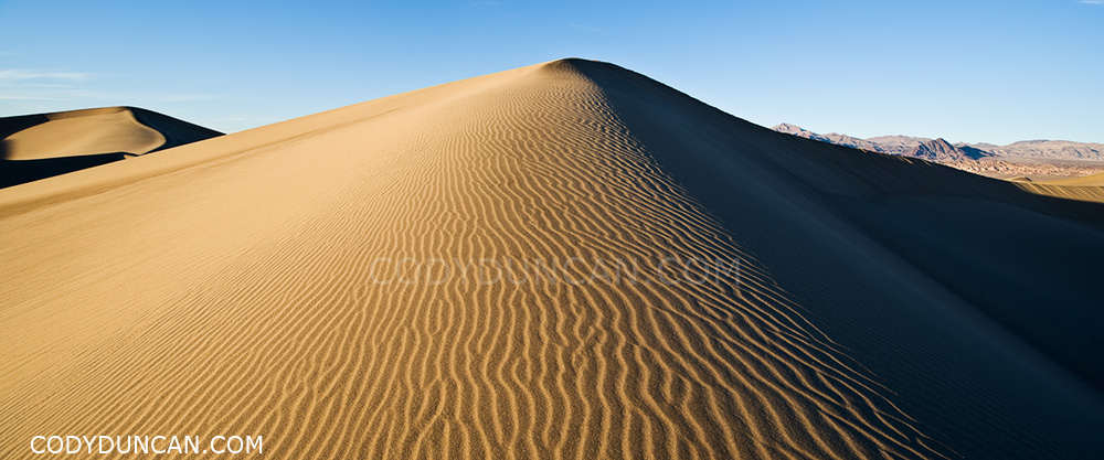
Panoramic landscape photo - Mesquite flat sand dunes, Death Valley, California

Mesquite Flat sand dunes, Death Valley national park, California.

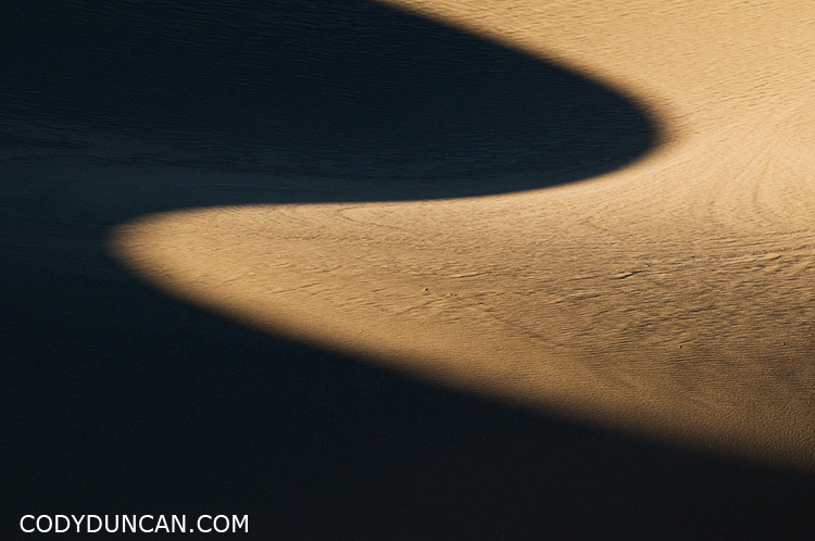
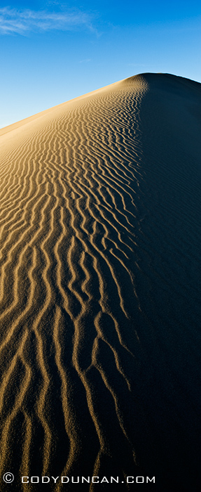
It was a frustrating exercise in futility wandering among the dunes, in search of the Dune that I had in my mind.  The Dune with that perfectly sculpted ridge, gently rounded and allowing the late afternoon shadows to gently fall across.  The untouched patterns of a thousand years of wind blown into the sand, like a sea of snakes racing into the distance.  The Dune, rising alone into the sky above all others, casting ever growing shadows as the sun determines the day has been long enough.

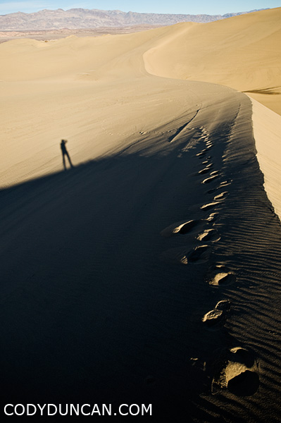
Judging by the amount of footprints, half the world must also be searching for that perfect dune.  I wandered for miles and hours.  In straight lines, circles, and zigzags.  To the tops of the highest dunes and into the lowest valleys.  North, south, east, west, and at one point, clear across the whole of the dunes.  My water bottle empty, mouth dry, I still wandered.  And everywhere, footprints!

It’s mostly my fault though.  The Mesquite dunes are right on the side of the road in a fairly popular national park, so what should I expect other than that lots of people walk among them. If  I was in some middle of nowhere place in north Africa and experienced the same, then I would be a bit more frustrated.  And winter is the best time in Death Valley as the temperatures are tolerable.  This year especially, with higher than average rain has probably drawn more people to the park to see the normally dry lakes not dry.

California landscape photography - Mesquite flat sand dunes, Death Valley national park

Panoramic landscape photo - Mesquite flat sand dunes, Death Valley, California

California travel photographer Cody Duncan - Self portrait on sand dunes in Death Valley

Share:

  • Click to share on X (Opens in new window) X
  • Click to share on Facebook (Opens in new window) Facebook
  • Click to share on Reddit (Opens in new window) Reddit
  • Click to email a link to a friend (Opens in new window) Email
https://www.codyduncan.com/blogimages/2013/07/codyduncan-logo.png 0 0 Cody https://www.codyduncan.com/blogimages/2013/07/codyduncan-logo.png Cody2010-03-03 08:30:482010-03-02 10:14:31Footprints Everywhere! Wanderings Among the Mesquite Flat Sand Dunes – Death Valley
Page 22 of 41«‹2021222324›»
X Logo X Logo Followon X RSS Feed Logo RSS Feed Logo Subscribeto RSS Feed

Seasons On Lofoten Summer eBook

Seasons On Lofoten Winter eBook

Seasons On Lofoten: Winter

Recent Posts

  • New eBook | Lofoten Islands – Northern Light
  • Padjelantaleden eBook update
  • Ebook update – West Lofoten Hikes 4th Edition
  • New Ebook – Padjelantaleden Hiking Guide
  • Kungsleden South ebook update – 2nd edition – Kvikkjokk to Hemavan

Recent Comments

  • Gerry on rincon dawn
  • Kim on Schmitsch – Smicz
  • Jamie on Hindera Family Origins in Schmitsch, Silesia – Smicz, Poland
  • Patty Regan-Macrina on Schmitsch – Smicz
  • Dušan on Hiking Sweden’s Kungsleden Trail In Autumn

Categories

  • Austria
  • Baja
  • Baltic
  • British Columbia
  • Budapest
  • California
  • Caving
  • China
  • Cities
  • Climbing
  • Colorado
  • Czech Republic
  • Festivals
  • Food
  • France
  • Germany
  • Greenland
  • hiking
  • Historic Places
  • In Print
  • Ireland
  • Italy
  • Japan
  • Lake Powell
  • Landscape
  • Lithuania
  • Lofoten Islands
  • Moorea
  • Mostly Photos
  • Mountains
  • New Zealand
  • Night
  • none
  • Norway
  • Oregon
  • Panoramics
  • Photo Tours
  • Photo Workshops
  • Poland
  • Racing
  • Random stuff
  • Santa Barbara
  • Scotland
  • Stock Photography
  • surfing
  • Sweden
  • Switzerland
  • Timelapse
  • Tips and Tricks
  • Travel
  • Updates
  • Video
  • Wales
  • Washington
  • wildlife

Archives

  • December 2022
  • May 2022
  • July 2020
  • November 2019
  • May 2019
  • April 2018
  • January 2018
  • February 2017
  • January 2017
  • December 2016
  • November 2016
  • October 2016
  • September 2016
  • August 2016
  • May 2016
  • January 2016
  • December 2015
  • November 2015
  • October 2015
  • August 2015
  • July 2015
  • June 2015
  • April 2015
  • January 2015
  • December 2014
  • October 2014
  • September 2014
  • August 2014
  • July 2014
  • June 2014
  • May 2014
  • April 2014
  • March 2014
  • February 2014
  • January 2014
  • December 2013
  • November 2013
  • August 2013
  • July 2013
  • June 2013
  • May 2013
  • April 2013
  • March 2013
  • February 2013
  • January 2013
  • December 2012
  • November 2012
  • October 2012
  • September 2012
  • August 2012
  • July 2012
  • June 2012
  • May 2012
  • April 2012
  • March 2012
  • February 2012
  • January 2012
  • December 2011
  • September 2011
  • August 2011
  • July 2011
  • June 2011
  • May 2011
  • April 2011
  • March 2011
  • February 2011
  • January 2011
  • December 2010
  • November 2010
  • October 2010
  • September 2010
  • August 2010
  • July 2010
  • June 2010
  • May 2010
  • April 2010
  • March 2010
  • February 2010
  • January 2010
  • December 2009
  • November 2009
  • October 2009
  • September 2009
  • August 2009
  • July 2009
  • June 2009
  • May 2009
  • April 2009
  • March 2009
  • February 2009
  • January 2009
  • December 2008
  • November 2008
  • October 2008
  • September 2008
  • August 2008
  • July 2008
  • June 2008
  • May 2008
  • April 2008
  • March 2008
  • February 2008
  • January 2008
  • December 2007
  • November 2007
  • October 2007
  • September 2007
  • August 2007
  • July 2007
  • June 2007
  • May 2007
  • April 2007
  • March 2007
  • February 2007
  • January 2007
  • December 2006
  • November 2006
  • October 2006
  • August 2006
  • July 2006
  • June 2006
  • May 2006
  • April 2006
  • March 2006
  • February 2006
  • January 2006
  • December 2005
  • November 2005
  • October 2005

Stock Image Search

Enter Keyword(s), Subject(s) or Location(s) to search stock photo archive

New on the Blog

  • New eBook | Lofoten Islands – Northern Light December 8, 2022
  • Padjelantaleden eBook update December 5, 2022
  • Ebook update – West Lofoten Hikes 4th Edition May 21, 2022
X Logo X Logo Followon X RSS Feed Logo RSS Feed Logo Subscribeto RSS Feed

Seasons On Lofoten Winter eBook

Seasons On Lofoten Winter - 4th edition

Kungsleden Trail eBook

Kungsleden Trail Hiking Guide

Kungsleden Trail Hiking Guide

Website Search

Search Search

Stock Image Seach

Enter Keyword(s), Subject(s) or Location(s) to search stock photo archive
Scroll to top Scroll to top Scroll to top

This site uses cookies. By continuing to browse the site, you are agreeing to our use of cookies.

OKLearn more

Cookie and Privacy Settings


How we use cookies

We may request cookies to be set on your device. We use cookies to let us know when you visit our websites, how you interact with us, to enrich your user experience, and to customize your relationship with our website.

Click on the different category headings to find out more. You can also change some of your preferences. Note that blocking some types of cookies may impact your experience on our websites and the services we are able to offer.

Essential Website Cookies

These cookies are strictly necessary to provide you with services available through our website and to use some of its features.

Because these cookies are strictly necessary to deliver the website, refusing them will have impact how our site functions. You always can block or delete cookies by changing your browser settings and force blocking all cookies on this website. But this will always prompt you to accept/refuse cookies when revisiting our site.

We fully respect if you want to refuse cookies but to avoid asking you again and again kindly allow us to store a cookie for that. You are free to opt out any time or opt in for other cookies to get a better experience. If you refuse cookies we will remove all set cookies in our domain.

We provide you with a list of stored cookies on your computer in our domain so you can check what we stored. Due to security reasons we are not able to show or modify cookies from other domains. You can check these in your browser security settings.

Google Analytics Cookies

These cookies collect information that is used either in aggregate form to help us understand how our website is being used or how effective our marketing campaigns are, or to help us customize our website and application for you in order to enhance your experience.

If you do not want that we track your visit to our site you can disable tracking in your browser here:

Other external services

We also use different external services like Google Webfonts, Google Maps, and external Video providers. Since these providers may collect personal data like your IP address we allow you to block them here. Please be aware that this might heavily reduce the functionality and appearance of our site. Changes will take effect once you reload the page.

Google Webfont Settings:

Google Map Settings:

Google reCaptcha Settings:

Vimeo and Youtube video embeds:

Other cookies

The following cookies are also needed - You can choose if you want to allow them:

Accept settingsHide notification only