• Link to X
  • Link to Facebook
  • Link to Instagram
  • Home
  • About
+47 95 44 46 62
Cody Duncan Photography
  • Portfolio
  • Ebooks
  • Motion
  • Travel
    • STORIES
      • Lofoten’s Mountains of Summer
      • Lofoten Autumn Nights
      • Lofoten Winter Journeys
      • Kungsleden Trail Sweden
      • Baltic Gold
    • GUIDES
      • Norway – Besseggen Ridge
      • Sweden – Kungsleden Trail
    • FESTIVALS
      • Germany – Pottenstein – Ewige Anbetung Fire Festival
    • GEAR
      • Backpacking Gear – 2015
  • Blog
  • Contact
  • Click to open the search input field Click to open the search input field Search
  • Menu Menu

Deep Freeze Wales Part III

December 6, 2010/3 Comments/in Landscape, Mostly Photos, Wales/by Cody

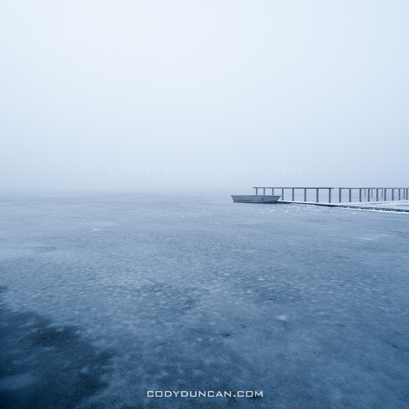
Llangorse lake winter ice december 2010

Photo: Row boat frozen in ice on Llangorse lake, Brecon Beacons national park, Wales. December 2010

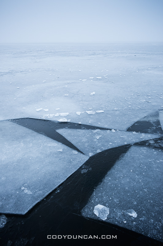
Woke up early this morning to watch the fog at Llangorse lake.  Well, it wasn’t the plan to watch the fog, but that’s about all I was able to see.  I was here yesterday evening, but an unfortunate accident – me breaking through the ice and plunging my leg into some frozen pond – meant I had to go home an warm up instead of waiting for twilight to arrive.  Today, fog.   The temp was only -5º C at 6am, but today is feeling really cold for some reason, even now at noon when it’s only -2º C. I’ll have to wait a few more days before I can head back and try to get the Photos I was looking for.

Llangorse lake winter ice december 2010

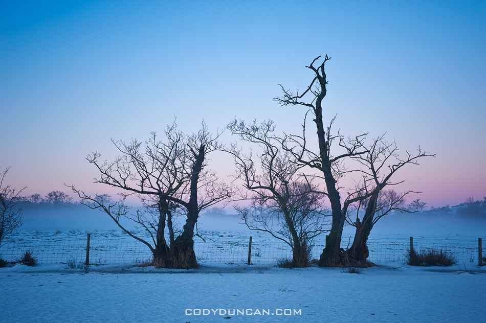
Wales winter landscape

Photo: Ground fog over frozen farm field in winter twilight, Llangorse lake, Brecon Beacons national park, Wales.

Share:

  • Click to share on X (Opens in new window) X
  • Click to share on Facebook (Opens in new window) Facebook
  • Click to share on Reddit (Opens in new window) Reddit
  • Click to email a link to a friend (Opens in new window) Email
https://www.codyduncan.com/blogimages/2013/07/codyduncan-logo.png 0 0 Cody https://www.codyduncan.com/blogimages/2013/07/codyduncan-logo.png Cody2010-12-06 13:34:572010-12-06 13:34:57Deep Freeze Wales Part III

Deep Freeze Wales Part II

December 2, 2010/0 Comments/in Landscape, Mostly Photos, Mountains, Panoramics, Wales/by Cody

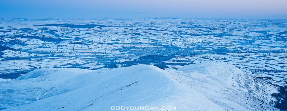
Brecon Beacons Wales snow november 2010

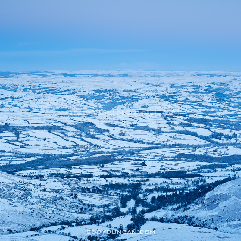
Photo: Frozen Welsh landscape from summit of Pen Y Fan, Brecon Beacons national park, Wales. November 28, 2010

A few more photos from Pen Y Fan and the Brecon Beacons on Sunday.  The last few days have seen the temperature rise to around 0º C with several more snowfalls, but nothing like last week.  Still a very wintry landscape and since they don’t use snow tires (or should I say tyres) here in the UK, they tend to drive like Californians do when it rains; not very well.  Here in the countryside many of the roads don’t get cleared from snow, so it can be a bit difficult to get around.  Almost got stuck up in the mountains on Tuesday on the way back from checking out the waterfalls at Ystradfellte to see if they’ve begun to ice up at all.

Brecon Beacons Wales snow november 2010

Brecon Beacons plane crash november 2010

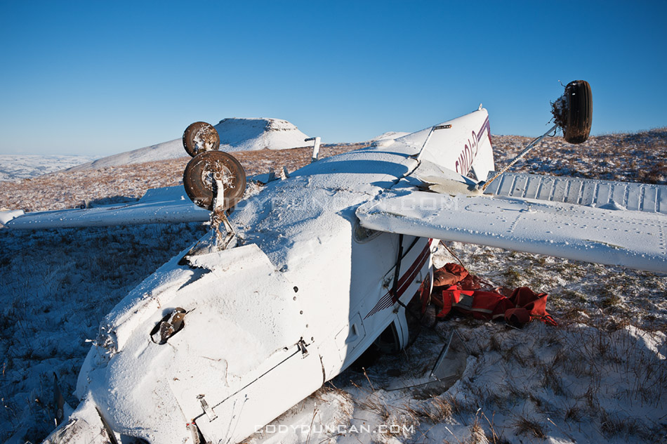
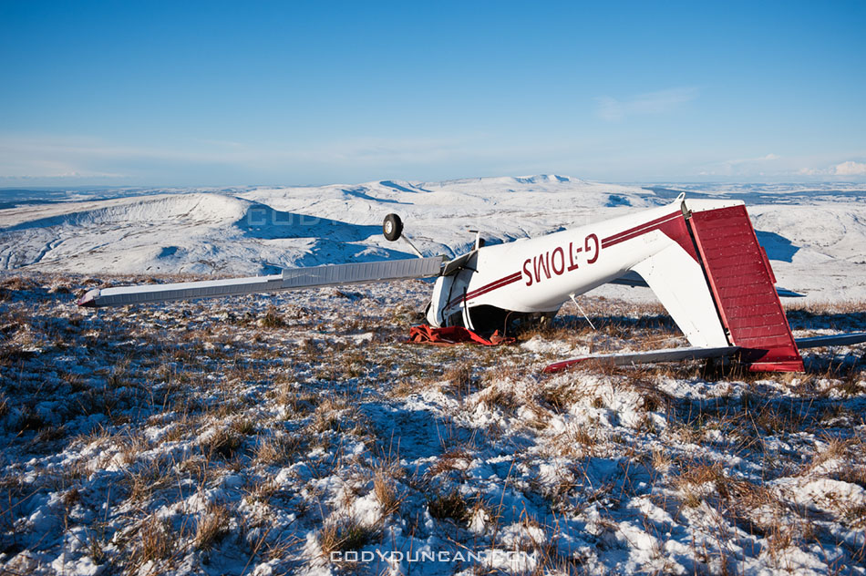
Photo: Small plane crash in Brecon Beacons near Pen Y Fan

On Friday this plane crashed up on the ridge near Pen Y Fan.  Looks bad but apparently the pilot was able to crawl out and walk away.  Pretty amazing.

Brecon Beacons plane crash november 2010

Share:

  • Click to share on X (Opens in new window) X
  • Click to share on Facebook (Opens in new window) Facebook
  • Click to share on Reddit (Opens in new window) Reddit
  • Click to email a link to a friend (Opens in new window) Email
https://www.codyduncan.com/blogimages/2013/07/codyduncan-logo.png 0 0 Cody https://www.codyduncan.com/blogimages/2013/07/codyduncan-logo.png Cody2010-12-02 17:40:452010-12-02 17:40:45Deep Freeze Wales Part II

Deep Freeze Wales

December 1, 2010/0 Comments/in hiking, Landscape, Mostly Photos, Mountains, Panoramics, Wales/by Cody

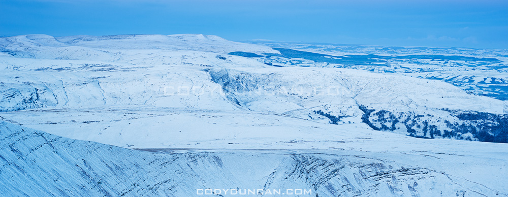
Winter view from Pen Y Fan over a frozen Welsh Landscape, Brecon Beacons national park, Wales

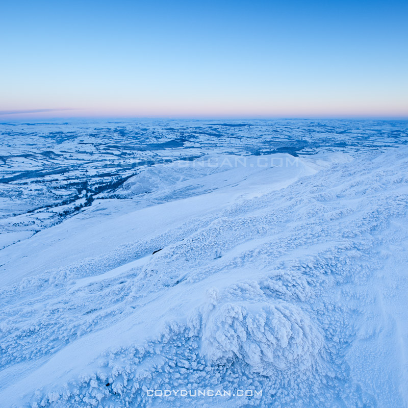
Photo: Dawn view from Pen Y Fan over a frozen Welsh landscape in record setting cold temperatures Sunday, November 28 2010

The Russians have been kind enough to send an express delivery of Siberian wind from the east to the UK.  The results sent temperatures plummeting and brought the earliest widespread winter storms since 1993.  Saturday night saw Wales with the coldest temperature in the UK at -17 degrees Celsius, somewhere towards the left horizon of the above photo, about 20 miles north from Pen Y Fan. However I didn’t know any of this when I thought I would head to the hills for sunrise on Sunday.  All I knew was that clear weather was forecast and hoped for a good sunrise.

So instead of taking shelter in a warm house, I set the alarm for 4:45 am; intent on heading up Pen Y Fan for sunrise.  Waking in the darkness of early Sunday morning I checked the outdoor thermometer, -11.5.  Hmm, better take another jacket today.  I hit the trail a little after 6 am, the dawn glow barely visible above the mountains in the east.  It was eerily silent as I walked through the dark and frozen world, the crunching of snow beneath my feet the only sound.  The wind arrived once I hit the ridge and was exposed to the east.  Brutally cold, and a shock for November in what should normally be the mild weathered UK.  A low bank of clouds in the southeast blocked most the color of the sunrise unfortunately, but the views were still amazing and the air amazingly clear.

Winter view from summit of Pen Y Fan towards Black Mountains in west, Brecon Beacons national park, Wales

Photo: View from Pen Y Fan across Brecon Beacons national park towards the Black Mountains in the west

Brecon beacons november UK snow

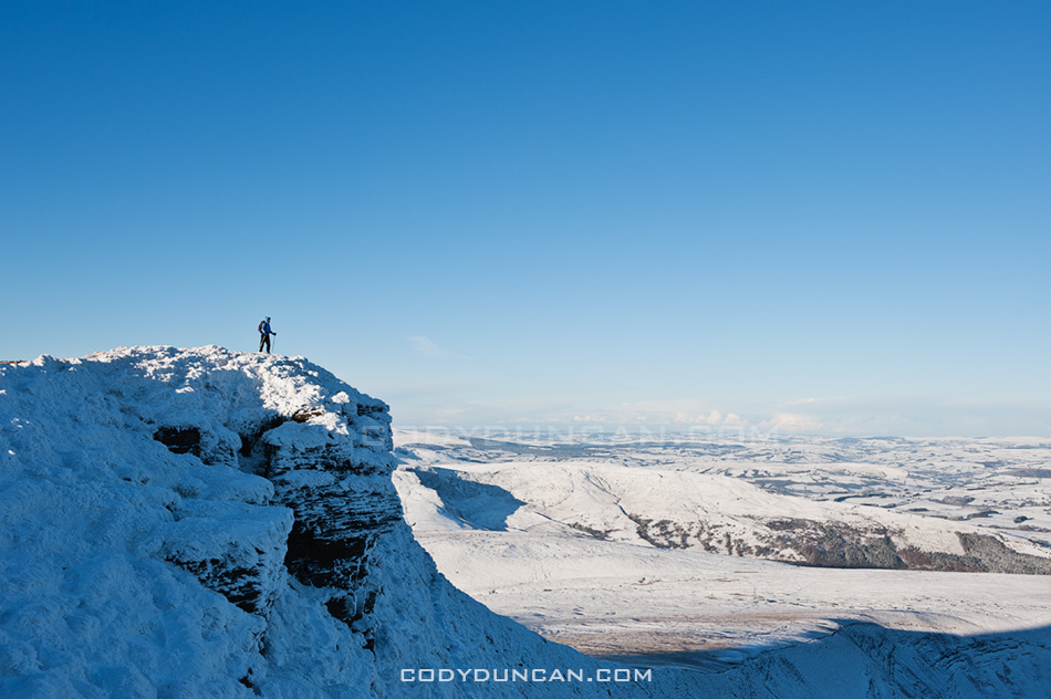
Photo: Hiker on summit of Corn Du overlooking a frozen landscape

Share:

  • Click to share on X (Opens in new window) X
  • Click to share on Facebook (Opens in new window) Facebook
  • Click to share on Reddit (Opens in new window) Reddit
  • Click to email a link to a friend (Opens in new window) Email
https://www.codyduncan.com/blogimages/2013/07/codyduncan-logo.png 0 0 Cody https://www.codyduncan.com/blogimages/2013/07/codyduncan-logo.png Cody2010-12-01 13:09:102010-12-01 13:09:10Deep Freeze Wales

Lofoten Islands Hikes – Justadtinden

November 25, 2010/1 Comment/in hiking, Landscape, Lofoten Islands, Mostly Photos, Mountains, Norway, Travel/by Cody

Justadtind lofoten islands

Photo: Justadtinden rises in the distance

Lofoten Islands Mountain Hikes: Justadtinden

Justadtinden (738 meters) is the highest peak on the eastern side of Vestvågøya.  An easy and well worn trail through a scenic mountain landscape makes reaching the summit of Justadtinden a relatively easy hike and a good first introduction to the Lofoten islands.  While the summit itself is rather flat and slightly anticlimactic, the 360º view is still something impressive.  When the sun is out and the winds are calm, I imagine this would be a nice place for a picnic on a summer afternoon.

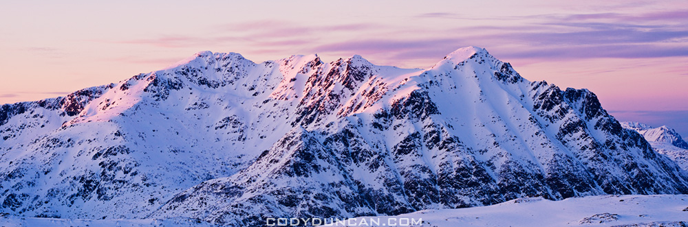
Photo: Winter view from Stamsundsheia. Justadtinden (738 meters) is flat summit on left, Kangerurtinden (704 meters) on right

Getting There

By Car: From north or south, take the E10 to Leknes.  From Leknes, take the 815 towards Stamsund.  After approximately 4km the road rises to the pass at Hagskaret (Where the large building is).  There are two parking options here on the left side of the road (before the building), one paved, one dirt.

From the parking area, take the dirt road towards the large antenna visible a couple hundred meters to the north.  Keep following the road straight.  After passing the antenna building on the right (don’t turn here), the road will soon end and turn into a hiking trail.  There are several trails that cross back and forth, keep in the general direction of the right (east).

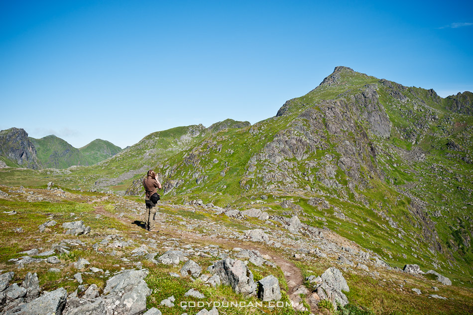
Photo: Mountain landscape near Justadtinden

The Trail
From the start of the trail, the summit of Justadtind is approximately 6km away, with 600 meters of elevation gain.  The first half of the trail gently gains elevation while wandering through low hills and ridges.  The second half of the trail gradually increases in steepness (though still quite a gentle grade) and passes through a section of rocks shortly before the summit.  The rocky outcropping that appears as the highest point in the top.

Photo: View from summit of Justadtinden towards Henningsvaer

Camping

There are numerous suitable places for a tent (mostly dry and mostly flat) along the trail, with access to water generally not too far away.  The summit itself is quite flat and large with plenty of room as well.  Depending on the wind direction, several large rocks could provide some shelter from the weather, but as always, necessary caution should be taking if wishing to camp on an exposed summit.  No water available at the top.

Useful Links

Topo map: Search ‘Justadtinden.’

View from Justadtinden, Vestvagoy, Lofoten islands, Norway

Photo: View from Justadtinden towards Himmeltindan

Lofoten islands winter

Photo: Justadtinden hidden behind Kangerurtinden in winter

Share:

  • Click to share on X (Opens in new window) X
  • Click to share on Facebook (Opens in new window) Facebook
  • Click to share on Reddit (Opens in new window) Reddit
  • Click to email a link to a friend (Opens in new window) Email
https://www.codyduncan.com/blogimages/2013/07/codyduncan-logo.png 0 0 Cody https://www.codyduncan.com/blogimages/2013/07/codyduncan-logo.png Cody2010-11-25 10:00:342010-11-24 16:07:11Lofoten Islands Hikes – Justadtinden

Western Isles Scotland Photo Gallery

November 15, 2010/0 Comments/in Landscape, Mostly Photos, Scotland, Travel/by Cody

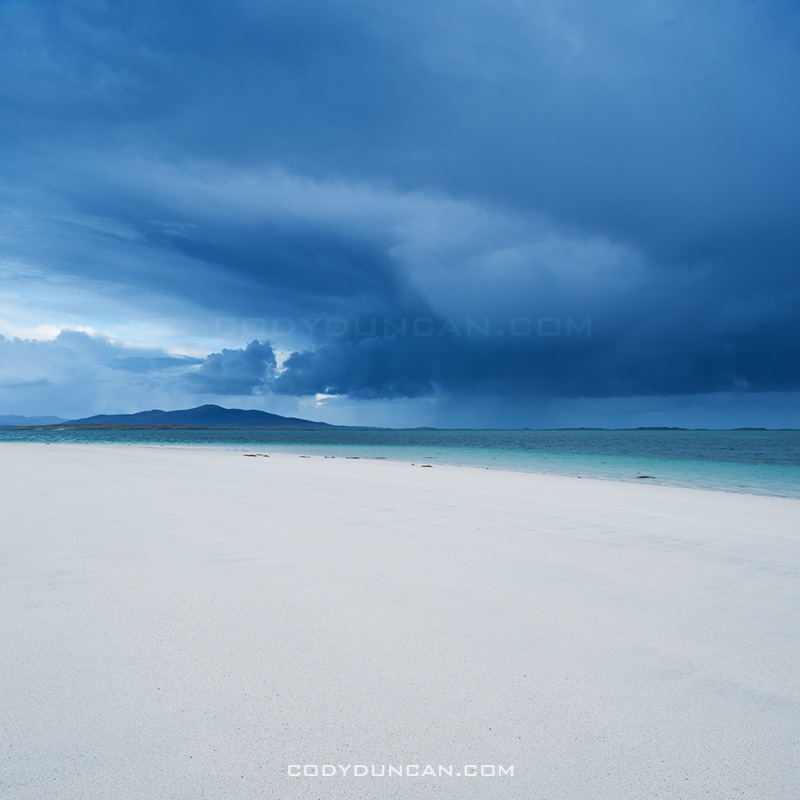
Storm over beach, Berneray, Scotland

Photo: Autumn storm passes over Sound of Harris, Berneray, Outer Hebrides, Scotland

SCOTLAND OUTER HEBRIDES PHOTO GALLERY: CLICK HERE

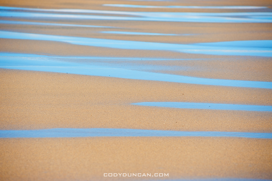
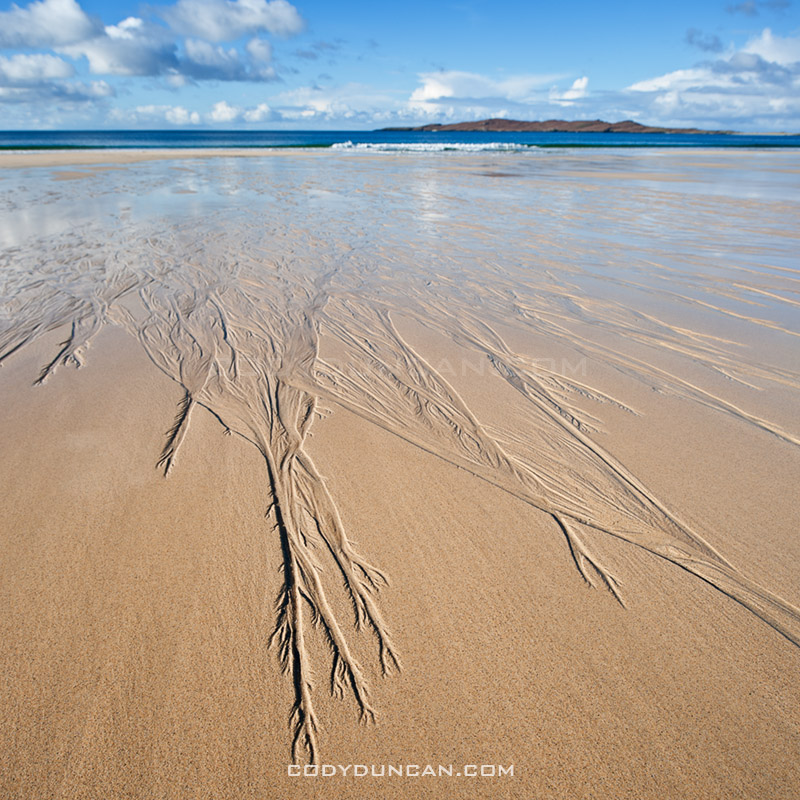
I’ve put up a image gallery from my Scottish islands trip at the end of October.  Photos from Isle of Harris, Isle of Lewis, Berneray, and North Uist.

Scenic Traigh Lar Beach, Isle of Harris

Scenic Traigh Lar Beach, Isle of Harris

Share:

  • Click to share on X (Opens in new window) X
  • Click to share on Facebook (Opens in new window) Facebook
  • Click to share on Reddit (Opens in new window) Reddit
  • Click to email a link to a friend (Opens in new window) Email
https://www.codyduncan.com/blogimages/2013/07/codyduncan-logo.png 0 0 Cody https://www.codyduncan.com/blogimages/2013/07/codyduncan-logo.png Cody2010-11-15 12:51:592010-11-15 12:51:59Western Isles Scotland Photo Gallery

Callanish Standing Stones – Isle of Lewis

November 5, 2010/2 Comments/in Historic Places, Mostly Photos, Panoramics, Scotland, Travel/by Cody

Callanish standing stones

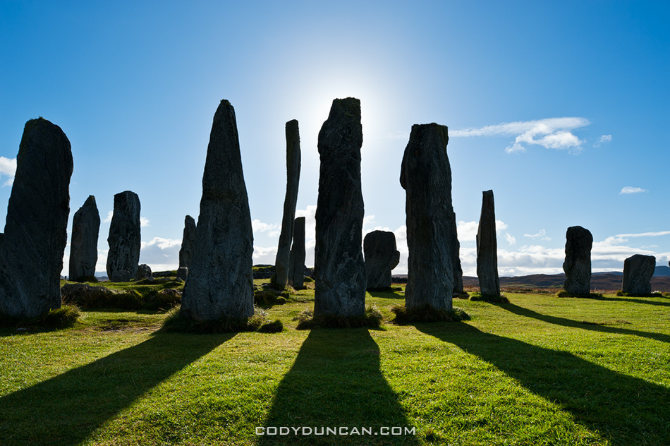
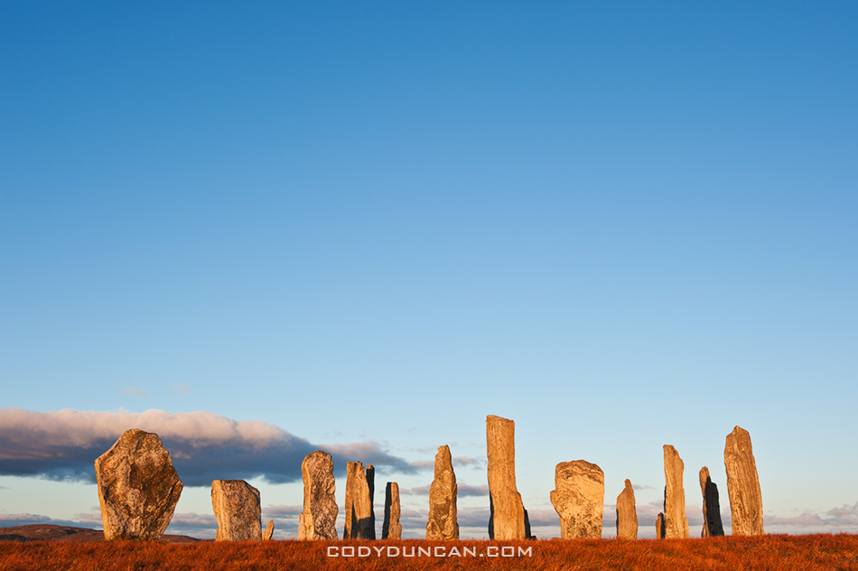
Photo: Callanish standing stones, Isle of Lewis, Outer Hebrides, Scotland

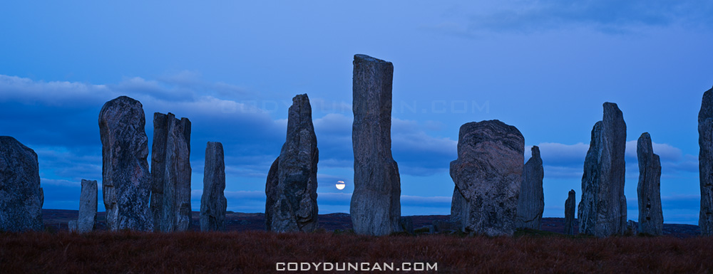
The standing stones at Callanish are one of the more important sites in Scotland.  These image are from the main stone circle, but there are also several other smaller circles within view from this location.  And although I’ve done my best to make the location look isolated, in reality there is a village and houses just a 100 meters away.  Kind of takes away a bit of the mystery of a place like this.  For me it is some ancient place out of the long forgotten past.  In my mind it would be better located off in some distant boggy moorland with nothing else around.  For the locals of the village, it’s just a place they walk their dogs through.  The other stones at Callanish are just in the middle of sheep and cow pasture.

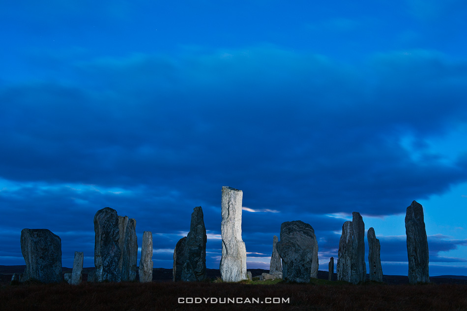
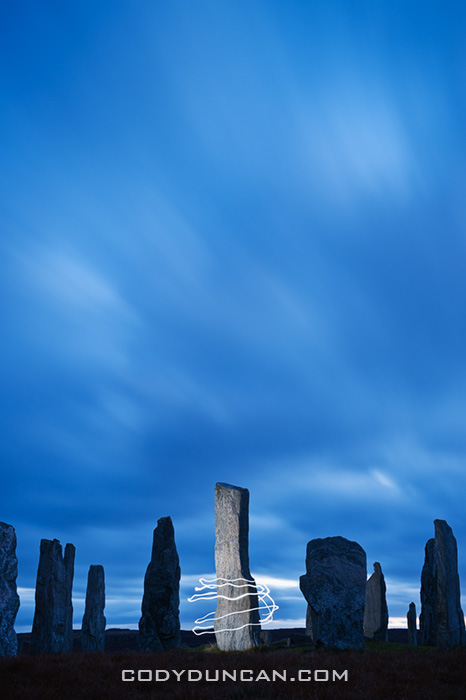
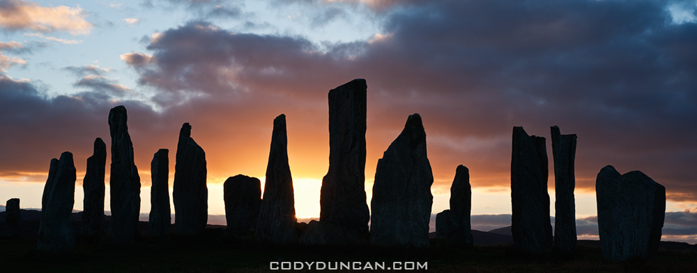
Anyhow, even though the stones have been photographed a million + times, they where still one of the locations I wanted to visit on my island trip.  I first stopped by in mid afternoon and got lucky with some blue sky and sun.  next I returned just prior to sunset and again was lucky and had about 10 minutes of sun before it disappeared behind the clouds.  I waited a bit into the night and was again lucky with the rising full moon.  I got a bit bored, and cold, waiting around for the sky to darken so I pulled out my flash and decided to play around a bit.  I must have looked like a complete mad man, running around the stones in the dark, popping off my flash at apparently random times, then running back to my camera.  Luckily I was the only one around by this point.

Callanish standing stones, Isle of Lewis, Outer Hebrides, Scotland

Evening sky over Callanish standing stones, Isle of Lewis, Outer Hebrides, Scotland

Callanish standing stones

Silhouette of Callanish standing stones, Isle of Lewis, Outer Hebrides, Scotland

Share:

  • Click to share on X (Opens in new window) X
  • Click to share on Facebook (Opens in new window) Facebook
  • Click to share on Reddit (Opens in new window) Reddit
  • Click to email a link to a friend (Opens in new window) Email
https://www.codyduncan.com/blogimages/2013/07/codyduncan-logo.png 0 0 Cody https://www.codyduncan.com/blogimages/2013/07/codyduncan-logo.png Cody2010-11-05 10:18:312010-11-05 10:18:31Callanish Standing Stones – Isle of Lewis

Western Isles

November 1, 2010/1 Comment/in Landscape, Mostly Photos, Panoramics, Scotland, Travel/by Cody

callanish stones, isle of lewis, scotland

Photo: Autumn moonrise, Callanish standing stones, Isle of Lewis, Scotland

I’ve just returned from a week out on the islands of the Outer Hebrides off the west coast of Scotland.  I took the ferry from Uig on the Isle of Skye out to Tarbert on the Isle of Harris.  Then I traveled north to the Isle of Lewis, which is still part of the same island as Harris, for a couple nights.  After that I took the ferry down to Berneray and traveled the islands of North and South Uist and Benebecula.  Unfortunately, the first two days where the only ones of good weather, the rest of the trip consisted of heavy rain and strong winds. Still managed a few photos here and there…

My last visit to the islands was in 2003, and then I was only on Lewis and without a car, so most of the trip was new territory for me.  As a whole the islands are amazingly scenic, with everything from vast empty white sand beaches to rugged mountains and the worst bog that I’ve ever seen in my life.  I look forward to returning again in the not too distant future.

Traigh Rosamol Beach, Isle of Harris, Scotland

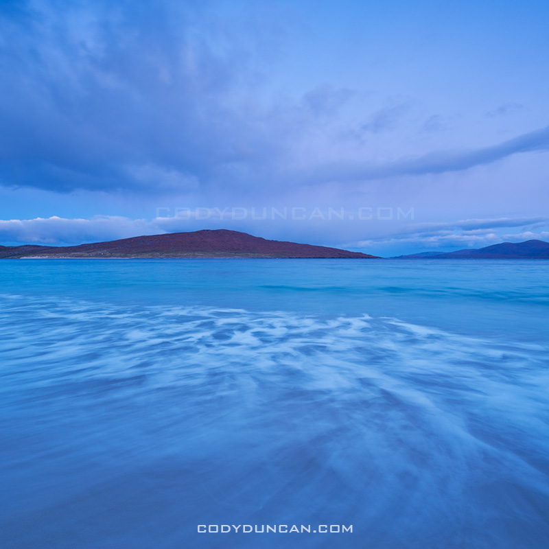
Photo: Dawn light on Traigh Rosamol Beach, Isle of Harris, Scotland

Share:

  • Click to share on X (Opens in new window) X
  • Click to share on Facebook (Opens in new window) Facebook
  • Click to share on Reddit (Opens in new window) Reddit
  • Click to email a link to a friend (Opens in new window) Email
https://www.codyduncan.com/blogimages/2013/07/codyduncan-logo.png 0 0 Cody https://www.codyduncan.com/blogimages/2013/07/codyduncan-logo.png Cody2010-11-01 19:54:032010-11-01 19:54:03Western Isles

Sgwd Clun-Gwyn Waterfall

October 20, 2010/0 Comments/in Landscape, Mostly Photos, Wales/by Cody

Sgwd Clun-Gwyn waterfall

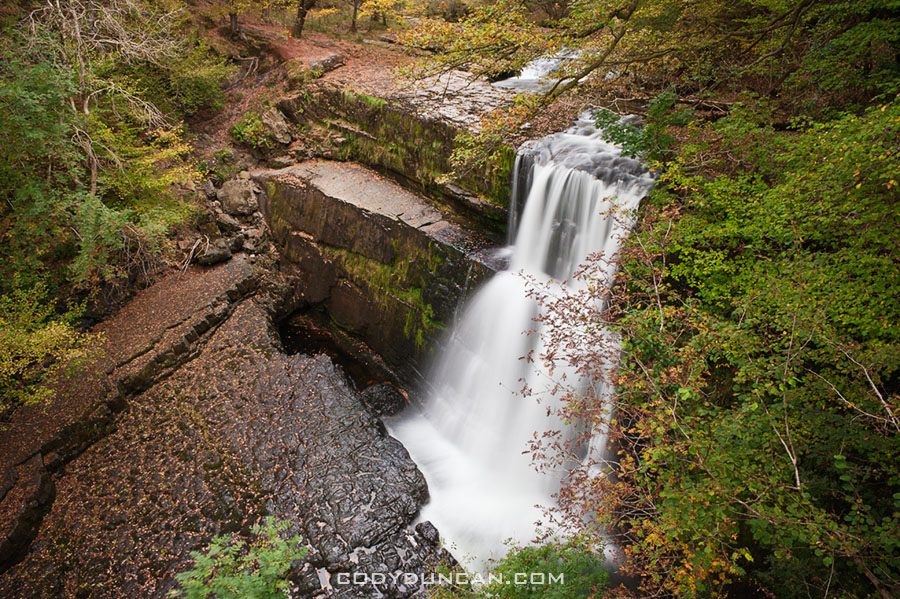
Photo: Sgwd Clun-Gwyn waterfall, river Mellte, near Ystradfellte, Brecon Beacons national park, Wales

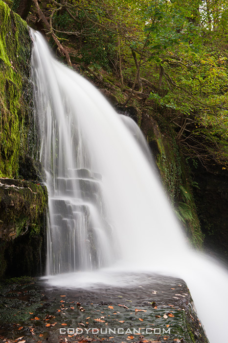
The river Mellte near Ystradfellte forms part of  ‘waterfall country’ on the southern parts of the Brecon Beacons national park.  I’ve never spent much time around here as I’d rather head up into the hills or go climbing, but a particularly bleak Autumn day on Monday seemed like a good time to go check things out.  I had seen some smaller waterfalls last week, but these are definitely more impressive.  A couple weeks back there were some heavy rains and flooding.  The high water line was clearly visible on the riverbank, would have been quite a sight to see the falls then.  Hopefully I’ll get down here another time or two as the autumn color progresses.

Sgwd Clun-Gwyn waterfall

Share:

  • Click to share on X (Opens in new window) X
  • Click to share on Facebook (Opens in new window) Facebook
  • Click to share on Reddit (Opens in new window) Reddit
  • Click to email a link to a friend (Opens in new window) Email
https://www.codyduncan.com/blogimages/2013/07/codyduncan-logo.png 0 0 Cody https://www.codyduncan.com/blogimages/2013/07/codyduncan-logo.png Cody2010-10-20 15:58:382010-10-20 15:58:38Sgwd Clun-Gwyn Waterfall

Maen Llia

October 19, 2010/0 Comments/in Historic Places, Landscape, Mostly Photos, Night, Updates, Wales/by Cody

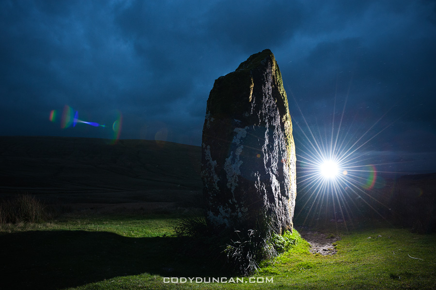
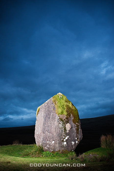
Maen Llia standing stone, Brecon Beacons national park, Wales

Photo: Maen Llia standing stone, Brecon Beacons national park, Wales

It’s been on my mind lately to try and make some portrait style photos of some of the standing stones in the Brecon Beacons region.  Last night was my first attempt at this, using a single Nikon SB-800 as an off camera flash and the gigantic Maen Llia stone as my model.  Unfortunately, and what seems to be my luck these last few months, it started raining after about 10 minutes, before the sky was dark enough to really create the photos that I wanted.    Hopefully I can make it back again in the next few weeks and have another try.

Also, if you read my blog by RSS feed, stop by and have a look.  I’ve made a few changes, the biggest of which will be larger images, now up to 950px wide.  Though if your monitor resolution is less than 1200px, it might look a bit funny, sorry…

Maen Llia standing stone, Brecon Beacons national park, Wales

Share:

  • Click to share on X (Opens in new window) X
  • Click to share on Facebook (Opens in new window) Facebook
  • Click to share on Reddit (Opens in new window) Reddit
  • Click to email a link to a friend (Opens in new window) Email
https://www.codyduncan.com/blogimages/2013/07/codyduncan-logo.png 0 0 Cody https://www.codyduncan.com/blogimages/2013/07/codyduncan-logo.png Cody2010-10-19 12:54:292010-10-19 12:54:29Maen Llia

Bunes Beach Camping – Lofoten Islands

October 5, 2010/5 Comments/in Landscape, Lofoten Islands, Mostly Photos, Norway, Travel/by Cody

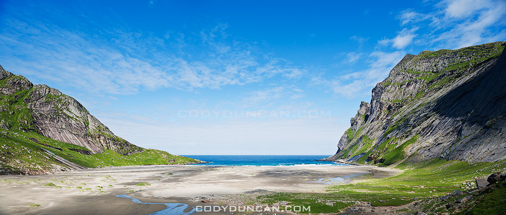
Bunes Beach panoramic photo, Lofoten islands, Norway

Photo: Panoramic view of Bunes beach, Lofoten islands, Norway

Bunes Beach, Moskenesøya, Lofoten Islands, Norway

Bunes is one of the more scenic and isolated beaches on the Lofoten Islands.  Though unfortunately this isolation does not always mean the beach is uncrowded.  On a sunny summer day thick crowds of tourists will be waiting on the pier in Reine to catch the morning ferry over for the day. However, as afternoon approaches the crowds begin the walk back over the pass on their return to civilization.  Now the beach becomes empty and quiet, likely only a few groups of campers will remain and have the place to themselves.  Time is irrelevant in summer anyhow.  The sun will shine until late in the night when it finally passes behind the mountains to the north.

The beach is larger than it first appears.  From the end of the trail to the water is around 600-650 meters, while the beach is 750 meters across.  High, glacially carved cliffs surround the beach, the massive 602 meter west face of Helvetestinden being the most impressive.  The beach faces north-west and is a good place to catch a sunset from late summer to early autumn. Wander out to the cliffs on the left, past the single house, for the best view.  Storms can unfortunately leave sections of the beach rather covered in debris, particularly towards the back. Though on the bright side, a ready supply of driftwood can be found for evening campfires.
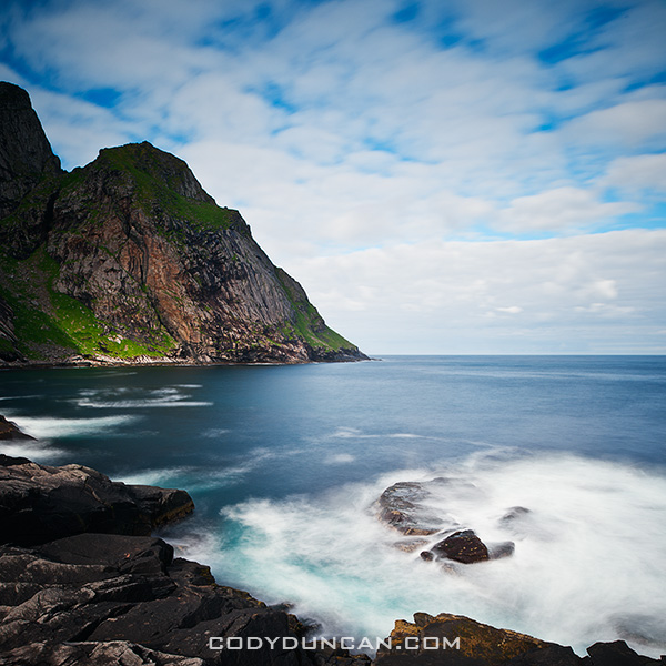
Neutral Density long exposure, Bunes beach, Moskenesoy, Lofoten islands, Norway

Photo: Daytime long exposure with 10 stop neutral density filter, Bunes beach, Lofoten islands, Norway
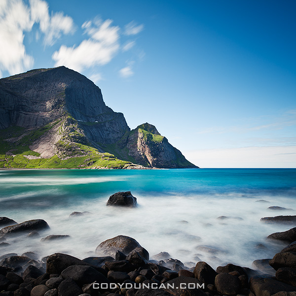
Neutral Density long exposure, Bunes beach, Moskenesoy, Lofoten islands, Norway

Photo: Daytime long exposure with 10 stop neutral density filter, Bunes beach, Lofoten islands, Norway
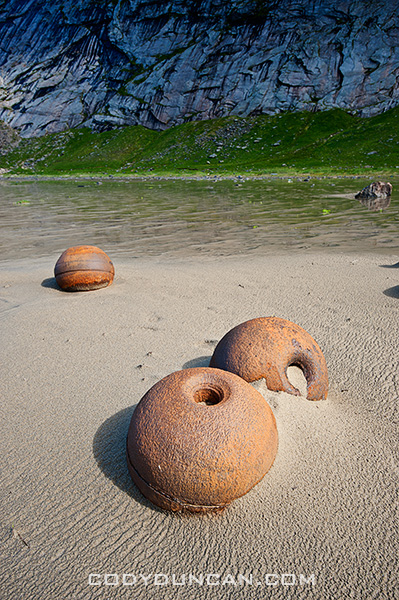
Bunes Beach Lofoten islands

camping at Bunes Beach, Lofoten islands, Norway

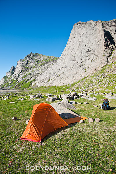
Photo: Summer camping at Bunes beach, Lofoten islands, Norway

Camping
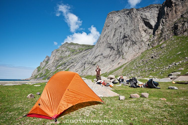
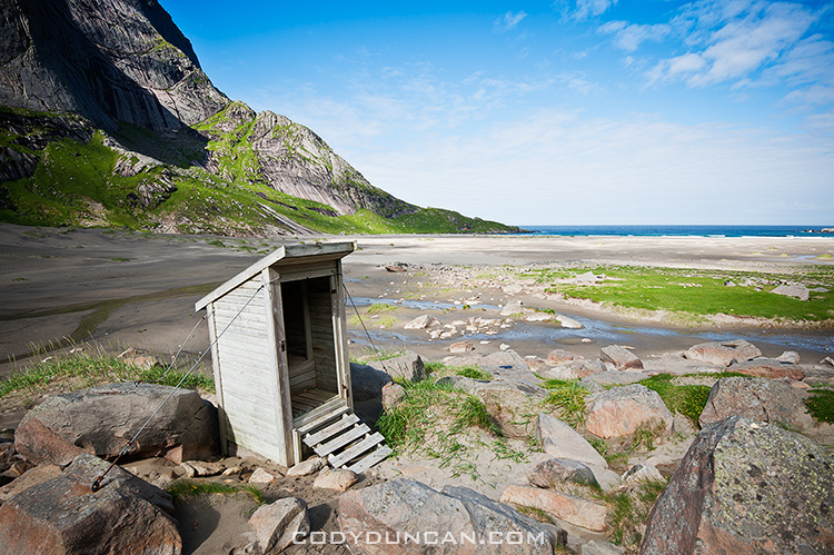
The best camping is on the flat grassy dunes found at the back of the beach.  The area is large so even if some other groups are present, there is no feeling of crowding.  No supplies are available in Vindstad, so be sure to bring everything you would need for typical wilderness camping.  Fresh water can be collected via several waterfalls towards the back-left side of the beach.  A door-less drop toilet is on the side of the trail just before reaching the beach.

A note of caution should be made to the weather. The beach and camping areas are completely exposed to the north-west and any weather which my come from there.  And once the afternoon ferry leaves you are stuck there until the following morning, so be sure to check the forecast for the following days if planning on camping.  If bad weather does arrive, there are several large boulders on the Vindstad side of the pass that have enough room for 1-2 tents and should provide enough shelter from the wind, depending on the direction.
camping at Bunes Beach, Lofoten islands, Norway

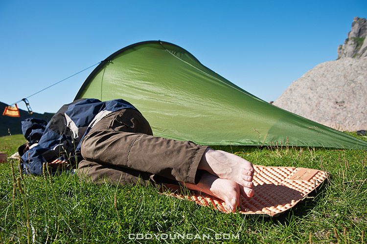
Photo: Afternoon nap in the sun, Bunes beach, Lofoten islands, Norway
camping at Bunes Beach, Lofoten islands, Norway

Photo: Sunny summer afternoon at camp, Bunes beach, Lofoten islands, Norway
Bunes Beach, Lofoten islands, Norway

Photo: Toilet with a view, Bunes beach, Lofoten islands, Norway

Getting There
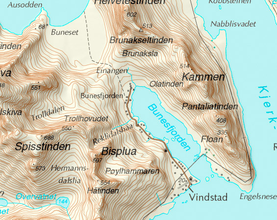
The easiest approach is to take the Ferry from Reine to the village of Vindstad.  From there follow the easy path through the village and towards the back of the Fjord.  After about 2 km the village will end at there will be a small trail on the left.  This should be marked with a sign saying ‘Bunes,’ or something thereabouts.  An easy and well worn trail leads over the small pass and down onto the beach.  Be sure to measure how long you’ll need to get back to catch the ferry on time, but 1 hr should be plenty for most people.

The ferry time schedule can be found here: CLICK HERE
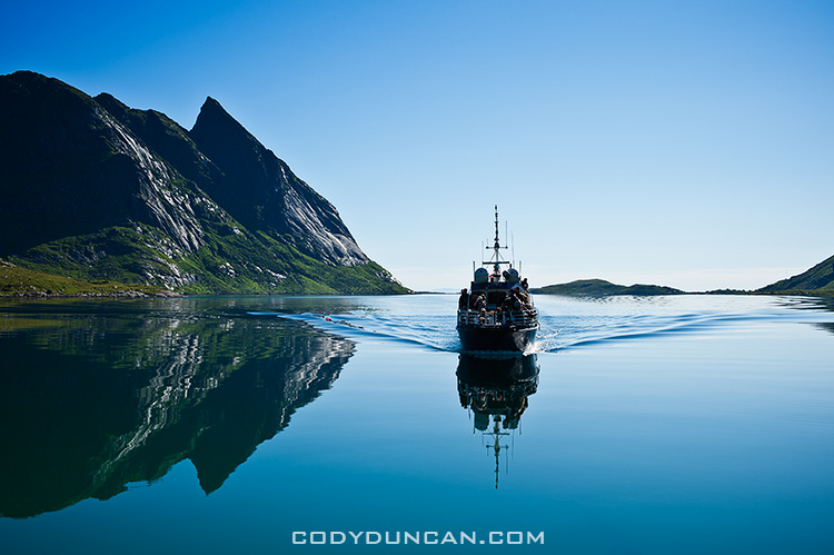
Reine ferry boat in Fjord, Lofoten islands

Photo: Reine ferry arriving to pick up passengers in Vindstad
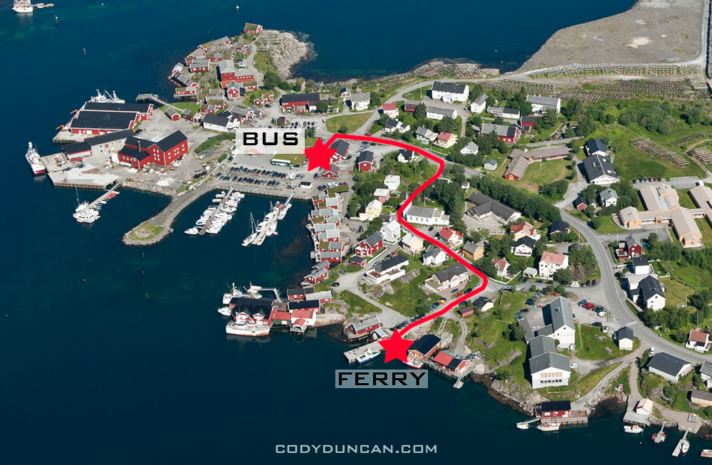
Reine ferry directions

Photo: Reine, showing locations of bus stop and Ferry port
Share:

  • Click to share on X (Opens in new window) X
  • Click to share on Facebook (Opens in new window) Facebook
  • Click to share on Reddit (Opens in new window) Reddit
  • Click to email a link to a friend (Opens in new window) Email
https://www.codyduncan.com/blogimages/2013/07/codyduncan-logo.png 0 0 Cody https://www.codyduncan.com/blogimages/2013/07/codyduncan-logo.png Cody2010-10-05 12:51:482010-10-13 20:30:04Bunes Beach Camping – Lofoten Islands
Page 17 of 53«‹1516171819›»
X Logo X Logo Followon X RSS Feed Logo RSS Feed Logo Subscribeto RSS Feed

Seasons On Lofoten Summer eBook

Seasons On Lofoten Winter eBook

Seasons On Lofoten: Winter

Recent Posts

  • New eBook | Lofoten Islands – Northern Light
  • Padjelantaleden eBook update
  • Ebook update – West Lofoten Hikes 4th Edition
  • New Ebook – Padjelantaleden Hiking Guide
  • Kungsleden South ebook update – 2nd edition – Kvikkjokk to Hemavan

Recent Comments

  • Gerry on rincon dawn
  • Kim on Schmitsch – Smicz
  • Jamie on Hindera Family Origins in Schmitsch, Silesia – Smicz, Poland
  • Patty Regan-Macrina on Schmitsch – Smicz
  • Dušan on Hiking Sweden’s Kungsleden Trail In Autumn

Categories

  • Austria
  • Baja
  • Baltic
  • British Columbia
  • Budapest
  • California
  • Caving
  • China
  • Cities
  • Climbing
  • Colorado
  • Czech Republic
  • Festivals
  • Food
  • France
  • Germany
  • Greenland
  • hiking
  • Historic Places
  • In Print
  • Ireland
  • Italy
  • Japan
  • Lake Powell
  • Landscape
  • Lithuania
  • Lofoten Islands
  • Moorea
  • Mostly Photos
  • Mountains
  • New Zealand
  • Night
  • none
  • Norway
  • Oregon
  • Panoramics
  • Photo Tours
  • Photo Workshops
  • Poland
  • Racing
  • Random stuff
  • Santa Barbara
  • Scotland
  • Stock Photography
  • surfing
  • Sweden
  • Switzerland
  • Timelapse
  • Tips and Tricks
  • Travel
  • Updates
  • Video
  • Wales
  • Washington
  • wildlife

Archives

  • December 2022
  • May 2022
  • July 2020
  • November 2019
  • May 2019
  • April 2018
  • January 2018
  • February 2017
  • January 2017
  • December 2016
  • November 2016
  • October 2016
  • September 2016
  • August 2016
  • May 2016
  • January 2016
  • December 2015
  • November 2015
  • October 2015
  • August 2015
  • July 2015
  • June 2015
  • April 2015
  • January 2015
  • December 2014
  • October 2014
  • September 2014
  • August 2014
  • July 2014
  • June 2014
  • May 2014
  • April 2014
  • March 2014
  • February 2014
  • January 2014
  • December 2013
  • November 2013
  • August 2013
  • July 2013
  • June 2013
  • May 2013
  • April 2013
  • March 2013
  • February 2013
  • January 2013
  • December 2012
  • November 2012
  • October 2012
  • September 2012
  • August 2012
  • July 2012
  • June 2012
  • May 2012
  • April 2012
  • March 2012
  • February 2012
  • January 2012
  • December 2011
  • September 2011
  • August 2011
  • July 2011
  • June 2011
  • May 2011
  • April 2011
  • March 2011
  • February 2011
  • January 2011
  • December 2010
  • November 2010
  • October 2010
  • September 2010
  • August 2010
  • July 2010
  • June 2010
  • May 2010
  • April 2010
  • March 2010
  • February 2010
  • January 2010
  • December 2009
  • November 2009
  • October 2009
  • September 2009
  • August 2009
  • July 2009
  • June 2009
  • May 2009
  • April 2009
  • March 2009
  • February 2009
  • January 2009
  • December 2008
  • November 2008
  • October 2008
  • September 2008
  • August 2008
  • July 2008
  • June 2008
  • May 2008
  • April 2008
  • March 2008
  • February 2008
  • January 2008
  • December 2007
  • November 2007
  • October 2007
  • September 2007
  • August 2007
  • July 2007
  • June 2007
  • May 2007
  • April 2007
  • March 2007
  • February 2007
  • January 2007
  • December 2006
  • November 2006
  • October 2006
  • August 2006
  • July 2006
  • June 2006
  • May 2006
  • April 2006
  • March 2006
  • February 2006
  • January 2006
  • December 2005
  • November 2005
  • October 2005

Stock Image Search

Enter Keyword(s), Subject(s) or Location(s) to search stock photo archive

New on the Blog

  • New eBook | Lofoten Islands – Northern Light December 8, 2022
  • Padjelantaleden eBook update December 5, 2022
  • Ebook update – West Lofoten Hikes 4th Edition May 21, 2022
X Logo X Logo Followon X RSS Feed Logo RSS Feed Logo Subscribeto RSS Feed

Seasons On Lofoten Winter eBook

Seasons On Lofoten Winter - 4th edition

Kungsleden Trail eBook

Kungsleden Trail Hiking Guide

Kungsleden Trail Hiking Guide

Website Search

Search Search

Stock Image Seach

Enter Keyword(s), Subject(s) or Location(s) to search stock photo archive
Scroll to top Scroll to top Scroll to top

This site uses cookies. By continuing to browse the site, you are agreeing to our use of cookies.

OKLearn more

Cookie and Privacy Settings


How we use cookies

We may request cookies to be set on your device. We use cookies to let us know when you visit our websites, how you interact with us, to enrich your user experience, and to customize your relationship with our website.

Click on the different category headings to find out more. You can also change some of your preferences. Note that blocking some types of cookies may impact your experience on our websites and the services we are able to offer.

Essential Website Cookies

These cookies are strictly necessary to provide you with services available through our website and to use some of its features.

Because these cookies are strictly necessary to deliver the website, refusing them will have impact how our site functions. You always can block or delete cookies by changing your browser settings and force blocking all cookies on this website. But this will always prompt you to accept/refuse cookies when revisiting our site.

We fully respect if you want to refuse cookies but to avoid asking you again and again kindly allow us to store a cookie for that. You are free to opt out any time or opt in for other cookies to get a better experience. If you refuse cookies we will remove all set cookies in our domain.

We provide you with a list of stored cookies on your computer in our domain so you can check what we stored. Due to security reasons we are not able to show or modify cookies from other domains. You can check these in your browser security settings.

Google Analytics Cookies

These cookies collect information that is used either in aggregate form to help us understand how our website is being used or how effective our marketing campaigns are, or to help us customize our website and application for you in order to enhance your experience.

If you do not want that we track your visit to our site you can disable tracking in your browser here:

Other external services

We also use different external services like Google Webfonts, Google Maps, and external Video providers. Since these providers may collect personal data like your IP address we allow you to block them here. Please be aware that this might heavily reduce the functionality and appearance of our site. Changes will take effect once you reload the page.

Google Webfont Settings:

Google Map Settings:

Google reCaptcha Settings:

Vimeo and Youtube video embeds:

Other cookies

The following cookies are also needed - You can choose if you want to allow them:

Accept settingsHide notification only