Mount Shasta

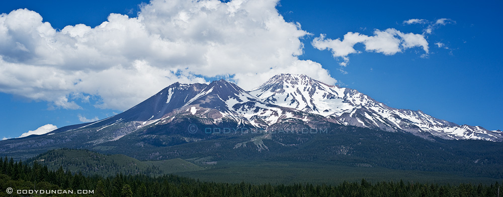
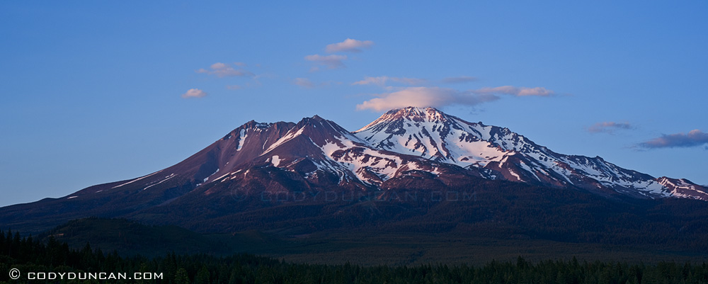
Mount Shasta is one of my favorite mountains in California.  Unlike the chain of rugged granite peaks of the Sierra, Shasta is simply a giant volcano rising 10,000 (3,000m) above the surrounding landscape to a height of 14,179 ft (4,322 m).  The mountain is at the southern end of the Cascade range, a series of (mostly) volcanic peaks surrounded by endless Bigfoot-roamed forests starting in northern California, through Oregon and Washington and up into British Columbia.

Panoramic landscape photography Nikon d700 85mm tilt-shift lens - Mount Shasta, California

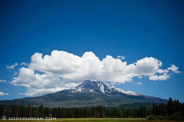
Landscape stock photography - Mount Shasta, California

Panoramic landscape photography Nikon d700 85mm tilt-shift lens - Mount Shasta, California

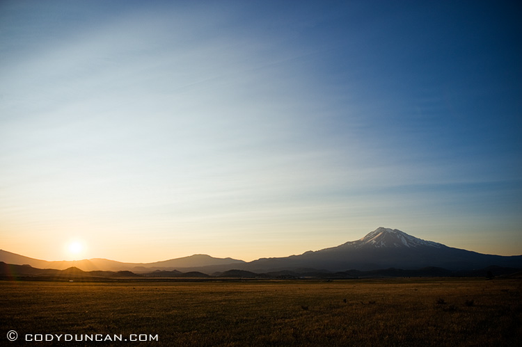
Landscape stock photography - Mount Shasta, California

Tuolumne Meadows and the Yosemite High Country

After the Morning at the Alabama Hills I was yet undecided as to where to go.  As I headed north towards Bishop I heard the days weather forecast on the radio:  hot and sunny in the Owen’s valley and a possibility of thunderstorms up by Yosemite.  So off I went!

No thunderstorms ever arrived, but at least there were some nice clouds during the afternoon and of course at the 9,000ft of Tuolumne Meadows, a sane temperature.  I’ve never acually been here during the summer (usually in the autumn), so it was nice to see everything lush and green, and full of tourists.  Lucky enough, I found myself a campsite at the Tuolumne Meadows campground which saved me from having to drive out of the park at night, and back again in the early morning for sunrise.

Even in the sun, the Sierra hummingbird mosquito was in full attack mode.  Around sunset, while standing in the meadows, I estimate something like 5-6 bites per photo taken.  I remembered why I never go near the Sierra high country during summer.

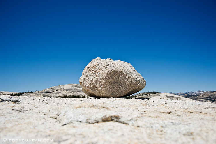
Lone rock on top of Pothole dome, Tuolumne meadown, Yosemite national park, California

Lone rock sits on Pothole dome.  I wonder how long that rock has been sitting there?

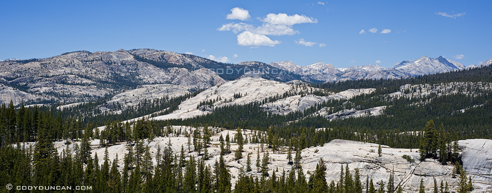
Panoramic landscape photo of granite mountains of Yosemite high country, California

Panoramic photo of Tenaya lake and high country, Yosemite national park, California

View from above Olmstead point looking back towards Tenaya lake.

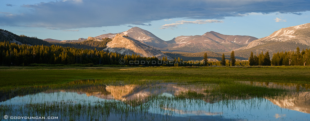
Panoramic landscape photo: Tuolumne meadows at sunset, Yosemite national park, California

Sunset over flooded field in Tuolumne Meadows.  Lembert dome in the middle of photo, with 13,053 ft (3979 m) Mt. Dana rising in the distant background.

Alabama Hills and Eastern Sierra Nevada Mountains

The Alabama Hills are one of my favorite places here in California and a usual stop anytime I head to the east side of the Sierra Nevada Mountains.  Normally I avoid the area during summer as the temperature is often well above my level of tolerance,  But I decided to check things out anyhow.  On the way up as I was crossing the Antelope Valley before entering the high desert area, I knew I would be in trouble from the heat.  I guess after too much time in Northern Europe, I had forgotten that I really don’t enjoy myself in 100˚ (37˚c) temperatures (yes, I’m spoiled living on the coast).  Turning off in Lone Pine during the late afternoon I headed straight through the Alabama hills and up to the 8,000 (2500m) foot coolness of the Whitney Portal to get a bit of an escape from the heat.  The light was pretty bad anyhow, so I sat around up there and got eaten by mosquitoes for an hour or two.

I have a couple favorite places to camp, but since there is so much to see, I usually do a little exploring to see if I can’t find some cool new place.  The whole area is open for wild camping, so I like to look for a spot where I can roll out the back of my truck at dawn, walk about 10 feet or crawl up some rock and start shooting.  Sure beats having to drive anywhere!
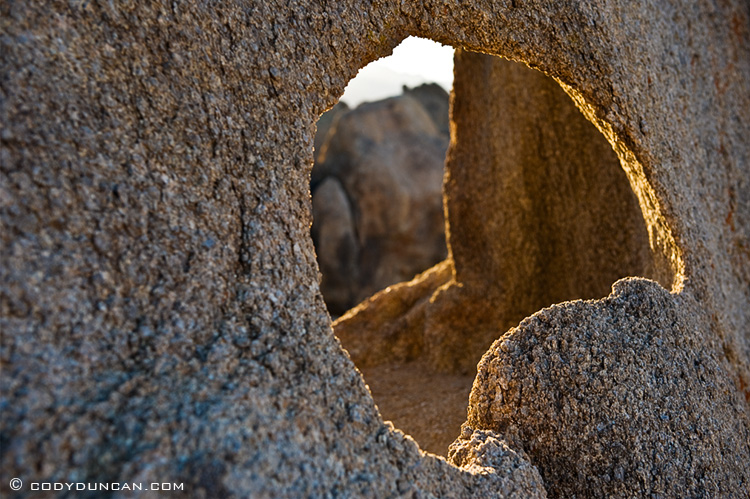
Alabama HIlls, Owen's valley, California

Panoramic landscape stock photography: Alabama Hills, Owen's valley, California

Night panoramic landscape photography Nikon d700 85mm tilt-shift lens: Sierra Nevada Mountains, California

The sunset was actually one of the boring-er ones that I’ve witnessed, but what can you do.  Took a few night photos, but a pretty good wind picked up around sundown which was blowing a lot of dust around.  So after a five minute photo, I’d have to clean everything off again.
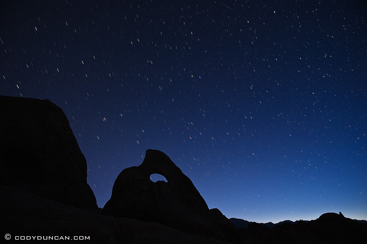
NIght photography Nikon d700: star trails over rock formations, Alabama Hills, California

Dawn broke to a perfectly clear sky, again, nothing spectacular.  Better weather for climbing than photography.
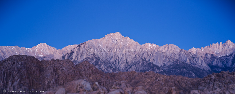
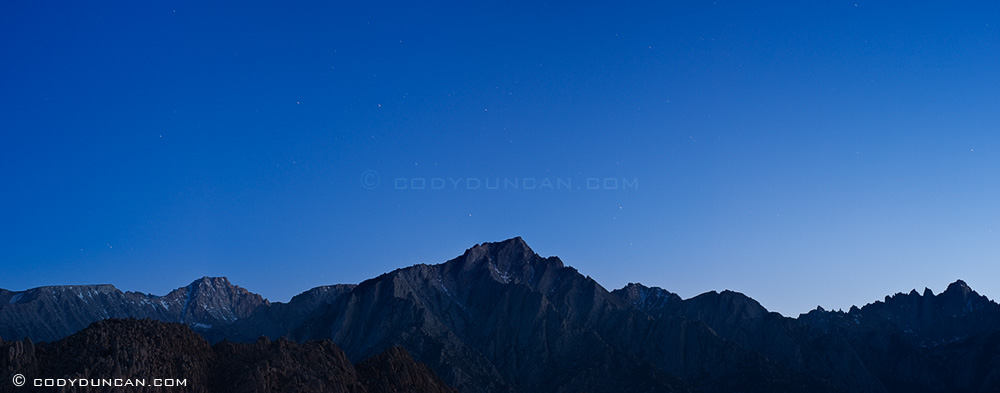
Tilt-Shift panoramic landscape photography: Sierra Nevada mountains, California

Lone Pine peak in the center of the photo, with Mount Whitney (14,505 feet – 4,421m, highest mountain in California and lower 48) on the very right of the photo in the pre-dawn light.
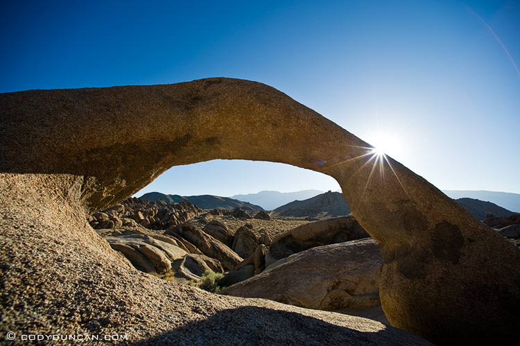
Landscape stock photography: Mobius Arch, Alabama Hills, Owen's Valley, California

Mobius Arch, one of the more famous icons in the area.
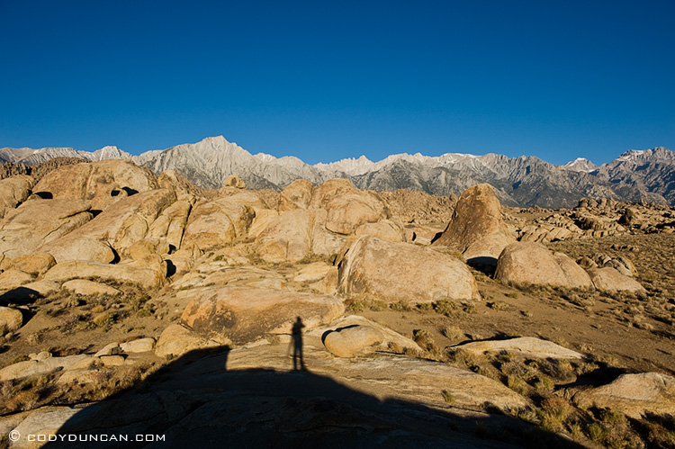
Alabama Hills and Sierra Nevada Mountains, Lone Pine, California

By 7:00 am it was already getting hot and the light hazy and washed out.  So I decided to some place higher and cooler for the day…