Rainbow at Sunrise over mountains from Bunes Beach, Moskenesoy, Lofoten Islands, Norway

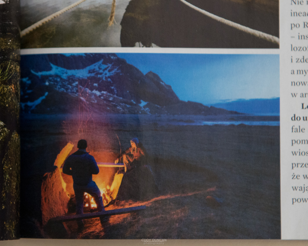
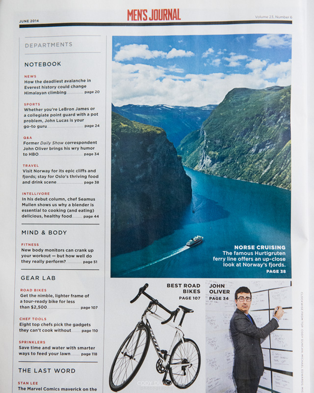
Lofoten – Norway Travel Plans – Summer/Autumn 2014

Rainbow at Sunrise over mountains from Bunes Beach, Moskenesoy, Lofoten Islands, Norway

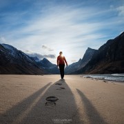
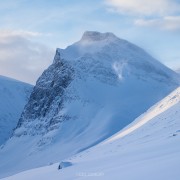
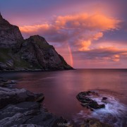
Photo: Sunrise rainbow at Bunes beach, Moskenesøy, Lofoten Islands, Norway.  August 2013

A couple days ago I booked two sets of plane tickets for Norway!  As many times as I’ve been to Lofoten now, I still get excited once I commit to a plan and get things rolling.  Only seven weeks of waiting left – well, I’ll hopefully keep quite busy at work to be able to pay for it all.  If not, I’ll be selling off some gear that doesn’t see much use anymore.

I was actually getting a little stressed, as I waited a little too long and prices were getting expensive!  But for some reason I remembered that Norwegian Airlines now has a Los Angeles – Oslo flight (direct).  Checking prices, it was about 1/2 price of anything else I could find (as I write this today, July 2rd, you can fly LA – Oslo (via Stockholm) on September 10th for $347 one way. Some cheaper prices if you go out a few more months).  Even more so in that I need to fly to Norway, but return home from the UK – which they also have London-Gatwick – LA direct as well.

I’ve flown with Norwegian plenty of times on inter-Europe trips to Norway, but haven’t ever taken one of their long haul flights before.  Knowing they are a bit ‘spartan,’ (ie: you need to pay for anything extra, even food) I’m not 100% sure what to expect, but for the price, I think I’ll be happy.  And hell, even half the United flights I seem to end up on don’t even have personal TV screens.  It worked out as the most convenient connection to get me to Tromsø anyhow.

Sorry to sound like an advertisement for Norwegian.  Though unfortunately for me, I don’t get to write one of those ‘This post was brought to you by Blah Blah Blah, opinions my own etc…’ at the bottom of this post – which would mean I got something for free.  I didn’t.  I just think this is a good deal for us Americans heading to Norway, and elsewhere in Europe.  Especially for us California folk.  And I really like Norwegian’s system of more or less considering every flight as one-way, which means it’s not any extra cost to fly to one destination and leave from another as you can easily book two separate one-way flights.

Now I just need to talk my brother into driving me to LA on a Sunday afternoon…

AUGUST – Sailing Trip to Lofoten

As I mentioned a little while back, I’m going sailing around Lofoten with Vertical Shot Expeditions.  I can’t really write how excited I am about this, but I am!  It is the first time I have ever signed up for any sort of tour – I’m normally quite a firm DIY type person; but there’s not really a way I could put a sailing trip together myself – well, maybe if I won the lottery or found some heavy duty sponsorship – so the opportunity to participate in this trip was too good to pass up.  Hopefully I’ll return with lots of new images for this site.
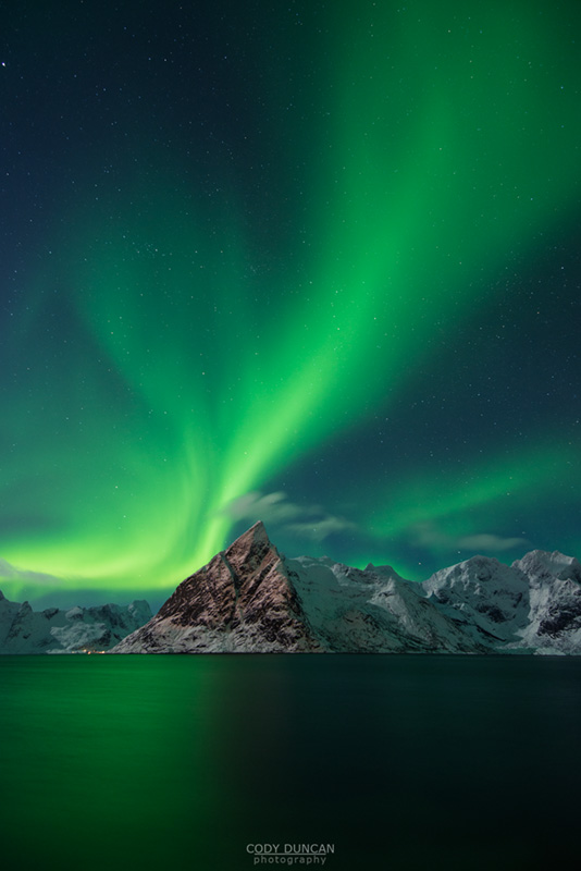
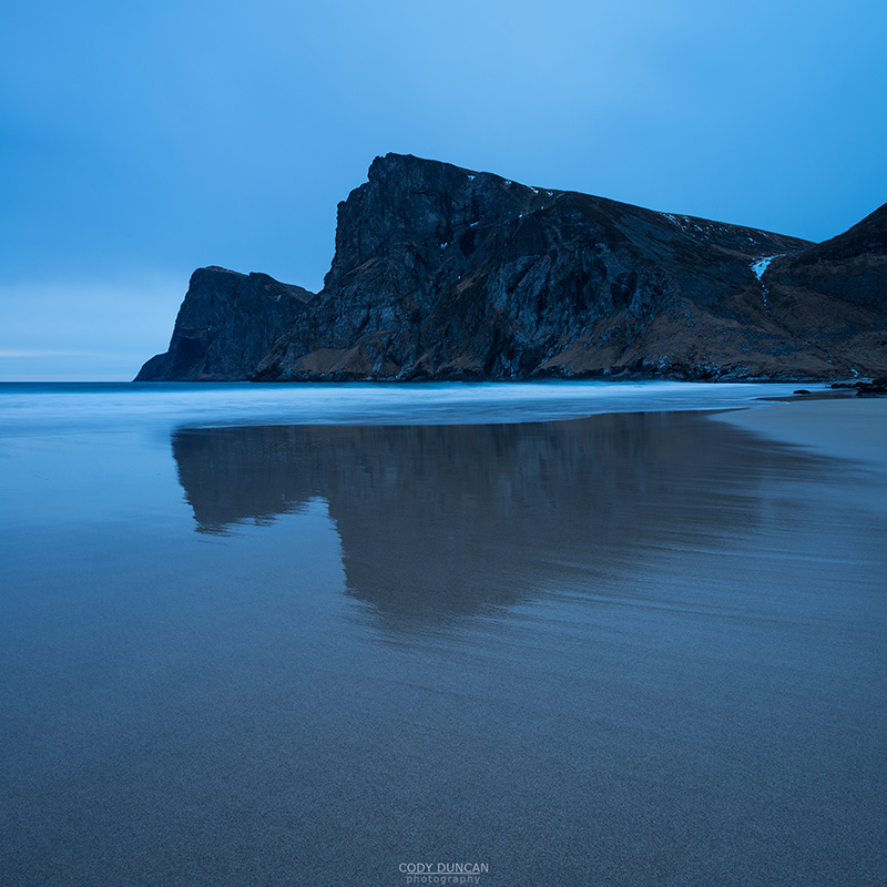
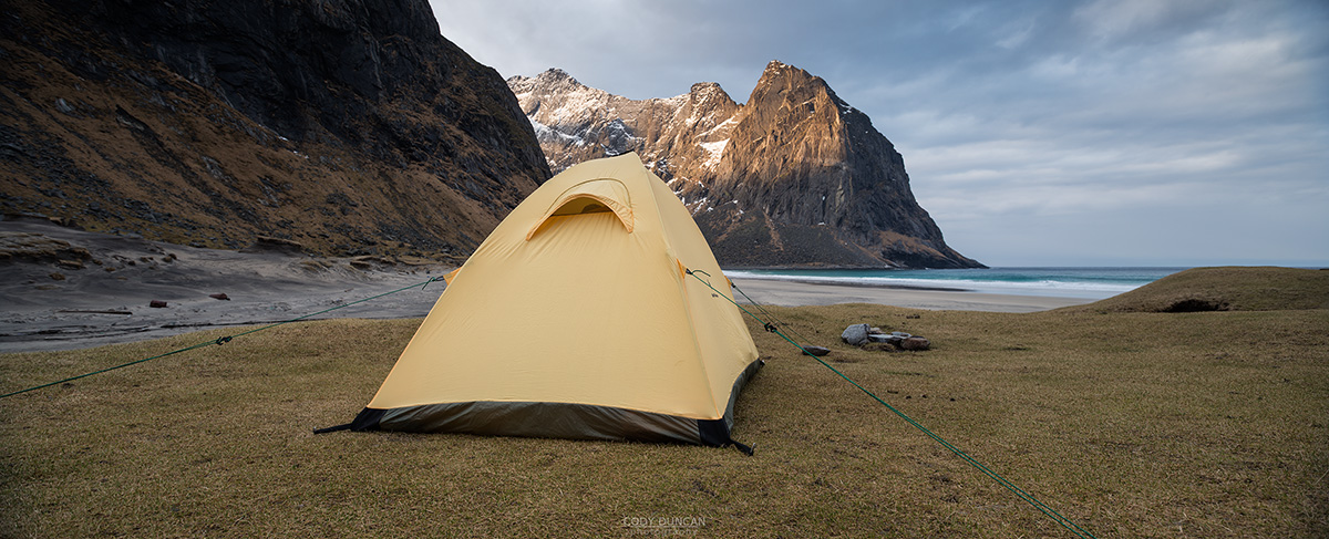
SEPTEMBER – Lofoten

I have been a little on the fence about what to do after the sailing trip, which ends September 6.  I have received a couple requests for some small private group tours – workshops around Lofoten for the Autumn, but so far none of these have come to fruition.  I also thought about going back to Sweden for another try at Sarek national park.  But I think it will be better if I put this off another year.   Luckily, life sometimes as a way of making decisions for you.

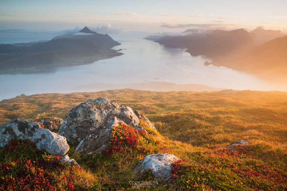
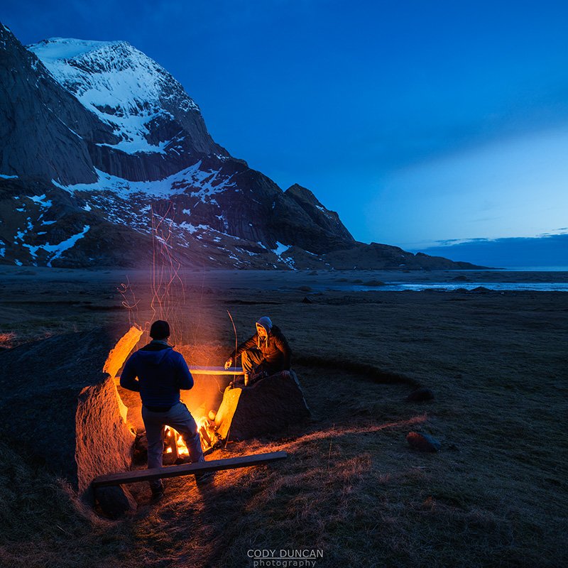
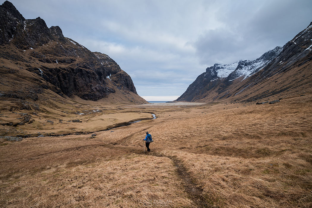
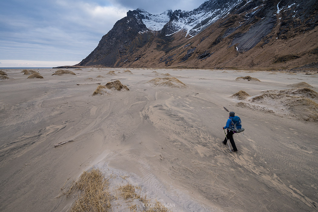
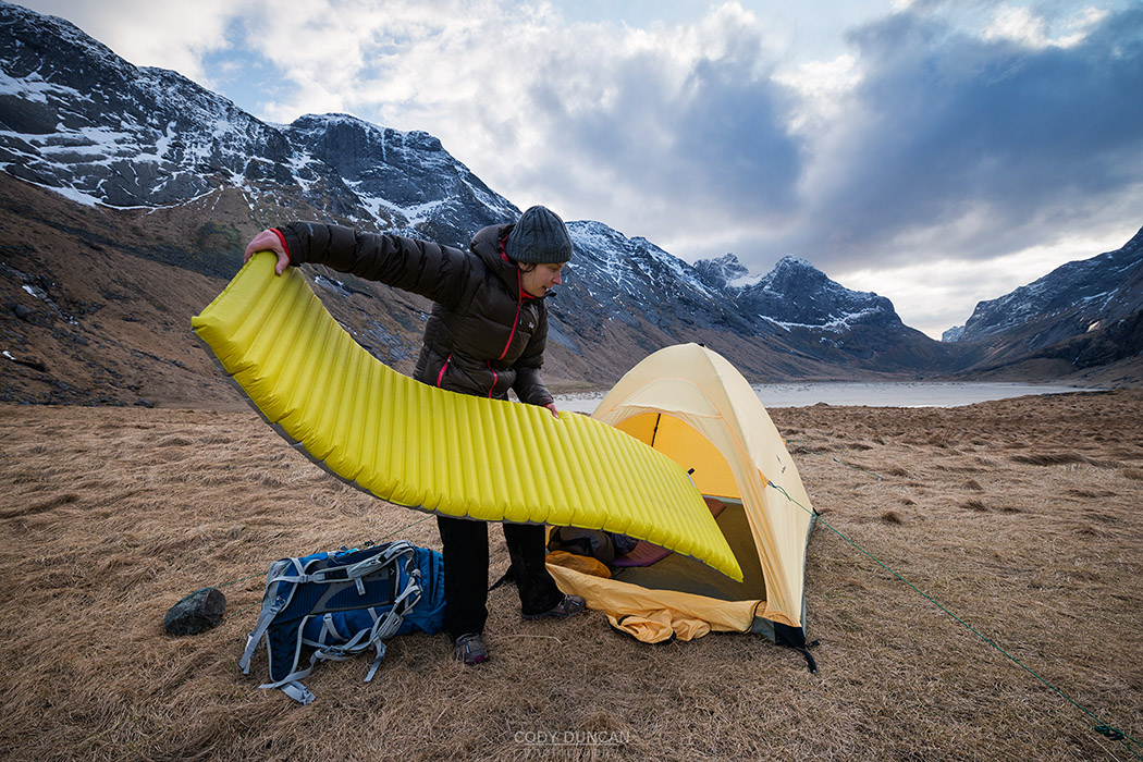
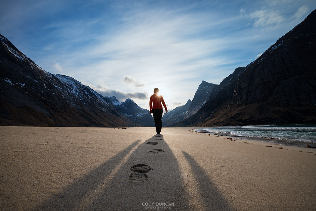
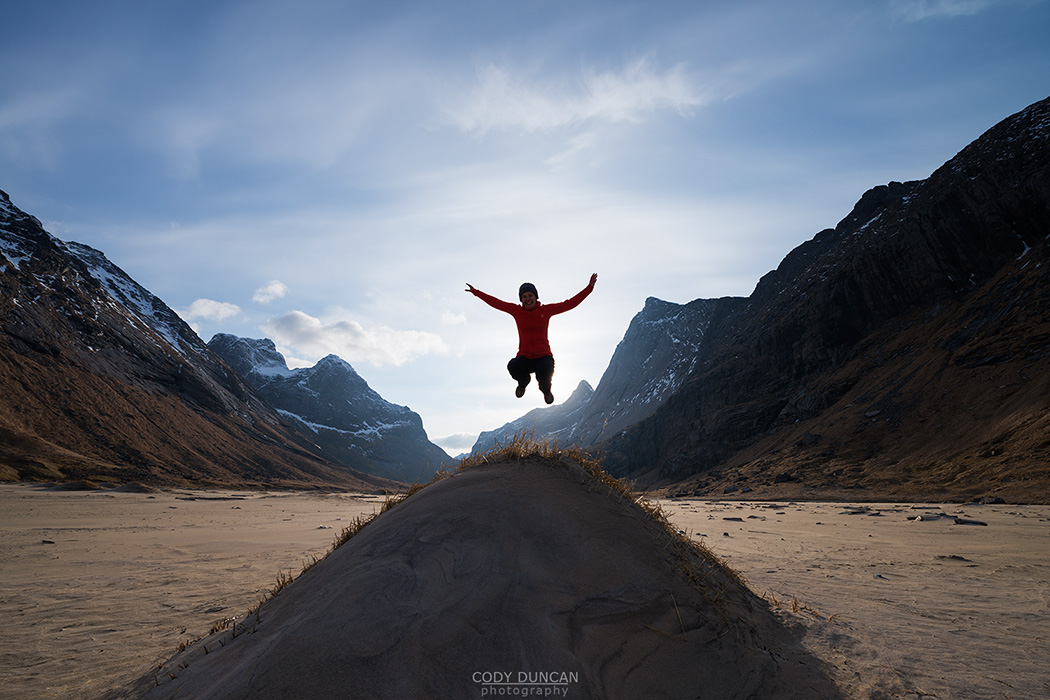
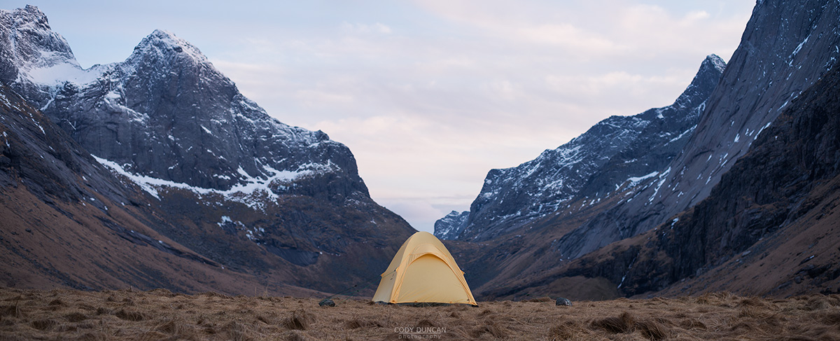
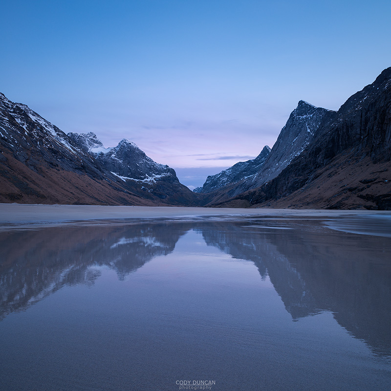
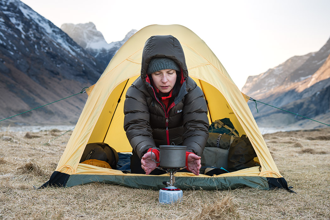
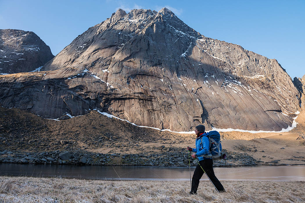
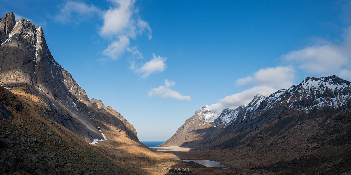
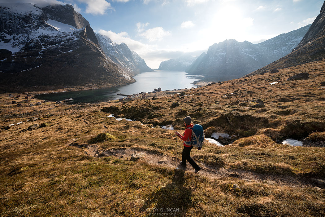
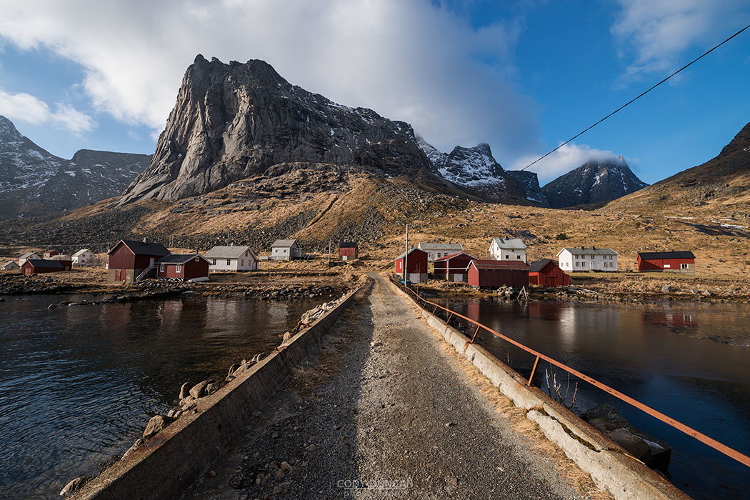
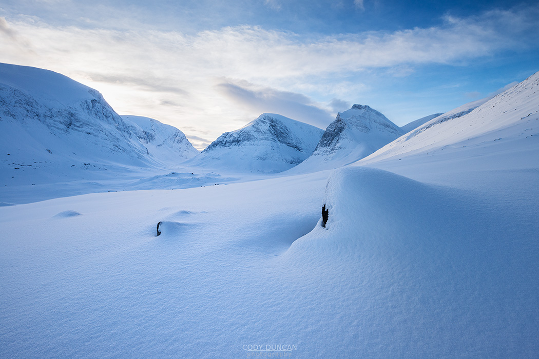
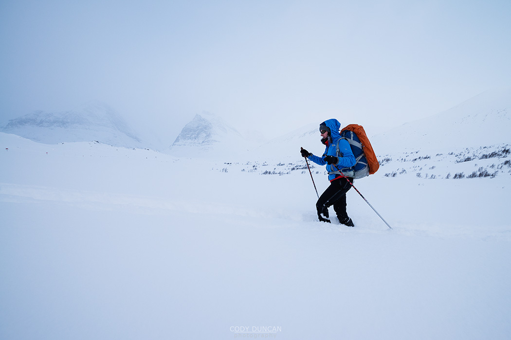
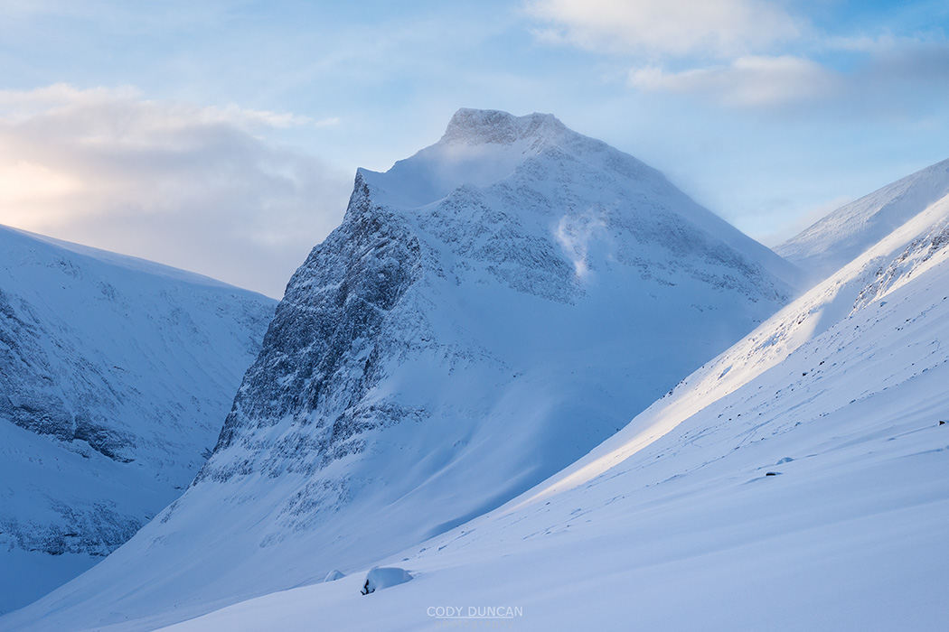
Without going into to much detail, I will be spending the whole of September on Lofoten.  I’ve already spent several hours looking at the topo maps at UT.NO, planning for the next series of mountain hikes to add to this website.  I think I’m gathering a pretty good list of peaks that I’m trying to sort out into various priority levels.  Though I’m not overly optimistic that the mostly calm, dry weather of the last two years will repeat itself again, so we’ll see how many mountain days I actually get.  There are also a few peaks I would like to revisit, like Himmeltindene, where I didn’t have the best Photography weather on my previous trip.  And there are a few seldom photographed valleys full of birch trees that will hopefully turn a brilliant gold come the second half of the month, with vertical walls of granite rising above.  So that might requite a few nights out in the tent, waiting for the light.

OCTOBER – Norway Road Trip

I’ll probably leave Lofoten around the first of October, although I’m a little hesitant to leave right as the northern light season is beginning, hopefully I’ll see something decent by the end of September.  From Lofoten, I’ll have two weeks to travel through central Norway, and visit some places that have been on my ‘to photograph’ list for a while.  Though I fear I might be a little late in the year for some places.  In mid October I need to be in the Netherlands to catch a ferry to the UK.  Which is probably for the better, as the car wont have snow tires.

By the beginning of November I’ll be home in California again, counting down the days until January 2015 when I head back to Lofoten to help guide a Photography workshop by Muench Workshops.

View over Nappstraumen from summit of Offersøykammen, Vestvågøya, Lofoten Islands, Norway

Lofoten Islands Travel Podcast Interview – Kuadrant Podscast

View over Nappstraumen from summit of Offersøykammen, Vestvågøya, Lofoten Islands, Norway

Photo: Autumn view from Offersøykammen, Vestvågøy, Lofoten Islands, Norway.  October 2012

I was recently interviewed for a new Travel podcast – Kuadrant Podcast.  It was the first time I’ve ever done a ‘live’ interview, or basically any sort of interview for that matter, so I’m not sure how much to tell you to expect from me.  But if you’re interested in spending 30 minutes of your life to hear me talk about Lofoten, travel, and photography, you can do so…

KUADRANT PODCAST – Episode 11 – Capturing Seasons In Lofoten

Without going into too much detail, I talk a bit about my early visits to Lofoten (2001/2006 – I’m getting old!) and why I was drawn to the islands and have returned so many times over the years.  Give it a listen and let me know what you think.  Maybe I will try and do more of these things! (ha!)

Two people enjoy campfire at Bunes Beach, Moskenesoy, Lofoten Islands, Norway

Recent Published Works – Norway and Lofoten

Two people enjoy campfire at Bunes Beach, Moskenesoy, Lofoten Islands, Norway

Photo: Campfire at Bunes beach, Moskenesøy, Lofoten Islands, Norway.  April 2013

Lofoten Islands in National Geographic Traveler Poland – February 2014

A couple of my Lofoten images were published in the February edition of the Polish version of National Geographic Traveler magazine in an article about the world’s most spectacular islands, in which Lofoten rightly was included.

As someone who would loosely be described as a landscape photographer; I would rather be an adventure photographer, but I don’t have enough friends to travel with, so am forced to go alone and merely take landscape photos of my travels – or stay at home, the question is often asked: ‘ Would you like to shoot for National Geographic?’

While the answer is an obvious ‘YES!’  Life is not so simple as based upon the opinions of friends and family.  But now I’m proud to announce I now have some humble beginnings within the famed yellow borders.

Evening twilight over Reine from summit of Reinebringen, Moskenesoy, Lofoten Islands, Norway

Photo: Autumn twilight over Reine from summit of Reinebringen, Moskenesøy, Lofoten Islands, Norway.  September 2013

Lofoten national geographic traveler poland

Photo: Lofoten – National Geographic Traveler (Poland), February 2014

lofoten-nat-geo-traveler-02

Photo: Lofoten – National Geographic Traveler (Poland), February 2014

——-

Hurtigruten and Geirangerfjord, Norway in Men’s Journal – June 2014

One of my Images of the Hurtigruten traveling through the Geirangerfjord in central Norway is in June’s issue of Men’s Journal magazine (US).  I took the image while on a multi-day hitchhiking trip between Bergen and Trondheim (and back) in the summer of 2006 – when I had a lot more free time than money – which is pretty much my same situation today.  I haven’t been to Geirangerfjord since that trip, but my fortune of good timing and weather has made the series of images I took there some of my best selling ones over the last years.

Hurtigruten Norway Mens Journal Magazine

Photo: Hurtigruten and Geirangerfjord, Norway – Men’s Journal Magazine, June 2014

Winter storm over snow covered beach, Unstad, Lofoten islands, Norway

Lofoten Islands Photography Workshop – January 2015

Winter storm over snow covered beach, Unstad, Lofoten islands, Norway

Photo: Clearing winter storm at Unstad beach, Vestvågøy, Lofoten Islands, Norway.

I’m honored to announce that I’ll be joining the January 2015 Muench Photography Workshops tour as their guide to the Lofoten section of the tour.

The complete tour is 10 days, from January 15-25, 2015 and will be led by world renowned landscape photographers and workshop leaders Marc Muench and Andy Williams.  I will be guiding the group on the Lofoten part, January 15-20, after which the group will travel north to Vesterålen for several days spent whale and sea eagle watching.  It will be exciting tour to say the least, and is one of the earliest tours offered in the year, which is looking like it will be a crowded winter on Lofoten, which is perhaps becoming the ‘new Iceland’ for landscape photographers.

Our base for the Lofoten part of the trip will be Elaissen Rorbuer on Hamnøy, with fantastic photo opportunities just out the front door (and even from inside the cabins themselves!).

More info can be found here: Muench Workshops – Lofoten

As of June 1, 2014, the workshop is fully booked – sorry for not announcing earlier, if anyone was interested.  Still, I suggest getting in contact incase free space becomes available.  Or perhaps a 2016 workshop will be scheduled if enough people express interest.

—–

I myself will likely spend the remainder of January and most of February on the islands.  My skis got no use this year, so I’m hoping for better snow conditions in 2015!  And I really want to be somewhere high and alone in the mountains and watch the northern lights dance overhead.  I’m also thinking of maybe giving another go at the Kungsleden trail, if I can somehow afford it again.

Aurora Borealis - Northern Lights fill sky over Olstind mountain peak and reflect in fjord, Toppøya, Lofoten Islands, Norway

Photo: Northern Lights rise into the sky over Olstind, Hamnøy, Moskenesøy, Lofoten Islands, Norway.

Female hiker takes in view of Llangorse lake from Mynydd Llangorse, Brecon Beacons national park, Wales

Brecon Beacons National Park – Mynydd Llangorse

Female hiker takes in view of Llangorse lake from Mynydd Llangorse, Brecon Beacons national park, Wales

Photo: Watching sunset over Llangorse lake from Mynydd Llangorse, Black Mountains, Brecon Beacons national park, Wales.  April 2014

With the long days of summer just around the corner it’s now possible to head out into the Black Mountains for quick evening hikes from here in Hay-on-Wye.  Normally, the default hike is Twmpa or Hay Bluff, the quickest mountains two reach, just down the road and the very eastern border of Brecon Beacons national park.  With rainy days often spent at the climbing gym at llangorse, I’ve often had my eye of the isolated peaks of Mynydd Troed and Mynydd Llangorse for some time.  And looking for something new to wander around to break out of the normal routine, I finally made the effort to get there.

Arriving at the small parking area between both peaks, I decided to head up the lower Mynydd Llangorse, at 515 meters, as the views towards Llangorse lakes seemed to be more promising.  A short ascent leads to the mountain’s ridge and fantastic views of the gently rolling hills and Hedged-in fields of the Welsh countrside.  In the distant west, the flat, table-like summit of Pen Y Fan rose into the mist.

A strange, soft light covered the last, fading off into the hazy distant mountain peaks.  At times, the sun would break through the clouds, casting beams of light over the land in typical Welsh fashion.  Sunset looked like it would be promising, so I stayed up on the mountain, often surrounded by the wild Welsh mountain ponies, grazing away on the spring grass, until strangely pink sun sunk below the horizon.  Now I’m just waiting for a day with some nice puffy clouds to head back again.

For more images from Mynydd Llangorse, and the rest of the Brecon Beacons national park, you can visit my Welsh image archive: HERE

View towards Llangorse lake from Mynydd Llangorse, Brecon Beacons national park, Wales

Photo: Views over the scenic Welsh countryside, Mynydd Llangorse, Black Mountains, Brecon Beacons national park, Wales.  April 2014

View towards Llangorse lake from Mynydd Llangorse, Brecon Beacons national park, Wales

Photo: Rays of light break through the clouds, Mynydd Llangorse, Black Mountains, Brecon Beacons national park, Wales.  April 2014

Old drystone wall on Mynydd Llangorse, Brecon Beacons national park, Wales

Photo: Old stone wall on Mynydd Llangorse, Black Mountains, Brecon Beacons national park, Wales.  April 2014

Wild Welsh Mountain Pony grazing on hillside of Mynydd Llangorse, Brecon Beacons national park, Wales

Photo: Welsh mountain pony at sunset, Mynydd Llangorse, Black Mountains, Brecon Beacons national park, Wales.  April 2014

Wild Welsh Mountain Pony at sunset on Mynydd Llangorse, Brecon Beacons national park, Wales

Photo: Welsh mountain pony at sunset, Mynydd Llangorse, Black Mountains, Brecon Beacons national park, Wales.  April 2014

Female hill walker hiking on Carmarthen Fans - Bannau Sir Gaer with Picws Du in distance, Black Mountain, Brecon Beacons national park, Wales

Brecon Beacons National Park – Black Mountain

Female hill walker on Carmarthen Fans - Bannau Sir Gaer with Picws Du in distance, Black Mountain, Brecon Beacons national park, Wales

Photo: View along the Carmarthen Fans, Black Mountain, Brecon Beacons national park, Wales.  April 2014

The Black Mountain – Y Mynydd Du, the strangely singularl named mountain range, not to be confused with the Black Mountains or Black Mountain itself, on the Western edge of south Wales’ Brecon Beacons national park is home to the some of the most stunning and wild mountains of the national park.  While the central peaks of the Brecons Beacons can have a near endless train of people heading up on a sunny Sunday afternoon, the Black Mountain receives only a fraction of the foot traffic which is one of the reasons that they are my favourite mountains in the region to hike.

When a fair weathered day presented itself a few weekends back, I headed west to hike one my favourite route: Bannau Sir Gaer – Camarthen Fans.  Often I hike in from the east, as it’s quick to get there, and often just ascend Fan Brycheiniog before returning, but this time I wanted to wait around until sunset, and so decided to hike in from the west via Llyn Y Fan Fach.  From Llyn Y Fan Fach, the trail ascends to Waun Lefrith, with scenic view of the entire Camarthen Fans, before continuing on to the first high point at Picws Du.  From here the trail descends before climbing again to Fan Foel and eventually on to the high point of the range, the 802 meter high Fan Brycheiniog.

Instead of descending the mountains and heading back to the car park, I decided to head back up Picws Du and back along the Camarthen Fan ridge to Waun Lefrith where I was hoping to wait for sunset.  Buts as the afternoon hours passed, heavy clouds began rolling in from the west, and it was evident that any sunset would be unlikely.  So after 7:00pm, as the spring sky was beginning to darken I began to head back down the mountain, slightly hurried by the calling of dinner.

For more images from Black Mountain, and the rest of the Brecon Beacons national park, you can visit my Welsh image archive: HERE

Female hill walker hiking towards Waun Lefrith above Llyn Y Fan Fach, Black Mountain, Brecon Beacons national park, Wales

Photo: Hiking above Llyn Y Fan Fach, Black Mountain, Brecon Beacons national park, Wales.  April 2014

Llyn Y Fan Fach and Carmarthen Fans, Black Mountain, Brecon Beacons national park, Wales

Photo: Llyn Y Fan Fach and Carmarthen Fans, Black Mountain, Brecon Beacons national park, Wales.  April 2014

Female hill walker hiking on Carmarthen Fans - Bannau Sir Gaer with Picws Du in distance, Black Mountain, Brecon Beacons national park, Wales

Photo: View along Carmarthen Fans, Black Mountain, Brecon Beacons national park, Wales.  April 2014

Rock outcropping on ridge of Carmarthen Fans - Bannau Sir Gaer, Black Mountain, Brecon Beacons national park, Wales

Photo: Rock outcropping, Black Mountain, Brecon Beacons national park, Wales.  April 2014

View along Carmarthen Fans - Bannau Sir Gaer towards Picws Du, Black Mountain, Brecon Beacons national park, Wales

Photo: Last light touchest the summit of Fan Foel, Black Mountain, Brecon Beacons national park, Wales

Female hiker leaves footprints in sand on scenic Horseid beach, Moskenesøy, Lofoten Islands, Norway

Lofoten Islands Winter 2014 – Horseid Beach

Female hiker hiking trail towards Horseid beach, Moskenesøy, Lofoten Islands, Norway

Photo: Hiking towards Horseid Beach, Moskenesoy, Lofoten Islands, Norway.  March 2014

For a reason unknown to me, but likely having some purpose, the Monday morning ferry to Vindstand and Kjerkfjord leaves Reine at 07:00 am.  In early March this means it’s still quite dark out.  As the crew showed up and we boarded the boat I was still not sure where we would be going, but as the assistant came around to collect our payments I said Kjerkfjord.  We were committed now.

We were the only two passengers onboard as MS Fjordkyss idled out of the harbour and into the fjord.  The forecast was for dry weather, but I know better than to believe this, especially when Horseid is concerned, as the steep mountains gather all the nearby clouds and let them sit over the beach, dropping any rain they may have, before moving out to sea.  So as I saw the heavy layer of cloud hanging over the pass, I wondered if it would not have been better to go to Bunes, which was cloud free as far as I could tell.

As the boat headed deeper into Kjerkfjord the first few drops of rain began to fall from the heavy clouds.  Not again. I Thought.  I was hoping to hike this route at least once without rain.  My two previous visits having been rather soggy.

Soon the ferry pulled up to the small pier and dropped us off.  We were now alone and the end of the world.  Save for a few seagulls and the splashing of waves, the world was silent.

It must have been a bit colder here than in the fjord, as the rain began to turn into a warm snow, tentatively balanced on the border of freezing.  But it was just cold enough to save me from putting my rain shell on, where I would likely overheat on the hike up the pass.

An added benefit of the cold temperatures is that much of the normally boggy and wet trail was frozen.  Where feet would normally slip and sink into mud, the shoes gripped the solid ground and moved forward with ease.  That is until the ice was reached.

Though the trail was more or less entirely snow free, other than the light amount falling as we hiked, it was quite icy, especially on the beach side where the numerous small creeks oozed out over the trail in frozen sheets of ice.  The going down was slow, careful work to avoid slipping and several minor detours where required to circumvent some particularly icy sections of trail.  Eventually flat ground was reached and we could hike with a bit more ease.

In summer, the worst section of the trail is the section around the lake and to the back of the beach.  Despite my best efforts keeping my feet dry to that point, they never remain so, as hundreds of meters of bog and wet grass need to be crossed.  Again, the cold came to our rescue and the frozen grass crunched underfoot.  A few particularly muddy sections remained unfrozen, but these were easily avoided.

Female hiker hiking across sand at Horseid beach, Moskenesøy, Lofoten Islands, Norway

Photo: Hiking across Horseid beach, Moskenesoy, Lofoten Islands, Norway.  March 2014

Female hiker sets up tent on wild camping trip to Horseid beach, Moskenesøy, Lofoten Islands, Norway

Photo: Setting up camp at Horseid beach, Moskenesoy, Lofoten Islands, Norway.  March 2014

Female backpacker takes in view from tent while camping at Horseid beach, Moskenesøy, Lofoten Islands, Norway

Photo: Wild camping at Horseid beach, Moskenesoy, Lofoten Islands, Norway.  March 2014

Female hiker leaves footprints in sand on scenic Horseid beach, Moskenesøy, Lofoten Islands, Norway

Photo: Enjoying the brief winter sun at Horseid beach, Moskenesoy, Lofoten Islands, Norway.  March 2014

Female hiker jumps in air on sand dune at Horseid beach, Moskenesøy, Lofoten Islands, Norway

Photo: Enjoying the brief winter sun at Horseid beach, Moskenesoy, Lofoten Islands, Norway.  March 2014

Tent with scenic mountain backdrop while wild camping at Horseid beach, Moskenesøy, Lofoten Islands, Norway

Photo: Camping among the mountains at Horseid beach, Moskenesoy, Lofoten Islands, Norway.  March 2014

Upon reaching the sand, it is a deceptively long walk to my preferred camping area on the small grassy hill at the front of the beach, overlooking the the waves as they wash against the jagged cliffs.  Here, there is one last obstacle to negotiate, in the form of a small creek.  Often it can be a small hop across and on to some rocks, but as we neared, it was obviously going to take a bit more effort.  Finding what I thought was a suitable place to cross, I put my trekking poles into the water and proceeded to jump.  The poles instantly sunk beneath the sand and I lost momentum, sending one of my feet deep into the water.  I mumbled a few low curses and I hiked up through the grass towards the top of the hill.  I guess I wouldn’t avoid wet feet after all.

As we began to setup camp I noticed the weather beginning to clear a bit.  I wasn’t sure if the March sun would rise high enough over the mountains for the beach to get any direct sunlight, as had been the case at Bunes beach a couple weeks before, but soon enough, the sun broke free of the clouds and cast a brilliant light over our camp and the beach.  We had been halfway through with cooking lunch, but gave this up to go enjoy what little sunlight we might receive.  A little before 13:00 shadow crept back across the sand as the sun returned behind the mountains for the remainder of the day.

With the beach now cast in shadow and the little warmth the sun provided gone, we headed back to camp to finally continue with lunch.  The fuel canister for my stove wasn’t enjoying to cold temperatures as I attempted to boil water for soup.  The best solution seemed for me to wrap my bare hands around it, my face a little closer to the flame than I would like, which provided enough warmth to get the stove moving at a slightly better pace.

The sky was nearly cloudless as evening arrived and I first headed back to the beach before then going out to the cliffs beyond camp, with some hope that maybe the sun might crest around the distant mountain which guarded the bay.  It didn’t, but there was still some nice light to be seen.

Normally while camping, I would spend some hours sitting around a campfire.  But in dry winter conditions, it was obvious that any attempt at a fire would likely light the surrounding grass and possibly start a wildfire.  Not something I was looking to do.  So it was back to the tent to warm up in the sleeping bags and stare at the stars.

The sky remained clear as the night progressed, and I proceeded with my usual system of having my alarm go off every 30 minutes in order to check for northern lights.  But as much as I would have loved a shot of Auroras filling the sky over my tent, they remained quiet.

Mountains rise above the scenic Horseid beach, Lofoten Islands, Norway

Photo: Winter twilight over Horseid beach, Moskenesoy, Lofoten Islands, Norway.  March 2014

Tent illuminated at night while wild camping at scenic Horseid beach, Moskenesøy, Lofoten Islands, Norway

Photo: Night at Horseid beach, Moskenesoy, Lofoten Islands, Norway.  March 2014

female hiker warms hands with stove on cold morning wild camping at Horseid beach, Moskenesøy, Lofoten Islands, Norway

Photo: Warming cold hands by the stove at Horseid beach, Moskenesoy, Lofoten Islands, Norway.  March 2014

Mountain peak rises above female hiker hiking trail away from Horseid beach, Moskenesøy, Lofoten Islands, Norway

Photo: Hiking back towards Kjerkfjord from Horseid beach, Moskenesoy, Lofoten Islands, Norway.  March 2014

Panoramic mountain view towards Horseid beach, Moskenesøy, Lofoten Islands, Norway

Photo: Panoramic view towards Horseid beach, Moskenesoy, Lofoten Islands, Norway.  March 2014

Female hiker descending trail to catch ferry at village of Kjerkfjord, Moskenesøy, Lofoten Islands, Norway

Photo: Descending towards Kjerkfjord, Moskenesoy, Lofoten Islands, Norway.  March 2014

View from jetty of small village of Kjerkfjord - Kierkefjord, only reached by boat, Moskenesøy, Lofoten Islands, Norway

Photo: the Scenic village of Kjerkfjord, Moskenesoy, Lofoten Islands, Norway.  March 2014

The only return ferry on Tuesday was the 15:00 afternoon one.  This gave us a plenty of time to lounge around camp before packing up and heading back over the mountain to civilisation.  It was another brilliantly sunny day.  One of those perfect moments where you’re glad to be out in the wild.  We gave ourselves longer than needed to make the return hike.  This turned out to be way more time than necessary as ascending the icy trail was much quicker than our previous day’s descent.  As we neared to top, we were cast back into the sun’s bright light, which remained over us for the remainder of the walk back to Kjerkfjord.

There is not much of anything in Kjerkfjord, but thankfully there is a small waiting room near the end of the pier; otherwise it would be a cold wait for the boat to come.  Though I still remember a bad storm in summer of 2010 while heading out to Bunes beach, and picking up passengers from Kjerkfjord, half the passengers getting on seemed near hypothermic and soaked to the core.  Perhaps it wasn’t the best day for a hike.  It turned out not to be the best night for camping either, as I had to take shelter behind the old lady’s house at Bunes to keep my tent from breaking.  The next two days were brilliant however…

Back at the car in Reine, we headed back to the hostel in Stamsund, which had now officially opened for the season, and I claimed my usual corner bunk.  The weather began to turn and gale force winds swept over the islands.  Indoor weather.

The storm caused havoc with the transportation and ferries were canceled or rerouted.  As the final days arrived, I was anxiously checking conditions in order to figure out a way off the islands.  In such condition, I would have likely taken the last flight of the day from Lenkes to Bodoø.  But as we were leaving Bodø on a Sunday morning, the airport in Leknes closes around 14:00 on Saturdays, not really ideal.  So with an OK looking forecast, I decided to gamble on the Hurtigruten being able to make it to port in Stamsund.

I kept checking the Hurtigruten website, which was reporting weather delays, but no cancelations for Lofoten.  And watching the marine traffic website, I could see the boat on course to Stamsund, though this didn’t necessarily mean it could make it to harbour.  Just before ten we said our goodbyes and left the hostel.  Soon enough we were greeted with the loud horn of the Hurtigruten arriving at the harbour.  The nervousness that I had been feeling all day calmed a bit.  Though in one last act to keep me a bit on edge, They seemed to have trouble lowering the passenger foot ramp, which lowered up and down for 20 minutes or so as us passengers looked on nervously.  Finally, they seemed to give up and we were herded onto the car elevator and taken below deck, where we then had to follow a maze of hallways and stairs to find the reception, my skis banging into just about everything they could.

It was a rough crossing, but not the worst I’ve encountered, as the ship made it’s way across the stormy waters of the Vestfjord and onward to Bodø.  Arriving in the early hours of the morning, we had a bit of time to spend in the ferry terminal waiting room before continuing on to the airport.  In my last couple winter encounters, the door has been locked, requiring a phone call to gain entrance.  But as I approached the doors open, where I was immediately hit with the stench of stale alcohol and some rather homeless looking guys sitting on the benches – the reason they began locking the door in the first place.  I made a bed out of chairs and did my best to sleep, but I was too nervous about the drunks to get much.  Unsure if the airport opened at 4 or 5 in the morning, we decided to split the difference and leave a little after 04:00am for the 30 minute walk.

Norway wouldn’t give us up so easily and we were given one last rainy walk through the dark streets of Bodø.  It turns out the airport opens at 05:00am, so we had to sit outside awhile before someone finally came along and opened the door.  Soon enough we were in the sky, and I was heading south after 5 weeks in the Scandinavian arctic.


Mountain peaks rise over empty sands at Kvalvika beach, Moskenesøy, Lofoten Islands, Norway

Lofoten Islands Winter 2014 – A Night At Kvalvika Beach

footpints in sand at scenic Kvalvika beach, Moskenesøy, Lofoten Islands, Norway

Photo: Footprints in the sand at Kvalvika beach, Lofoten Islands, Norway.  March 2014

It is a scenic bus journey from Narvik to Lofoten.  I keep telling myself that I need to spend more time exploring Vesterålen and Ofoten, yet when the opportunity seems to present itself, I remain in the west of Lofoten.  Maybe next time I say to myself.  Maybe if I’m ever allowed to move to Norway, then I would have more time to travel further afield and begin new projects.  But for now, Lofoten remains my focus.

Though somewhat deflated from my failed winter attempt at the Kungsleden trail in Sweden, I now had more time on Lofoten than I was expecting.  Or I should say, despite the fact that I’m born in February, I seem to consistently forget the fact that the month only has 28 days!  Before departing for Sweden, I had made a reservation for my car rental on March 1st, which once I actually looked at a calendar, would have cut my time on the Kungsleden trail a day or two shorter than I was wanting.  But as it turned out, I didn’t need those extra days anyhow and was returning to the islands a few days ahead of schedule.

On a misty Wednesday afternoon we hopped off the bus in Stamsund and headed to the Hostel and back through the door that I had departed only 10 days before.  I called the Car rental guys to see if I could get a car a few days earlier, needing something big to sleep in from time to time.  Luckily they said they’d have something available for me the following morning.  Perfect.  I was back on Lofoten and back in the continued pursuit of Photos.

The snow was just as absent as when I had left, though Roar informed me that one storm had passed, but was quickly melted away.  In fact, he was happy of the fact that in the winter so far, he had yet to need the tractor to clear the driveway of snow.  For locals, dry years make life easier.  For the photographer in search of winter on the islands, you need to plan to return again in the next year.

The following couple days were grey and uneventful.  However, checking the forecast Friday evening, it looked like the weekend would clear up a bit.  Not having had my fill of camping, we decided to head to Kvalvika beach on Saturday.

My previous visit to Kvalvika was a painful one, as I sprained my ankle hiking down from a sunset trip of Ryten and then had to hobble my way back out the following morning and spent the rest of my days sitting in the hostel.  So this time, I hit the trail with extra caution as it may have been snow free, but there were still significant portions of ice to negotiate.  Luckily the worst of the ice was on the fjord side of the trail, versus the steeper and slippery beach side of the mountain pass and was actually much easier hiking than I was expecting.  We arrived to an empty beach and picked out a nice place to put the tent for the night before beginning the process of scouring the beach to collect enough driftwood for a couple hours of campfire; much needed warmth on the first of March.

The weather didn’t clear as much as I was hoping, with a layer of cloud hanging over most the sky and casting a flat light over the beach.  I spent most my time wandering around the rocks and doing my best to avoid getting my feet too wet.  Sometime in the afternoon we were joined by another couple, Marcin Dobas, a talented photographer and adventurer from Poland, and his girlfriend.  I had been in some contact with them in the previous days and invited them out to the beach if they were in the area.  So evening came with the four of us sitting around in the light and warmth of the campfire until the winter’s cold made a warm sleeping bag seem like a wiser option.

I peaked my head out of the tent in the morning, light!  Well not much, but something to break up the otherwise still mostly grey and cloudy sky.  Soon it was gone, and Kvalvika was back to a cold, bleak grey.  We packed camp, said or goodbyes and then headed back over the hill.

Sunday was cold and dark.  I took a few photos here and there, but nothing of much interest.  We thought about heading out to Bunes beach on the afternoon ferry from Reine, but unfortunately it happened to be the ‘every other’ Sunday when there is no boat.  That plan not longer possible, we slept in the car near Reine and set our alarms for 6:00am, to catch the 7:00am Monday morning boat.  I faded of to sleep wondering where to go.  Bunes beach, the easier and safer option.  Or Horseid beach, the more difficult and wilder option, but also the more scenic and spectacular option.  The weather forecast was okay, but not brilliant.  And the last time I chanced Horseid I was tent bound for nearly 24 hours of endless rain.  I had the night to sleep on it…

Mountain peaks rise over empty sands at Kvalvika beach, Moskenesøy, Lofoten Islands, Norway

Photo: Sand, sea, and mountains – Kvalvika beach, Lofoten Islands, Norway.  March 2014


Mountain peaks rise over empty sands at Kvalvika beach, Moskenesøy, Lofoten Islands, Norway

Photo: The steep cliffs of Ryten and Fuglhuken rise above Kvalvika beach, Lofoten Islands, Norway.  March 2014


Wild tent camping at scenic Kvalvika beach, Moskenesøy, Lofoten Islands, Norway

Photo: Wild camping at Kvalvika beach, Lofoten Islands, Norway.  March 2014


Mountain peaks rise over empty sands at Kvalvika beach, Moskenesøy, Lofoten Islands, Norway

Photo: Morning light illuminates the cliffs of Kjerringa, Kvalvika beach, Lofoten Islands, Norway.  March 2014


Spring farm fields near village of Scmicz - Schmitsch, Opole Voivodship, Poland

Hindera Family Origins in Schmitsch, Silesia – Smicz, Poland

Genealogy research into the Hindera, Lempka, Brinsa, Walczyk, Globisch, Pela, and Masur families originally from Smicz, Poland – Schmitsch, Silesia, Germany and settling in southeast Nebraska in the 1880’s – 1890’s.

This article is an update into my research, mainly of the Hindera surname.  A few years ago, I wrote a BLOG POST about my visit and viewing of the catholic church records in Smicz/Schmitsch, Poland.  What originally began as a confirmation of the birth of my GG grandfather – Albert Hindera, has now turned into a list of hundreds of names recording the historic residents of Smicz/Schmitch.


Spring farm fields near village of Scmicz - Schmitsch, Opole Voivodship, Poland

Photo: Green Silesian fields of Spring, near Smicz, Opole Voivodship, Poland

Background

In 2011, during a drip to Poland, I made my first visit to the small town of Smicz/Schmitsch, located in the southern part of Opole Voivodship, about 10 miles north of the Czech Republic border.  Historically, the Opole (German Oppeln) was located on the eastern most edge of the historic region of Silesia (German Schlesien – Oberschlesien, Polish Śląsk, Silesian Ślůnsk) and formed a part of several of the major European empires as power waxed and waned over the centuries.  In 1742, Prussia was the last to obtain control of the region, which eventually became absorbed into the formation of the German empire in 1871.  German control remained in various forms until the end of WW2 in 1945, when most of Silesia was given to Poland.

My first visit to the Church in 2010 was brief, but I was able to confirm that I was on the correct path.  I have attempted several other visits to access the records in the last couple years, but the priest has always been hesitant to give further access.  Not willing to run into roadblocks, and after a bit of research, I visited the state historic archives in Opole, Poland in May 2013.  Fortunately, the archives have microfilm copies of all the regional church records, including Smicz/Schmitsch.  I was also allowed to photograph the records to take home and review later, as there was too much information to simply write down.  After several hours in the archives, I had discovered dozens of new names and began to form something beginning to look like a family tree.

Luckily, You do not need to go to Poland to access the records.  Thanks to a comment on my last blog post, it came to my attention that the records can be accessed via the Mormon church, more specifically, via their genealogy website: familysearch.org

Smicz – Schmitsch Microfilm at Familysearch.org

You can see which microfilms are available to order:

Smicz microfilm Part 1 (this is the main and most relevant archive)

Smicz microfilm Part 2

Keywords:
Taufen – Baptism/birth records
Heiraten – Marriage records
Tote – Death records

My Research

The legibility of the records varies greatly, from simple and easy to read to impossible.  Much of this depends on the handwriting used at the time, the early 1900’s are some of the hardest records to read due to writing style, while at other times the pages are old and the ink so blurred/faded, that barely a word can be discerned.

The style of recording the Birth/Baptism information changed over the years.  The older records, before about 1850, contain long paragraphs wherein the parents’ names are somewhere written, not always clear of Legible.  After about 1850, the records are kept in a much more legible, clear fashion.  There are also multiple switches between the use of birth or baptism as the key recording element: sometimes names are listed by actual birth date while other times baptism date is recorded and the birth date is contained somewhere within the text.

I have found spelling to be more consistent than expected, though there are some deviations from time to time and perhaps an ’s’ become a ‘z’ or a ‘Johanna’ becomes an ‘Anna.’   It is also important to remember that administratively, the regions was German, while the population itself would have been a mixture of German and Polish.  Many names are Germanized versions of Polish names, which seem to have more flexible spellings than the fully German names.

There is also an interesting period from about 1750 – 1780 where a feminine form of the surname was given to women (Male Hindera – Female Hinderin, Male Walczyk – Female Walczykin, Male Masur – Female Masurin, etc).  This also corresponded with a ‘Latinization’ of many of the given names: Jacobi (Jacob), Bernardus (Bernard), Georginus (George).  This was only a short period before names returned to their normal style.  I do not know why this change occurred, but it was shortly after Prussia gained control of the region, so perhaps there was some brief change in naming conventions?  It is also during this period that Hindera (and a few others) received a temporary spelling change: Hindera to Hÿndera.  I have tried to find the origins of the ‘ÿ’ character without success.

I have found it useful to compare both birth/baptism and marriage records at the same time, as they both contain important elements to put the overall puzzle together.  The accuracy problem arises in the fact that nearly everyone is named the same back then; thus you have fathers, sons, cousins, mothers, daughters etc., all having the same names over multiple generations and often several identically named persons per generation.  So I discovered early on that I had made a few mistakes just going by name and approximate age.  For example, there are 3 ‘Marianna Brinsa’ born within about 10 years of each other, and all would be about the correct child bearing age for who I was looking for.  Initially I found one that I assumed to be correct based on her birth.  But upon comparing the marriage record which contained the birth date, and knowing this would be the correct Marianna Brinsa – married to Franz Brinsa, the birth record I had previously found was off by 4 years, and thus the wrong Marianna.

I have ordered and reviewed many of the records, but not all yet, and compiled a rather large list of names and geanologies, taking the Hindera line back to the mid 1700’s.  The first document I have made is a huge archive of hundreds of names, and quite confusing at first.  I have more or less recorded any seemingly relevant name I have seen.  While many of the lines may be unconnected or irrelevant, as many of the people had the same names, it is necessary to know who to exclude at times.  The second document is strictly the Hindera (and any directly related) family.  There are still a few holes, but I have traced the various family lines as some moved to Nebraska and others stayed in Smicz.  I have Hindera descendants born in Smicz up to the early 1930’s.

Any internet searches show that Hindera is a relatively rare surname.  Checking a modern surname map for Poland, it occurs nearly exclusively in the Smicz/Schmitsch area, which would likely indicate that the name probably originates there at some point in history.  In comparison, the name is somewhat more widespread in Germany, but this would likely be the result of the aftermath of the German expulsion from Poland at the end of WW2, as some of Hinderas would have likely moved to Germany during this time.

hindera-poland

Photo: Distribution of Hindera surname in Poland

Surname map for Poland – CLICK HERE 
Surname map for Germany – CLICK HERE 


View over spring farm fields towards village of Scmicz - Schmitsch, Opole Voivodship, Poland

Photo: Church tower of Smicz – Schmitsch rises in distance over fields, Opole Voivodship, Poland.

As I write this, I will be shortly returning to Smicz again in the middle of May (2014).  Along with another visit to Smicz, I am going planning on some exploration of other nearby villages to see if I happen upon any further information.  For example, the origins of the Lempka family appear to be in nearby Grabina/Grabine, but unlike the Hinderas, who still have descendants in Smicz, the Lempka family seems to have disappeared from the area completely after the families moved to Nebraska.  I would like to discover why.

If you would like to have a copy of my research, as well as some photos from Smicz, feel free to CONTACT ME and I will send you a copy.

Here is a brief listing of the direct family of Albert Hindera:

Paul Hindera – b. 30 June, 1799, Schmitsch (marriage record)
+ m. 28 Nov, 1828, Schmitsch – Age: 29, 24
Johanna Walczyk – b. 26 Dec. 1804, Schmistch

——Maria Hindera – b. 28 June, 1830, Schmitsch

——Franz Hindera – b. 11 Aug, 1832, Schmitsch
——+ m. 29 Sept, 1857, Schmitsch – Age 24, 23
——Marianna Brinsa – b. 1833/1834

——Rosalia Hindera – b. 4 Sept, 1840, Schmitsch
——+ m. 14 Jan, 1860, Schmitsch
——Anton Masur

——Thomas Hindera – b. 19 Dec, 1842, Schmitsch

——Catharina Hindera – b. 25 Nov, 1845, Schmitsch (marriage record)
——+ m. 26 Feb, 1867, Schmitsch – Age 23, 22
——Wilhelm Goreczka – b. 1843/1844, Ellgath (sp?) (marriage record)

——

Franz Hindera – b. 11 Aug, 1832, Schmitsch
+ m. 29 Sept, 1857, Schmitsch – Age 24, 23
Marianna Brinsa – b. 1833/1834

——Rosalia Hindera – b. 24 Aug, 1858, Schmitsch

——Marianna Hindera – b. 4 Aug, 1860, Schmitsch

——Albert Hindera – b. 5 June, 1862, Schmitsch
——+ m. 6 Oct, 1885, Nebraska
——Johanna (Anna) Lempka – b. 2 Jan, 1867, Schmitsch

——+ m. 30 Apr, 1894, Nebraska (Albert’s 2nd marriage)
——Mary Hintz

——Franz Hindera – b. 2 Aug, 1864, Schmitsch

——Felix HIndera – 2 Jan, 1867, Schmitsch

——Constantin Pius Hindera – b.10 Apr, 1869, Schmitsch

——Felicina Hindera – b. 7 June, 1871, Schmitsch
——+
——Frank Weber

——Martha Hindera – b. 19 Feb, 1874, Schmitsch
——+
——Florian Masur

——Johann Hindera – b. 31 May, 1876, Schmitsch
(Johann and John probably same person)
——John Hindera – b. May, 1877, Schmitsch (1900 Nebraska Census)
——+
——Anna Hupka – b. 1890, Nebraska

——Franciszka Hindera – b. 30 Jan, 1882, Schmitsch
(Franciszka and Frances probably same person)
——Frances Hindera
——+
——Joseph Lempka

Town hall and city center, Opole, Poland

Photo: Historic town hall of Opole, Poland.

Old buildings in rural village Scmicz - Schmitsch, Opole Voivodship, Poland

Photo: Smicz/Schmitsch, Opole Voivodship, Poland

Winter mountain landscape of Ladtjovagge valley viewed from near Kebnekaise Fjällstation, Lapland, Sweden

Swedish Interlude Part 2 – Kebnekaise Fjallstation

Winter mountain landscape of Ladtjovagge valley viewed from near Kebnekaise Fjällstation, Lapland, Sweden

Photo: Winter mountain landscape of Swedish Lapland, Kebnekaise Fjällstation, Sweden.  February 2014

…Continuing from PART 1

A steady snow was falling by the time the bus pulled into Kiruna late in the morning, the steep slag piles of the iron mine covered in hoarfrost and clouded in mist, resembling the White Wall out of Game of Thrones.  I made my way from the bus station to the hostel, only getting slightly lost and was informed check-in was not for a few hours, at least I could drop off my heavy bags.  I had a bit of scouting to do, namely to make sure if the sport shop had some Nordic touring skis available, as my girlfriend has actually never owned a pair of skis, much less touring ones.  After her arrival, and a hefty bill at the sports shop later, we were full prepared to head into the mountains.

I somewhat optimistically chose the Kungsleden trail as my first attempt for ski touring because, as I sold the idea to my girlfriend, ‘It’s mostly flat, without any big hills to ski up or down.’

More so, both of us had hiked the Route from Nikkaluokta to Abisko in September 2012, and I had hiked it previously in September 2009.  So, other than being mostly flat, it was also a route that I am familiar and comfortable with.  The only real challenge I perceived was weather and distance.  I optimistically put our chance of finishing at 50%.

The night at the hostel in Kiruna passed quickly and we were soon boarding the first bus of the 2014 winter season, heading to the trailhead at Nikkaluokta.  Arriving in Nikkaluokta a few hours later, the bus driver didn’t seem too concerned with collecting payment.  I asked in my bad Swedish if we needed to pay, but was informed that he had forgotten the change purse, the trip was free.  There were a couple other girls getting of the bus who were also traveling to Kebnekaise Fjällstation, the first STF run mountain hut along the trail, however, they didn’t look much prepared to ski the 19 km to get there.  After a bit of conversation, we learned that there is transport by snowmobile for the price of 300 SEK.  With only a few hours until darkness, doubtful enough time to get there, and having gotten the bus trip for free, we decided to spoil ourselves and be lazy.  The real journey could start tomorrow, and I knew this to be one of the more boring parts of the trail, just a long journey through the forest.

Snow mobile transport from Nikkaluokta to Kebnekaise Fjallstation

Photo: Snowmobile and Swedish winter mountain taxi, Nikkaluokta, Sweden.  February 2014

We geared up in thick winter overalls for the trip and were given a blanket to cover ourselves as we hopped onto a trailer pulled by the snowmobile. Then we were off, speeding down a path through the snow covered forest.  There apparently where a few thin spots in the ice, noted by sticks marking where not to go, as we crossed blank lakes and snaked up rivers.  About 45 minutes later we were pulling up to the Kebnekaise Fjällstation.  Snow was gently falling.

If I were 20 years old again, and Swedish, I think driving a snowmobile at one of the Swedish mountain huts would be the job for me!

We checked in as the first guests of the season and had the whole upper dorm to ourselves (no snoring). Kebnekaise Fjällstation is a full service mountain hut, but budgets forced us to decline the dinner and utilise what we were carrying.  Though most of the food is a bit fancy for my simple tastes anyhow, and I’m not sure I’d eat half of it if it were free, much less several hundred Swedish Kroner.  But a beer, warm fire, and, as we thought, one last wifi connection for the week, were thoroughly appreciated.  Snow was still falling as I headed up the stairs for bed.

The forecast had called for a couple days of calm before something of a storm would arrive.  As the world lightened with the arrival of day, I could still see a light snow still falling, nothing to worry about though.  But exiting the main lodge to head to the kitchen for breakfast, it was obvious the snow was deep.  Not ideal for for our first attempts at ski touring. And being the first ones of the season, this left me with the task of breaking 14km of trail through the knee/thigh deep powder.  Still, I remained optimistic as we set off.

Progress for me was slow, but steady, having proper ‘fat’ mountain touring skis and skins to keep me from sinking too much and make cutting turns, under the load of a backpack, on the downhills a bit easier.  For my girlfriend, with less than 1km ever skied on her skinny Nordic skis, the pace was tediously slow, even following in my tracks (which was more like slightly compressed snow than a proper touring track).  The downhills were even slower than the uphill sections for her, and touring was near impossible.  After more than an hour of travel, and barely more than 1km from the hut, it was decided to turn back.

Just at this time, a snowmobile passed by, cutting a nice trail.  But it turned to another part of the mountains and didn’t continue in the direction we needed.  We returned to the hut, disappointed.

We sat for a while, trying to decide what to do.  Having already bought 2000 SEK in hut vouchers (the mountain huts don’t accept credit cards anymore), I figured it would be best just to stay at Kebnekaise Fjällstation for a few more nights and at least get a little enjoyment out of the mountains before continuing on to Lofoten Islands again.

With the brilliant snow conditions, I wasted no time in skinning up a few hills and getting some turns in on the way back down.  If I wasn’t going to complete the tour, I still planned on enjoying myself.  This lasted for two days.  A storm arrived.

I’ve probably mentioned a dozen times in my last few posts that this was an unusually dry and warm winter for much of Scandinavia.  The storm arrived from the south.  Kebnekaise Fjällstation is somewhat sheltered from this direction, but I heard reports of broken windows and severe conditions in the other huts as they are situated in a series of north/south running valleys.  But with the wind came warm air and positive temperatures; in February!  There went my nice powder.

Tuesday morning it was time to leave the mountains.  We booked a return journey on the snowmobile back to Nikkaluokta and then planned on catching the bus back to Kiruna and continue by train to Narvik for the night.  Back in Nikkaluokta we had a couple hours to wait for the bus, but somewhere in the back of my mind, something was nagging me.  This led me to a little double checking of the schedule, where upon I was able to decipher that there is actually no bus on Tuesday.  This was confirmed by the shopkeeper.  Shit!  I could only sit there and laugh at my stupidity, as I contemplated having to return back to Kebnekaise Fjällstation again.

Luck was on our side though, as there randomly happen to be a Dutch couple and tour guide sitting in the cafe.  I wandered over to their table and explained the situation, and if we could maybe get a ride back to Kiruna.  I try to avoid putting people in such situations, where they might not want to say yes, but will look selfish if they say no and then have to finish their coffee with you staring at them.  But happily for us, they were quite nice and quickly offered to let us come along.  Skis were loaded into the van and off we went back towards civilisation.

We had a few hours to kill in Kiruna, so spent most of waiting in the warmth of the Folkets Hus – a much nicer place to wait than the bus station.  I actually thought there would be a bus to Narvik, but apparently it didn’t run on Tuesdays either, so we caught the free transfer shuttle to the new train station.  And there the wait began.

As much as I admire and will compliment the Scandinavians on nearly every aspect modern life, trains, at least in the north, are not their strong point.  Hour after hour passed, as the LED timetable board scheduled a new arrival time every 30 minutes or so.  Perhaps I should have picked up something for dinner in Kiruna?  Eventually, about 3 hours late, the train arrived and carried us west, back towards the Norway where I left little more than a week previously.  After the mandatory night in Narvik, although we arrived quite late, so I don’t begrudge the lack of onward transport options, we were on the morning bus back to the Lofoten Islands.  I wondered what new adventures would await.  (Mostly bad weather as it turned out…)

ski touring in deep snow near Kebnekaise Fjällstation, Lapland, Sweden

Photo: Struggling to ski through deep snow, Kungsleden trail, Sweden.  February 2014

Skis and snow in the Swedish Mountains

Photo: My ski getting ready for a run on some trackless powder, Kebnekaise Fjällstation, Sweden.  February 2014

Winter mountain landscape of Ladtjovagge valley viewed from near Kebnekaise Fjällstation, Lapland, Sweden

Photo: Scenic winter mountain landscape from near Kebnekaise Fjällstation, Sweden.  February 2014

Winter panoramic view of Ladtjovagge valley viewed from near Kebnekaise Fjällstation, Lappland, Sweden

Photo: Winter in the Swedish mountains near Kebnekaise Fjällstation, Sweden.  February 2014